Larrys River in Guysborough County, Nova Scotia — The Atlantic Provinces (North America)
Le Parc de nos Ancêtres
The Park of Our Ancestors
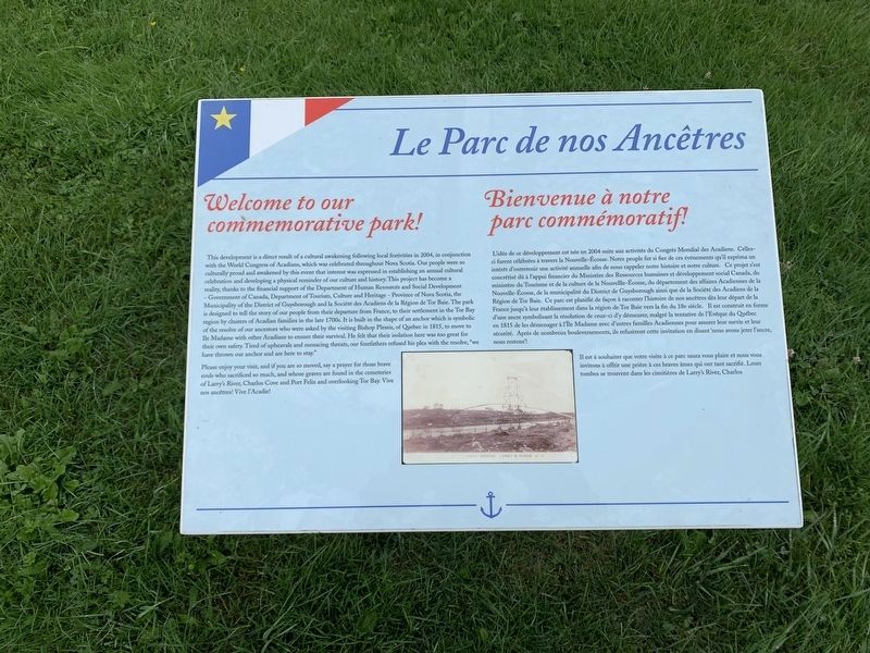
Welcome to our Commemorative Park!
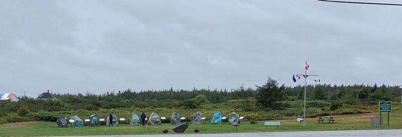
This development is a direct result of a cultural awakening following local festivities in 2004, in conjunction with the World Congress of Acadians, which was celebrated throughout Nova Scotia. Our people were so culturally proud and awakened by this event that interest was expressed in establishing an annual cultural celebration and developing a physical reminder of our culture and history. This project has become a reality, thanks to the financial support of the Department of Human Resources and Social Development - Government of Canada, Department of Tourism, Culture and Heritage - Province of Nova Scotia, the Municipality of the District of Guysborough and la Société des Acadiens de la Région de Tor Baie. The park is designed to tell the story of our people from their departure from France, to their settlement in the Tor Bay region by clusters of Acadian families in the late 1700s. It is built in the shape of an anchor which is symbolic of the resolve of our ancestors who were asked by the visiting Bishop Plessis, of Quebec in 1815, to move to Ile Madame with other Acadians to ensure their survival. He felt that their isolation here was too great their own safety. Tired of upheavals and menacing threats, our forefathers refused his plea with the resolve, "we have thrown our anchor and are here to stay."
Please enjoy your visit, and if you are so moved, say a prayer for those brave souls who sacrificed so much, and whose graves are found in the cemeteries of Larry's River, Charlos Cove and Port Felix and overlooking Tor Bay. Vive nos ancêtres! Vive l'Acadie!
L’idée de ce développement est née en 2004 suite aux activités du Congrès Mondial des Acadiens. Celles- ci furent célébrées à travers la Nouvelle-Écosse. Notre peuple fut si fier de ces événements qu'il exprima un intérêt d'entretenir une activité annuelle afin de nous rappeler notre histoire et notre culture. Ce projet s'est concrétisé dû à l'appui financier du Ministère des Ressources humaines et développement social Canada, du ministère du Tourisme et de la culture de la Nouvelle-Écosse, du département des affaires Acadiennes de la Nouvelle-Écosse, de la municipalité du District de Guysborough ainsi que de la Société des Acadiens de la Région de Tor Baie. Ce parc est planifié de façon à raconter l'histoire de nos ancêtres dès leur départ de la France jusqu'à leur établissement dans la région de Tor Baie vers la fin du 18e siècle.

Photographed By Steve Stoessel, August 27, 2019
2. Le Parc de nos Ancêtres
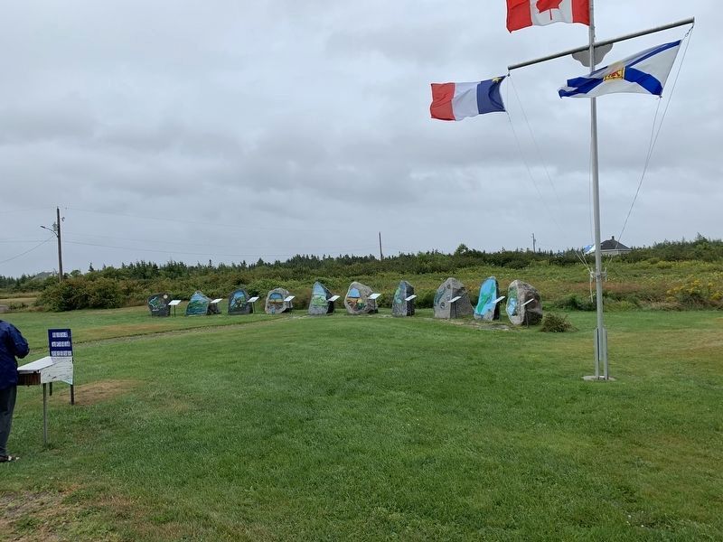
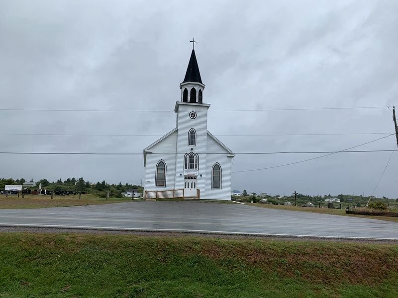
This is a large park with 16 bilingual markers. The markers are set out in a shape of an anchor. Each text mark has an accompanying rock bearing a painting about the text. This is the park viewed from across the road (from the church).
Il est à souhaiter que votre visite à ce parc saura vous plaire et nous vous invitons à offrir une prière à ces braves âmes qui ont tant sacrifié. Leurs tombes se trouvent dans les cimitières de Larry's River, Charlos
Topics and series. This historical marker is listed in these topic lists: Parks & Recreational Areas • Settlements & Settlers. In addition, it is included in the Acadian History series list. A significant historical year for this entry is 2004.
Location. 45° 13.311′ N, 61° 22.635′ W. Marker is in Larrys River, Nova Scotia, in Guysborough County. Marker is at the intersection of Marine Drive (Nova Scotia Route 316) and Ballfield Loop, on the right when traveling west on Marine Drive. Touch for map. Marker is in this post office area: Larrys River NS B0H 1T0, Canada. Touch for directions.
Other nearby markers. At least 8 other markers are within walking distance of this marker. Founding Families of the Acadian Communities Along Tor Bay 1797-1900 (here, next to this marker); Settlement of the Tor Bay Area circa 1797 (a few steps from this marker); Chezzetcook, Tracadie and Havre Boucher (a few steps from this marker); The Great Upheaval 1755-1763 (a few steps from this marker); The Scattering of a People (a few steps from this marker); The Resettlement (a few steps from this marker); Grand-Pré (a few steps from this marker); Acadian Dyke Building Along the Bay of Fundy (a few steps from this marker). Touch for a list and map of all markers in Larrys River.
More about this marker. The anchor shape can be seen clearly from satellite views of Larrys River
Credits. This page was last revised on October 16, 2019. It was originally submitted on October 16, 2019, by Steve Stoessel of Niskayuna, New York. This page has been viewed 137 times since then and 17 times this year. Photos: 1, 2, 3, 4. submitted on October 16, 2019, by Steve Stoessel of Niskayuna, New York. • Andrew Ruppenstein was the editor who published this page.


