Cumberland Township near Gettysburg in Adams County, Pennsylvania — The American Northeast (Mid-Atlantic)
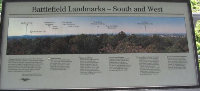
Battlefield Landmarks - South and West
Maj. Gen. George G. Meade, U.S.A.
Commander, Army of the Potomac
(1) Big Round Top
This rocky, wooded hill marked the extreme left flank of the Union line on July 2, the second day of the battle. Union troops seized Big Round Top on the evening of July 2, although by that time it had little strategic value.
(2) Little Round Top
Scene of heavy fighting on the afternoon of July 2 when Longstreet's Confederate First Corps attempted to turn the Union left flank on Cemetery Ridge. Site of one of six Union signal stations posted on the three-mile-long battlefield. The rocky crest afforded unobstructed views of the battlefield.
(3) Pennsylvania Memorial
Gettysburg National Park's largest monument, and one of the most prominent landmarks. It stands near the center of the 2nd and 3rd days' fighting. Inscribed on its bronze tablets are the names of 34,530 Pennsylvania soldiers who participated in the battle.
(4) Gettysburg National Cemetery
Established one month after the battle, this cemetery contains the remains of 3,512 soldiers killed at Gettysburg Address at the cemetery's dedication on November 19, 1863. The tombstones visible from here are actually in Evergreen Cemetery, an older cemetery located just in front of the National Cemetery.
(5) Lutheran Theological Seminary
Founded in 1826, it's the oldest Lutheran Seminary in the United States. During the battle, lookouts from both armies were posted in its cupola. The building also served as a hospital. Just beyond the seminary lies McPherson Ridge where the battle opened July 1.
Topics. This historical marker is listed in this topic list: War, US Civil. A significant historical year for this entry is 1863.
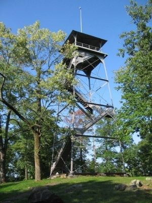
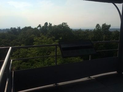
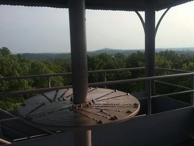
Location. 39° 49.204′ N, 77° 13.231′ W. Marker is near Gettysburg, Pennsylvania, in Adams County. It is in Cumberland Township. Marker is on Culp's Hill Loop, in the median. Located on the Observation Tower at the upper crest of Culp's Hill in Gettysburg National Military Park. Touch for map. Marker is in this post office area: Gettysburg PA 17325, United States of America. Touch for directions.
Other nearby markers. At least 8 other markers are within walking distance of this marker. Battlefield Landmarks - North and West (here, next to this marker); Battery K, Fifth U.S. Artillery (a few steps from this marker); 7th Indiana Infantry (within shouting distance of this marker); 76th New York Infantry (within shouting distance of this marker); The Deadened Woods (within shouting distance of this marker); Defense of Culp's Hill (within shouting distance of this marker); 95th New York Infantry (within shouting distance of this marker); Culp's Hill Rehabilitation (within shouting distance of this marker). Touch for a list and map of all markers in Gettysburg.
Credits. This page was last revised on February 7, 2023. It was originally submitted on December 4, 2008, by Craig Swain of Leesburg, Virginia. This page has been viewed 1,131 times since then and 18 times this year. Photos: 1. submitted on December 4, 2008, by Craig Swain of Leesburg, Virginia. 2. submitted on December 2, 2008, by Craig Swain of Leesburg, Virginia. 3. submitted on September 5, 2015, by J. Makali Bruton of Accra, Ghana. 4. submitted on December 4, 2008, by Craig Swain of Leesburg, Virginia. 5. submitted on September 5, 2015, by J. Makali Bruton of Accra, Ghana.


