Marker Logo HMdb.org THE HISTORICAL
MARKER DATABASE
“Bite-Size Bits of Local, National, and Global History”
Camano in Snohomish County, Washington — The American West (Northwest)
 

Utsalady Historic Site


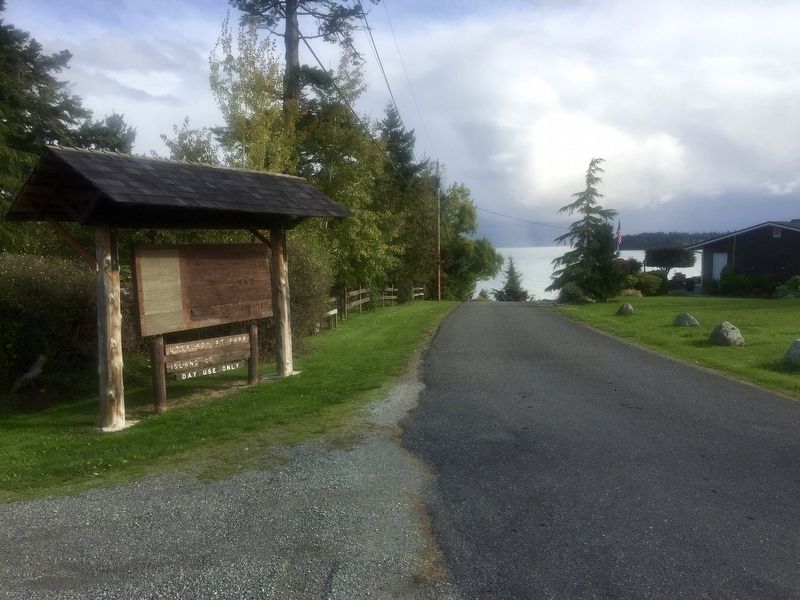
Utsalady Historic Site Marker image. Click for full size.
Photographed By Andrew Ruppenstein, October 8, 2019
1. Utsalady Historic Site Marker
Inscription.
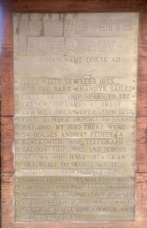
Indian name Doksk Ad

First white settlers 1853. 1855 the bark Anandyr sailed first cargo ship spars to the French shipyards at Brest. Saw mill began operation 1857. First lumber export to Shanghai 1860. By 1870 there were 54 houses and 147 people, a blacksmith shop, telegraph, saloon, shipyard and school. 1872 masonic hall. 1874 granary built to store Skagit grain. By 1883 sailing ships carried daily lumber production of 74,000 bd./ft. to world markets. Utsalady was point of departure for early white settlers in Stillaguamish and Skagit valleys.
 
Topics. This historical marker is listed in these topic lists: Industry & CommerceSettlements & Settlers. A significant historical year for this entry is 1853.
 
Location. 48° 15.342′ N, 122° 30.255′ W. Marker is in Camano, Washington, in Snohomish County. Marker is on North Shore Drive north of West Utsalady Point Road, on the left when traveling east. Touch for map. Marker is in this post office area: Camano Island WA 98282, United States of America. Touch for directions.
 
Other nearby markers. At least 8 other markers are within 8 miles of this marker, measured as the crow flies. Camano City Schoolhouse and Community Hall History (approx. 5.7 miles away); History of Camano/Camano City (approx. 5.7 miles away); Clara J. Stanwood Pearson (approx. 6.2 miles away); Stanwood Area Historical Society Veterans' Memorial

Paid Advertisement
Click on the ad for more information.
Please report objectionable advertising to the Editor.
Click or scan to see
this page online
(approx. 6.2 miles away); Oak Harbor’s Early “Town” (approx. 6.8 miles away); Oak Harbor's Ties to the Sea (approx. 6.9 miles away); Flintstone Park Flagpole (approx. 6.9 miles away); Beeksma’s Corner (approx. 7.4 miles away). Touch for a list and map of all markers in Camano.
 
Utsalady Historic Site Marker - wide view image. Click for full size.
Photographed By Andrew Ruppenstein, October 8, 2019
2. Utsalady Historic Site Marker - wide view
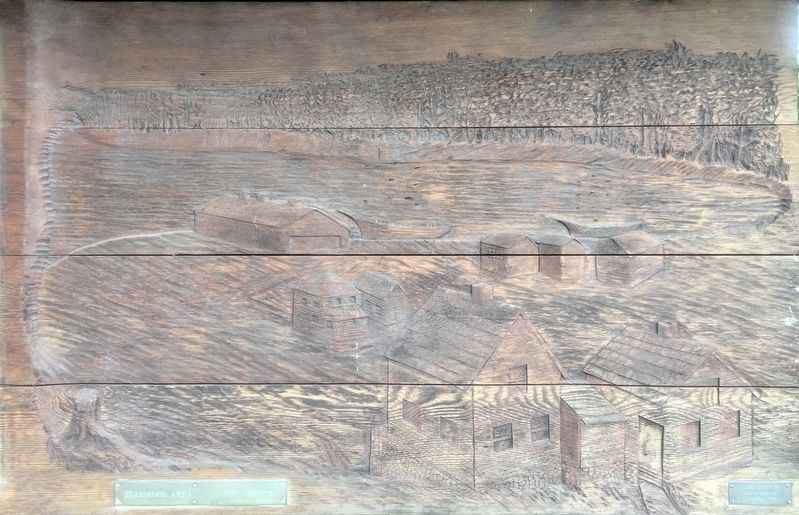
Woodcarving of historical view of Utsalady, carved by Carl Streyer and Gene Remington image. Click for full size.
1979
3. Woodcarving of historical view of Utsalady, carved by Carl Streyer and Gene Remington
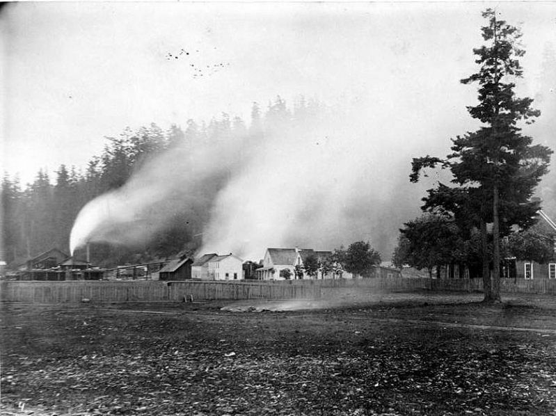
<i>Utsalady, Washington, ca. 1884</i> image. Click for full size.
Photo courtesy of the University of Washington Libraries, circa 1884
4. Utsalady, Washington, ca. 1884
"Field and houses with the lumber mill or sawmill in the distance, Utsalady, Washington, probably 1884"
 
 
Credits. This page was last revised on October 17, 2019. It was originally submitted on October 17, 2019, by Andrew Ruppenstein of Lamorinda, California. This page has been viewed 441 times since then and 156 times this year. Photos:   1, 2, 3, 4. submitted on October 17, 2019, by Andrew Ruppenstein of Lamorinda, California.
Share this page.  
Share on Tumblr
m=141229

CeraNet Cloud Computing sponsors the Historical Marker Database.
This website earns income from purchases you make after using our links to Amazon.com. We appreciate your support.
Paid Advertisement
Apr. 23, 2024