Near Georgesville in Franklin County, Ohio — The American Midwest (Great Lakes)
Back to the Same Old Grind
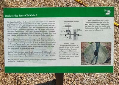
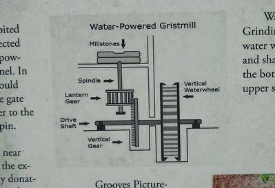
The Big and Little Darby Creeks are important waterways to all who inhabited their banks and nearby land, past and present. In 1805, a grist mill was erected by Samuel Dyer to grind grains into flour for local farmers. This mill was powered by water diverted from Little Darby Creek through a hand-dug channel. In times of drought a second hand-dug channel, over 100 yards in length, would allow water to flow from Big Darby Creek. The miller would open a sluice gate allowing the water to flow through a millrace that directed the water closer to the mill. The water would drop off the end onto a large wheel to make it spin.
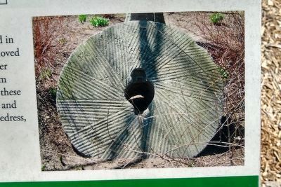
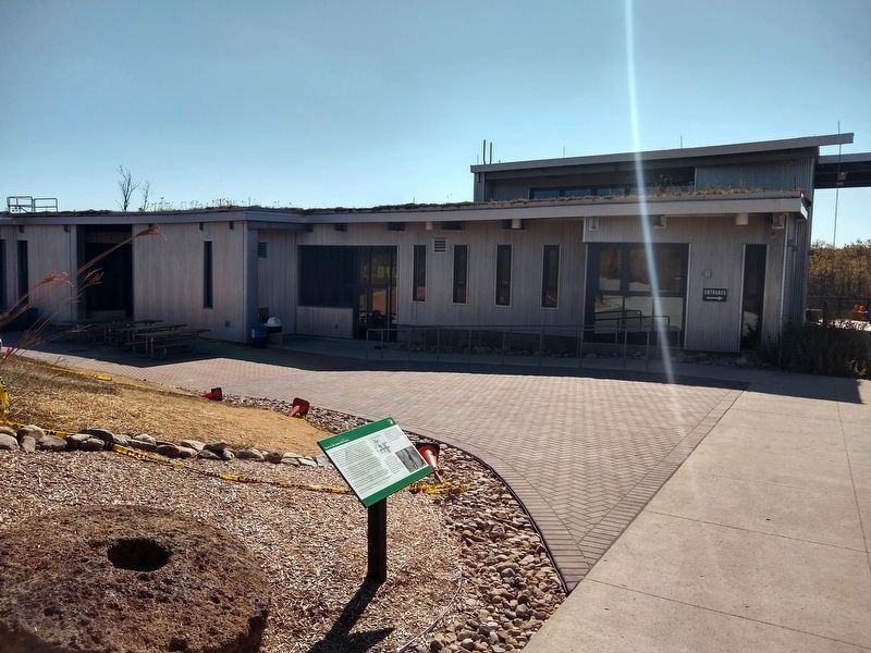
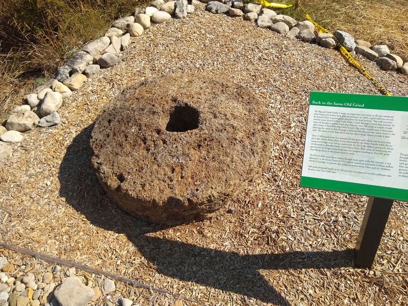
This 1,740 pound stone is a remnant of that grist mill which was located near the Little Darby Picnic Area. It was recovered by the Baker Family while the existing two bridges were being constructed. In 2015, the Baker's graciously donated the stone to Battelle Darby Creek Metro Park. After years of weathering the grooves are no longer present but one can imagine standing in the mill, grain dust flying about as the stones went to work.
The Dyer's Mill never burnt down, though many grist mills did. Instead, it was destroyed by the Great Flood of 1913 which caused an estimated 2 billion dollars worth of damage, in present day terms, to towns across Ohio and the Midwest.
Ask park personnel inside to see the grooves on a piece of another millstone also found in the Dyer Mill area.
Erected by Columbus and Franklin County Metro Parks.
Topics. This historical marker is listed in these topic lists: Disasters • Industry & Commerce • Man-Made Features. A significant historical year for this entry is 1805.
Location. 39° 54.775′ N, 83° 13.068′ W. Marker is near Georgesville, Ohio, in Franklin County. Marker can be reached from Jack McDowell Way, half a mile west of Darby Creek Drive. Marker is next to the nature center in Battelle Darby Creek Metro Park. Touch for map. Marker is at or near this postal address: 1775 Darby Creek Drive, Galloway OH 43119, United States of America. Touch for directions.
Other nearby markers. At least 8 other markers are within 3 miles of this marker, measured as the crow flies. The Glaciers Did It (a few steps from this marker); Stories in the Sediments (within shouting distance of this marker); A Valley Is Born (approx. 0.9 miles away); Big Darby Creek (approx. 0.9 miles away); Ice Over Ohio (approx. 0.9 miles away); Big Darby and Little Darby Creeks (approx. 1.3 miles away); A Valley is Born (approx. 2.1 miles away); The Voss Site (approx. 2.3 miles away). Touch for a list and map of all markers in Georgesville.
Also see . . . Great Flood of 1913. Wikipedia article (Submitted on October 22, 2019, by Joel Seewald of Madison Heights, Michigan.)
Credits. This page was last revised on October 22, 2019. It was originally submitted on October 22, 2019, by Joel Seewald of Madison Heights, Michigan. This page has been viewed 273 times since then and 28 times this year. Photos: 1, 2, 3, 4, 5. submitted on October 22, 2019, by Joel Seewald of Madison Heights, Michigan.
