Marker Logo HMdb.org THE HISTORICAL
MARKER DATABASE
“Bite-Size Bits of Local, National, and Global History”
Sommerhausen in Würzburg, Bavaria, Germany — Central Europe
 

Main Tor / Main Gate


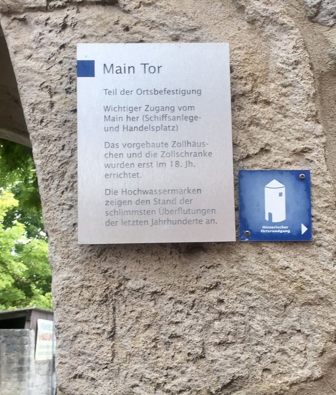
Main Tor / Main Gate Marker image. Click for full size.
Photographed By Andrew Ruppenstein, September 26, 2019
1. Main Tor / Main Gate Marker
Inscription.  
Teil der Ortsbefestigung

Wichtiger Zugang vom Main her (Schiffsanlege- und Handelsplatz)

Das vorgebaute Zollhäuschen und die Zollschranke wurden erst im 18. Jh. errichtet.

Die Hochwassermarken zeigen den Stand der schlimmsten Uberflutungen der letzten Jahrhunderte an.

-

(English translation:)

Section of the town defenses

Important access point to/from the Main River (docking point and commercial area)

The pre-fabbed customs house and customs barrier were first built in the 18th century.

The high water markers indicate the worst flooding of the last centuries.
 
Topics. This historical marker is listed in this topic list: Forts and Castles.
 
Location. 49° 42.299′ N, 10° 1.367′ E. Marker is in Sommerhausen, Bayern (Bavaria), in Würzburg. Marker is at the intersection of Maingasse and Ulrich-Gast-Weg, on the right when traveling west on Maingasse. Touch for map. Marker is at or near this postal address: Maingasse 4, Sommerhausen BY 97286, Germany. Touch for directions.
 
Other nearby markers. At least 8 other markers are within 10 kilometers of this marker, measured as the crow flies. Franz Daniel Pastorius Birthplace (within shouting

Paid Advertisement
Click on the ad for more information.
Please report objectionable advertising to the Editor.
Click or scan to see
this page online
distance of this marker); Franz Daniel Pastorius - The First German Settler in America (within shouting distance of this marker); Rathaus / Town Hall (about 120 meters away, measured in a direct line); Bartholomäus Kirche / Church of Bartholomäus (about 150 meters away); Katharinen-Brunnen / Catherine's Fountain (about 180 meters away); Johann Georg Krönlein (approx. 9.4 kilometers away); Wehrturm und Dorfbefestigung / Defensive Tower and Village Defenses (approx. 9.4 kilometers away); Zehnthaus / Tithing House (approx. 9.4 kilometers away). Touch for a list and map of all markers in Sommerhausen.
 
More about this marker. Note that the use of "Main" here is the name of the river upon which Sommerhausen is located.
 
Also see . . .  Maintor (Sommerhausen) (Würzburg Wiki, in German). (Submitted on October 24, 2019.)
 
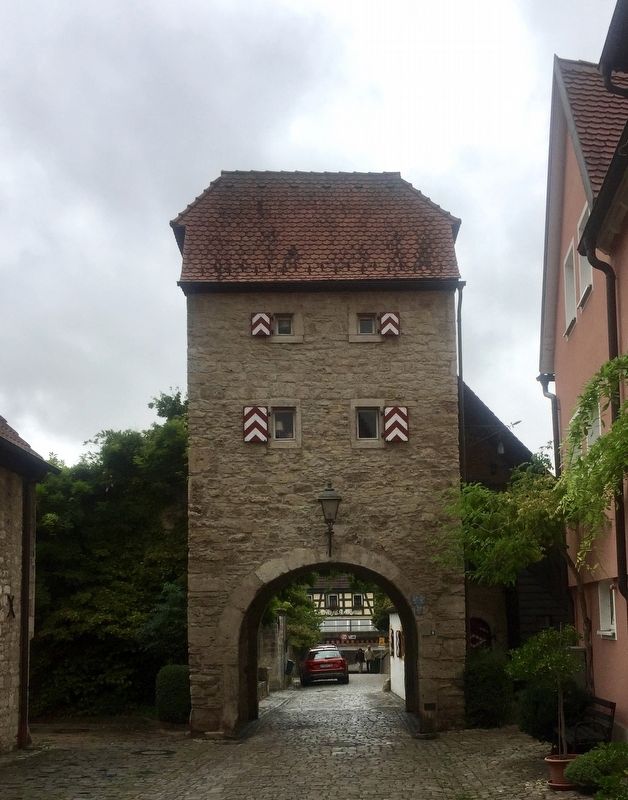
Main Tor / Main Gate and Marker image. Click for full size.
Photographed By Andrew Ruppenstein, September 26, 2019
2. Main Tor / Main Gate and Marker
The marker is (barely) visible here to the right of the archway.
 
 
Credits. This page was last revised on January 28, 2022. It was originally submitted on October 24, 2019, by Andrew Ruppenstein of Lamorinda, California. This page has been viewed 74 times since then and 2 times this year. Photos:   1, 2. submitted on October 24, 2019, by Andrew Ruppenstein of Lamorinda, California.
Share this page.  
Share on Tumblr
m=141547

CeraNet Cloud Computing sponsors the Historical Marker Database.
This website earns income from purchases you make after using our links to Amazon.com. We appreciate your support.
Paid Advertisement
May. 4, 2024