Orange Southern Pacific Depot
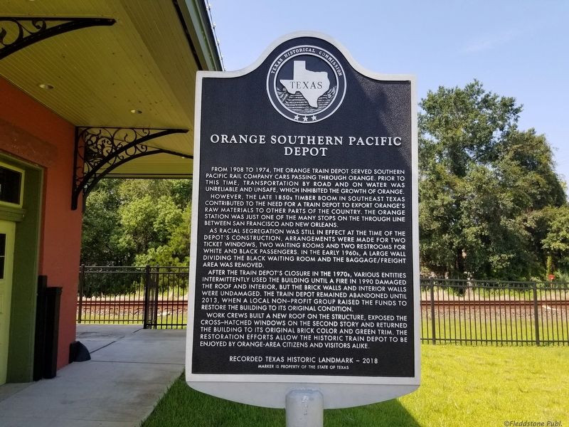
From 1908 to 1974, the Orange train depot served Southern Pacific Rail company cars passing through Orange. prior to this time, transportation by road and on water was unreliable and unsafe, which inhibited the growth of Orange.
However, the late 1850s timber boom in southeast Texas contributed to the need for a train depot to export Orange's raw materials to other parts of the country. The Orange station was just one of the many stops on the through line between San Francisco and New Orleans.
As racial segregation was still in effect at the time of the depot's construction, arrangements were made for two ticket windows, two waiting rooms and two restrooms for white and black passengers. In the early 1960s, a large wall dividing the black waiting room and the baggage/freight area was removed.
After the train depot's closure in the 1970s, various entities intermittently used the building until a fire in 1990 damaged the roof and interior, but the brick walls and interior walls were undamaged. the train depot remained abandoned until 2013, when a local non—profit group raised the funds to restore the building to its
this page online
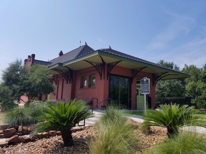
Work crews built a new roof on the structure, exposed the cross—hatched windows on the second story and returned the building to its original brick color and green trim. The restoration efforts allow the historic train depot to be enjoyed by Orange-area citizens and visitors alike.
Recorded Texas Historic Landmark 2018
Marker is property of the State of Texas
Erected 2018 by Texas Historical Commission. (Marker Number 20027.)
Topics and series. This historical marker is listed in these topic lists: Landmarks • Notable Buildings • Railroads & Streetcars. In addition, it is included in the Southern Pacific Railroad series list.
Location. 30° 5.616′ N, 93° 44.483′ W. Marker is in Orange, Texas, in Orange County. It is on North 11th Street near West Green Avenue (Business U.S. 90), on the right when traveling south. Touch for map. Marker is at or near this postal address: 409 11th Street, Orange TX 77630, United States of America. Touch for directions.
Regionally, this marker is in Texas’ Golden Triangle. It is also in the American South,
Other nearby markers. At least 8 other markers are within walking distance of this marker: Jorgensen House (about 500 feet away, measured in a direct line); Orange Chamber of Commerce (about 500 feet away); The Howell-Linscomb Home (about 600 feet away); Bland-Bazzano House (about 700 feet away); West End Park (about 700 feet away); Lutcher Memorial Church Building (approx. 0.2 miles away); First Christian Church of Orange (approx. 0.2 miles away); Homesite of Dr. Edgar William Brown (approx. ¼ mile away). Touch for a list and map of all markers in Orange.
Credits. This page was last revised on November 1, 2019. It was originally submitted on October 26, 2019, by Cajun Scrambler of Assumption, Louisiana. This page has been viewed 794 times since then and 50 times this year. Photos: 1, 2. submitted on October 26, 2019, by Cajun Scrambler of Assumption, Louisiana.
