Menomonee Valley in Milwaukee in Milwaukee County, Wisconsin — The American Midwest (Great Lakes)
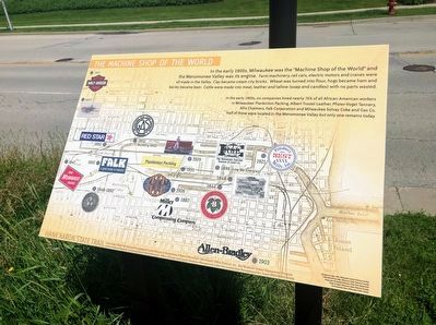
The Machine Shop of the World
In the early 1900s, six companies hired nearly 75% of all African-American workers in Milwaukee: Plankinton Packing, Albert Trostel leather, Pfister-Vogel Tannery, Allis Chalmers, Falk Corporation and Milwaukee Solvay Coke and Gas Co. Half of these were located in the Menomonee Valley but only one remains today.
Erected by Wisconsin Department of Natural Resources, Menomonee Valley Partners, Inc., the Wisconsin Coastal Management Program and the National Oceanic and Atmospheric Administration.
Topics. This historical marker is listed in this topic list: Industry & Commerce.
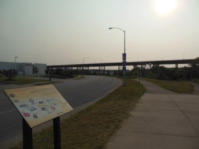
Location. 43° 1.488′ N, 87° 57.556′ W. Marker is in Milwaukee, Wisconsin, in Milwaukee County. It is in Menomonee Valley. Marker is on Canal Street, 0.1 miles east of Selig Drive, on the left when traveling west. Touch for map. Marker is at or near this postal address: Three Bridges Park, 610 S 35th St, Milwaukee WI 53214, United States of America. Touch for directions.
Other nearby markers. At least 8 other markers are within walking distance of this marker. Immigrants and Silver City (about 300 feet away, measured in a direct line); American Indians in the Menomonee Valley (about 300 feet away); Menomonee Valley Native Plants (approx. 0.2 miles away); Milwaukee Road Shops (approx. 0.2 miles away); A Changing Landscape (approx. 0.3 miles away); Hank Aaron (approx. 0.4 miles away); Hank Aaron State Trail (approx. 0.4 miles away); Hank Aaron - Changing Times (approx. 0.4 miles away). Touch for a list and map of all markers in Milwaukee.
Credits. This page was last revised on February 16, 2023. It was originally submitted on July 4, 2015, by Gordon Govier of Fitchburg, Wisconsin. This page has been viewed 1,384 times since then and 100 times this year. Last updated on October 27, 2019, by Devon Polzar of Port Washington, Wisconsin. Photos: 1, 2, 3. submitted on October 27, 2019, by Devon Polzar of Port Washington, Wisconsin. 4. submitted on July 4, 2015, by Gordon Govier of Fitchburg, Wisconsin. • Mark Hilton was the editor who published this page.


