Owego in Tioga County, New York — The American Northeast (Mid-Atlantic)
Native American Roots
Photographed by Steve Stoessel, October 26, 2019
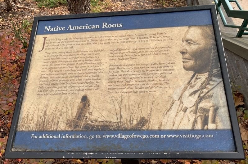
1. Native American Roots Marker
Jesse McQuigg made the following statement in 1851 when he witnessed Native Americans passing from the headwaters of the Susquehanna River at Otsego Lake on their way to Tioga Point, Chenango Point or Cayuga Lake around 1790 when he was just a boy. McQuigg came here in 1788 at the age of five and lived in a log cabin at the east side of this Park.
“I saw them coming down in their canoes, saw them first at the bend in the river above the village. There were several hundred canoes, some four to six Indians in a canoe; a good many squaws and young Indians among them. The canoes were of bark. It was a handsome sight as they approached the village: they came in such fine order. They came in a solid body and with great regularity and uniform movement, some of them ornamented with feathers, some with jewels, and covered with broaches generally of silver, generally with white woolen blankets and heavy stripes. Some had broad cloth blankets. The Indian men were generally of pretty good stature. They had their rifles, tomahawks, and scalping knives with them, pipes and their kind of tobacco.
They all landed here and cooked and ate their breakfast. They commenced landing at or near my father's house and so along down as far as James McMaster's house (today McMaster Street).
Between the two houses was an open plain, beautiful and green. They were very good natured. They were there all for peace. Their devices were cut in upon their ornaments, worked into their garments with porcupine quills and painted on. There appeared to be leaders or chiefs among them. Leggins, loincloths, blankets, head dress, moccasins, and ornaments were their costume. The women carried all the bundles and did all the work. Saw their wampum belts made of beads.”
For
this page online
Topics. This historical marker is listed in these topic lists: Indigenous Peoples and Communities • Settlements & Settlers. A significant historical year for this entry is 1851.
Location. 42° 6.164′ N, 76° 15.57′ W. Marker is in Owego, New York, in Tioga County. It is at the intersection of Front Street (New York State Route 17C) and Church Street, on the left when traveling west on Front Street. Touch for map. Marker is in this post office area: Owego NY 13827, United States of America. Touch for directions.

Regionally, this marker is in Upstate New York and in the Southern Tier. It is also in the American Northeast, in the Mid-Atlantic, in Appalachia, and specifically in Northern Appalachia. Globally, it is in North America, the Western Hemisphere, the Western World, and the Anglosphere. Historically, it finds itself in what was once New Netherland and also one of the original Thirteen Colonies.
Other nearby markers. At least 8 other markers are within walking distance of this marker: On the Site of Owego (a few steps from this marker); Owego Riverwalk

Photographed by Scott J. Payne, December 7, 2024
2. Native American Roots Marker
and the Susquehanna River
and the Susquehanna River
Also see . . . Owego, New York. Wikipedia entry (Submitted on January 13, 2026, by Larry Gertner of New York, New York.)

Photographed by Scott J. Payne, December 7, 2024
3. Two Rivers Greenway - Owego Segment
Native American Roots Marker is on the right, close to the river. The Clinton/Poor marker is on the left.
Credits. This page was last revised on January 13, 2026. It was originally submitted on October 28, 2019, by Steve Stoessel of Niskayuna, New York. This page has been viewed 958 times since then and 73 times this year. Photos: 1. submitted on October 28, 2019, by Steve Stoessel of Niskayuna, New York. 2, 3. submitted on December 8, 2024, by Scott J. Payne of Deposit, New York. • Michael Herrick was the editor who published this page.
