Near Craig in Lewis and Clark County, Montana — The American West (Mountains)
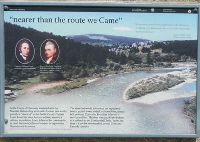
"nearer than the route we Came"
Inscription.
"To pass across the Traveler's Rest Creek to the Missouri at the Mouth of the Dearbourn's River is 400 miles nearer that the route we Came..." Captain William Clark, Written at Fort Clatsop
As the Corps of Discovery wintered with the Mandan Indians they were told of a river that would provide a "shortcut" to the Pacific Ocean. Captain Lewis found the river, but as a military man on a military mission, Lewis followed his commander in chief President Jefferson's orders to explore the Missouri and its source.
The river that would have saved the expedition time is today known as the Dearborn River, named by Lewis and Clark after President Jefferson's secretary of war. The river was used by the Indians as a pathway to the Continental Divide. Today, the river is a border between the Lewis & Clark and Cascade counties.
Erected by Lewis and Clark Trail Heritage Foundation, Lewis and Clark National Historic Trail.
Topics and series. This historical marker is listed in these topic lists: Exploration • Waterways & Vessels. In addition, it is included in the Former U.S. Presidents: #03 Thomas Jefferson, and the Lewis & Clark Expedition series lists.
Location. 47° 7.946′ N, 111° 54.093′ W. Marker is near Craig, Montana, in Lewis and Clark County. Marker is on Interstate 15 at milepost 240 near Bald Eagle Drive, on the right when traveling south. Touch for map. Marker is in this post office area: Wolf Creek MT 59648, United States of America. Touch for directions.
Other nearby markers. At least 8 other markers are within 2 miles of this marker, measured as the crow flies. Bighorned Animals (here, next to this marker); Join the Voyage of Discovery (within shouting distance of this marker); Continuing the Journey (about 600 feet away, measured in a direct line); Dearborn's River (about 600 feet away); Michael John MacKinnon (about 600 feet away); "Cliffs High and Steep" (about 600 feet away); The Dearborn – Ancient Interstate Highway (approx. half a mile away); The Search (approx. 1.7 miles away). Touch for a list and map of all markers in Craig.
More about this marker. This marker is located at the Southbound Dearborn Rest Area on Interstate 15.
Credits. This page was last revised on October 30, 2019. It was originally submitted on October 30, 2019, by Barry Swackhamer of Brentwood, California. This page has been viewed 219 times since then and 20 times this year. Photos: 1, 2. submitted on October 30, 2019, by Barry Swackhamer of Brentwood, California.

