Wheeling in Ohio County, West Virginia — The American South (Appalachia)
First State Capitol
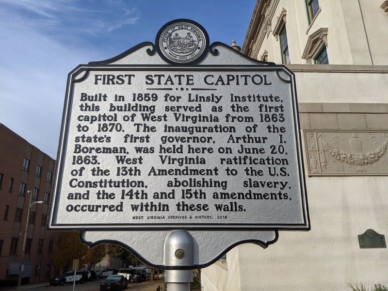
Photographed by Mike Wintermantel
1. First State Capitol Marker
Erected 2016 by West Virginia Archives & History.
Topics and series. This historical marker is listed in this topic list: Notable Buildings. In addition, it is included in the West Virginia Archives and History series list. A significant historical date for this entry is June 20, 1863.
Location. 40° 3.91′ N, 80° 43.193′ W. Marker is in Wheeling, West Virginia, in Ohio County. It is at the intersection of Eoff Street and 15th Street, on the right when traveling south on Eoff Street. Touch for map. Marker is in this post office area: Wheeling WV 26003, United States of America. Touch for directions.

Regionally, this marker is in the Northern Panhandle and in the High Valley. It is also in the American South, specifically in the Upper South, in the Ohio River
this page online
Other nearby markers. At least 8 other markers are within walking distance of this marker: A different marker also named First State Capitol (here, next to this marker); World War Memorial (within shouting distance of this marker); Saint Matthew's Episcopal Church (about 300 feet away, measured in a direct line); The Dr. John C. Hupp House (about 300 feet away); Joseph Thoburn (about 400 feet away); Cathedral Parish School (about 400 feet away); Kaley Center (about 400 feet away); WV Independence Hall (about 500 feet away). Touch for a list and map of all markers in Wheeling.
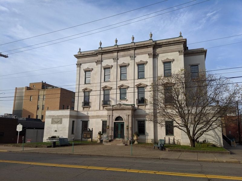
Photographed by Mike Wintermantel
2. First State Capitol Marker
Credits. This page was last revised on November 9, 2019. It was originally submitted on November 9, 2019, by Mike Wintermantel of Pittsburgh, Pennsylvania. This page has been viewed 409 times since then and 21 times this year. Photos: 1, 2. submitted on November 9, 2019, by Mike Wintermantel of Pittsburgh, Pennsylvania.
