Federal Courthouse (1898)
Southern District
| — | Choctaw and Chickasaw Nations, I.T. | — |
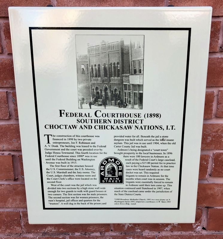
The first floor of the structure housed the U.S. Commissioner, the U.S. Attorney the U.S. Marshall and the Jury rooms. The Court, judges chambers, witness room and the Court Clerk's office were located on the second floor.
West of the court was the jail which was divided into two sections by a high stone wall wide enough for two guards to walk with guard houses at two corners. The first section was for male prisoners. The second section was for women prisoners, the men's hospital, jail offices and quarters for the "trustees". A well dug in the back of the prison yard provided water for all. Beneath the jail a stone dungeon was built which served as the ločal insane asylum. This jail was in use until 1904, when the old Carter County
this page online
Ardmore's being designated a "court town" brought prosperity to the local businesses. In 1896 there were 100 lawyers in Ardmore as a result of the Federal Court's large caseload, each paying a $15.00 permit fee to practice law in the Chickasaw Nation. At that time cases were heard randomly as no court docket was set. This required litigants to remain in Ardmore for the months when court was in session. The litigants were essentially forced to remain in Ardmore until their turn came up. This situation continued until Statehood in 1907, when much of the caseload came under the jurisdiction of the State District Courts.
*1890 Broadway Methodist Church, 1891 two story frame on N.
Washington burnt 1895, temporary courthouse on W. Main 1895
where Kress Bldg. stands
Erected by Ardmore Main Street Authority.
Topics. This historical marker is listed in these topic lists: Government & Politics • Notable Buildings. A significant historical year for this entry is 1898.
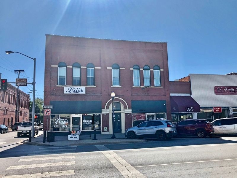
Location. 34° 10.379′ N, 97° 7.839′ W. Marker is in Ardmore, Oklahoma, in Carter County. It is at the intersection of West Main Street

Regionally, this marker is in the Chickasaw Nation and in South Central Oklahoma—Chickasaw Country. It is also in the American South, specifically on the prairies, and on the Southern Plains. Globally, it is in North America, the Western Hemisphere, the Western World, and the Anglosphere. Historically, it finds itself in what was once the territory of the Mississippian Culture and also the Louisiana Purchase.
Other nearby markers. At least 8 other markers are within walking distance of this marker: Noble Brothers Hardware (within shouting distance of this marker); Luke’s Music Store (within shouting distance of this marker); Randol Hotel (within shouting distance of this marker); Carter County Courthouse (about 300 feet away, measured in a direct line); The Banker's National Bank Building (about 400 feet away); Carter County (about 500 feet away); First Carter County Courthouse Sidewalk (about 500 feet away); The First National Bank and Trust Company of Ardmore (about 500 feet away). Touch for a list and map of all markers in Ardmore.
Credits. This page was last revised on November 9, 2019. It was originally submitted on November 9, 2019, by Mark Hilton of Montgomery, Alabama. This page has been viewed 976 times since then and 70 times this year. Photos: 1, 2. submitted on November 9, 2019, by Mark Hilton of Montgomery, Alabama.
