Fort Benton in Chouteau County, Montana — The American West (Mountains)
Church of the Immaculate Conception
Photographed by Barry Swackhamer, August 14, 2019
1. Church of the Immaculate Conception Marker
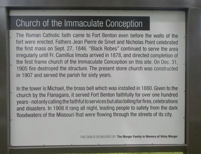
In the tower is Michael, the brass bell which was installed in 1880. Given to the church by the Flanagans, it served Fort Benton faithfully for over one hundred years - not only calling the faithful to services but also tolling for fires, celebrations and disasters. In 1908 it rang all night, leading people to safety from the dark floodwaters of the Missouri that were flowing through the streets of its city.
Erected by Fort Benton Community Improvement Association.
Topics. This historical marker is listed in this topic list: Religion & Religious Structures. A significant historical date for this entry is September 27, 1846.
Location. 47° 49.226′ N, 110° 40.274′ W.
this page online

Regionally, this marker is in Central Montana, in Missouri River Country, and specifically in Russell Country. It is also in the American Mountain West and in the Lewis & Clark Corridor. Globally, it is in North America, the Western Hemisphere, the Western World, and the Anglosphere. Historically, it finds itself in what was once Rupert’s Land and also the Louisiana Purchase.
Other nearby markers. At least 8 other markers are within walking distance of this marker: A different marker also named Church of the Immaculate Conception (a few steps from this marker); St. Paul's Episcopal Church (about 700 feet away, measured in a direct line); a different marker also named St. Paul's Episcopal Church (about 700 feet away); Chouteau County Courthouse (approx. 0.2 miles away); a different marker also named Chouteau County Courthouse
Photographed by Barry Swackhamer, August 14, 2019
2. Church of the Immaculate Conception Marker, inverse
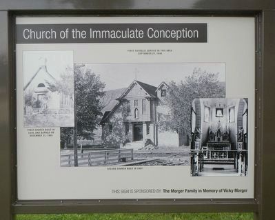
Captions: (top center) First Catholic service in this area September 27, 1846; (top left) First church built in 1879, and burned on December 31, 1905; (bottom center) Second church built in 1907.
Photographed by Barry Swackhamer, August 14, 2019
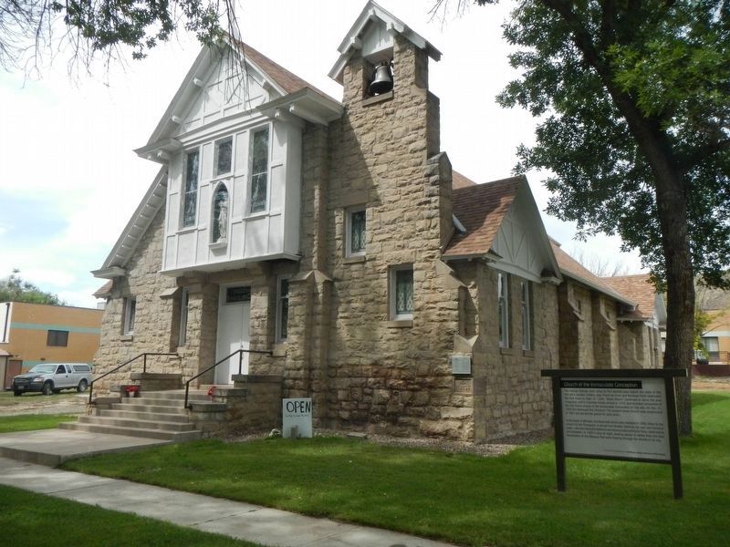
3. Church of the Immaculate Conception and Marker
Credits. This page was last revised on November 10, 2019. It was originally submitted on November 10, 2019, by Barry Swackhamer of Brentwood, California. This page has been viewed 376 times since then and 21 times this year. Photos: 1, 2, 3. submitted on November 10, 2019, by Barry Swackhamer of Brentwood, California.
