Big Sandy in Chouteau County, Montana — The American West (Mountains)
An Island on the Plains
The Bears Paw Mountains
Photographed by Barry Swackhamer, August 14, 2019
1. An Island on the Plains Marker
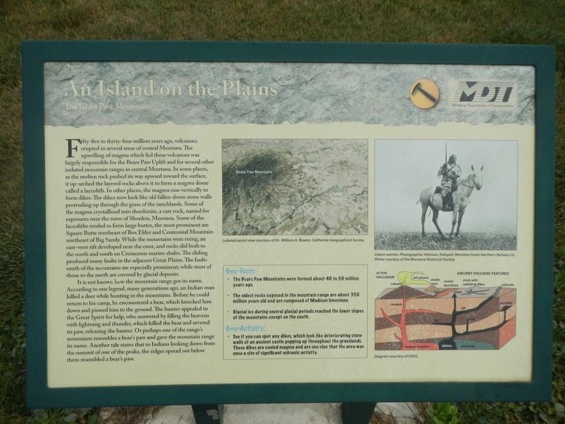
Captions: (top center) Labeled aerial view courtesy of California Geographical Survey; (top right) Indian warrior. Photographer Hileman, Kalispell; (bottom right) Diagram of ancient volcanic features; courtesy of USGS.
this page online
It is not known how the mountain range got its name. According to one legend, many generations ago, an Indian man killed a deer while hunting in the mountains. Before he could return to his camp, he encountered a bear, which knocked him down and pinned him to the ground. The hunter appealed to the Great Spirit for help, who answered by filling the heavens with lightning and thunder, which killed the bear and severed his paw, releasing the hunter. Or perhaps one of the range's mountains resembles a bear's paw and gave the mountain range its name. Another tale states that to Indians looking down from the summit of one of the peaks, the ridges spread out below them resembled a bear's paw.
Geo-Facts:
• The Bears Paw Mountains were formed about 40 to 50 million years ago.
• The oldest rocks exposed in the mountain range are about 350 million years old and are composed of Madison limestone.
• Glacial ice during several glacial periods reached the lower slopes of the mountains except on the south.
Geo-Activity:
• See if you can spot any dikes, which look
Photographed by Barry Swackhamer, August 14, 2019
2. An Island on the Plains Marker
Erected by Montana Department of Transportation.
Topics. This historical marker is listed in this topic list: Natural Features.
Location. 48° 10.765′ N, 110° 6.7′ W. Marker is in Big Sandy, Montana, in Chouteau County. It is at the intersection of Broadway (U.S. 87) and Johannas Avenue, on the left when traveling north on Broadway. Touch for map. Marker is in this post office area: Big Sandy MT 59520, United States of America. Touch for directions.

Regionally, this marker is in Central Montana, in Missouri River Country, and specifically in Russell Country. It is also in the American Mountain West and in the Lewis & Clark Corridor. Globally, it is in North America, the Western Hemisphere, the Western World, and the Anglosphere. Historically, it finds itself in what was once Rupert’s Land and also the Louisiana Purchase.
Other nearby markers. At least 7 other markers are within 13 miles of this marker, measured as the crow flies: Big Sandy (within shouting distance of this marker); Fort Walsh Trail (within shouting distance of this marker); Judith Landing (within shouting distance of this marker); Cow Island Trail (within shouting distance of this marker); Coal Banks Landing (approx. 11.7 miles away); Virgelle Mercantile (approx. 13 miles away); Virgelle State Bank (approx. 13 miles away).
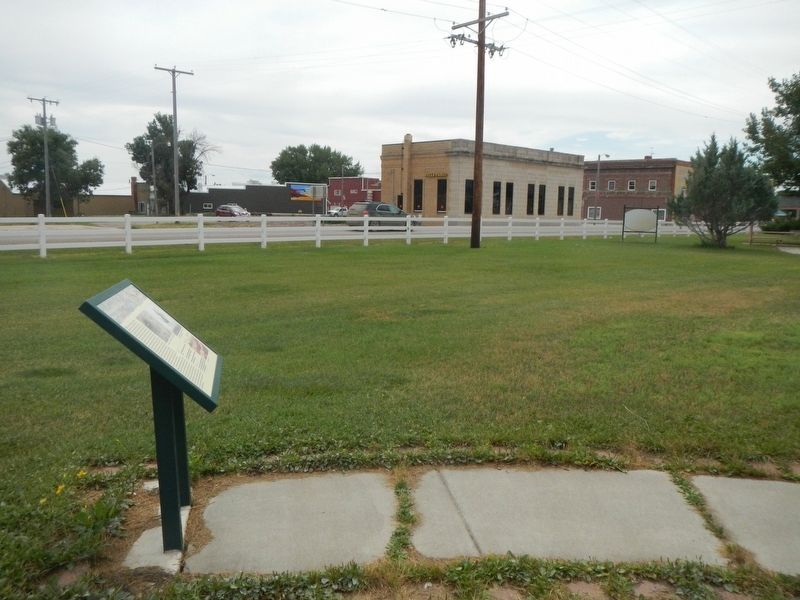
More about this marker. The marker is located in the Rest Stop & Park in Big Sandy.
Credits. This page was last revised on November 12, 2019. It was originally submitted on November 12, 2019, by Barry Swackhamer of Brentwood, California. This page has been viewed 409 times since then and 23 times this year. Photos: 1, 2. submitted on November 12, 2019, by Barry Swackhamer of Brentwood, California.
