Spanish Lake in St. Louis County, Missouri — The American Midwest (Upper Plains)
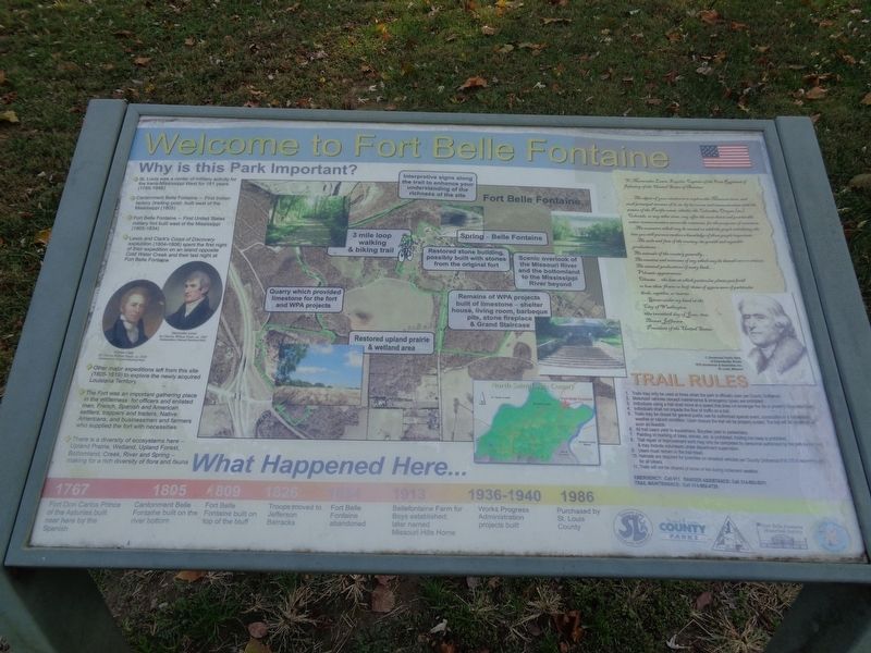
Welcome to Fort Belle Fontaine
•St. Louis was a center of military activity for the trans-Mississippi West for 181 years (1765-1946)
•Cantonment Belle Fontaine - First Indian factory (trading post) built west of the Mississippi (1805)
•Fort Belle Fontaine - First United States military fort built west of the Mississippi (1805-1834)
•Lewis and Clark's Corps of Discovery expedition (1804-1806) spent the first night of their expedition on an island opposite Cold Water Creek and their last night at Fort Belle Fontaine
•Other major expeditions left from this site (1805-1819) to explore the newly acquired Louisiana Territory
•The Fort was an important gathering place in the wilderness for officers and enlisted men, French, Spanish and American settlers, trappers and traders, Native Americans, and businessmen and farmers who supplied the fort with necessities
•There is a diversity of ecosystems here - Upland Prairie, Wetland, Upland Forest, Bottomland, Creek, River and Spring - making for a rich diversity of flora and fauna
(Letter from Thomas Jefferson:)
To Meriwether Lewis Esquire, Captain of the First Regiment of Infantry of the United States of America:
…The object of your mission is to explore the Missouri river, and such principal streams of it, as by its course and communication with the waters of the Pacific ocean, whether the Columbia, Oregon [sic], Colorado, or any other river, may offer the most direct and practicable water-communication across the continent, for the purposes of commerce.
…The commerce which may be carried on with the people inhabiting the line you will pursue renders a knowledge of those people important.
…The soils and face of the country; its growth and vegetable productions…
The animals of the country generally…
The remains and accounts of any which may be deemed rare or extinct;
The mineral productions of every kind;…
Volcanic appearances;
Climate…the date at which particular plants put forth or lose their flower or leaf; times of appearance of particular birds, reptiles or insects.
…Given under my hand at the City of Washington,
This twentieth day of June, 1803.
Thomas Jefferson
President of the United States
What Happened Here… (shown as a timeline, left to right)
1767- Fort Don Carlos Prince of the Asturias built near here by the Spanish
1805- Cantonment Belle Fontaine built on the river bottom
1809- Fort Belle Fontaine built on top of the bluff
1826- Troops moved to Jefferson Barracks
1834- Fort Belle Fontaine abandoned
1913- Bellefontaine Farm for Boys established; later named Missouri Hills Home
1936-1940- Works Progress Administration projects built
1986- Purchased by St. Louis County
Erected by Fort Belle Fontaine Historical Society, Missouri Conservation Department, Saint Louis County Parks and the Spanish Lake Community Association.
Topics and series. This historical marker is listed in these topic lists: Exploration • Forts and Castles • Parks & Recreational Areas. In addition, it is included in the Former U.S. Presidents: #03 Thomas Jefferson, and the Lewis & Clark Expedition series lists.
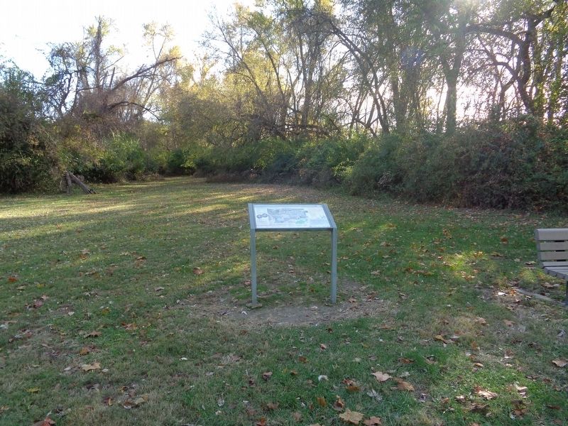
Location. 38° 49.466′ N, 90° 13.051′ W. Marker is in Spanish Lake, Missouri, in St. Louis County. Marker can be reached from Bellefontaine Road, 0.4 miles north of Fountainhead Lane, on the left when traveling north. Marker is on the grounds of Fort Belle Fontaine Park. It is at a roadside stand off the first road, as you turn the first left from the entrance. Please note that the marker is accessed only from 8am to the park's closure (30 minutes after sunset). Visitors may be asked to check in with the guards at the park's entrance. Touch for map. Marker is at or near this postal address: 13002 Bellefontaine Road, Saint Louis MO 63138, United States of America. Touch for directions.
Other nearby markers. At least 8 other markers are within 3 miles of this marker, measured as the crow flies. Fort Belle Fontaine (approx. 0.3 miles away); The Lewis and Clark Expedition (approx. 0.3 miles away); a different marker also named Fort Belle Fontaine (approx. 0.3 miles away); Belle Fontaine - Beautiful Fountain (approx. 0.3 miles away); a different marker also named Fort Belle Fontaine (approx. 0.4 miles away); Coldwater Creek (approx. 0.6 miles away); Spanish Lake (approx. 1.9 miles away); Columbia Bottom Conservation Area (approx. 2.1 miles away). Touch for a list and map of all markers in Spanish Lake.
Also see . . . Fort Belle Fontaine Park. From the St. Louis County Parks' website (Submitted on November 12, 2019, by Jason Voigt of Glen Carbon, Illinois.)
Credits. This page was last revised on November 13, 2019. It was originally submitted on November 12, 2019, by Jason Voigt of Glen Carbon, Illinois. This page has been viewed 256 times since then and 38 times this year. Photos: 1, 2. submitted on November 12, 2019, by Jason Voigt of Glen Carbon, Illinois. • Devry Becker Jones was the editor who published this page.

