Spanish Lake in St. Louis County, Missouri — The American Midwest (Upper Plains)
Fort Belle Fontaine
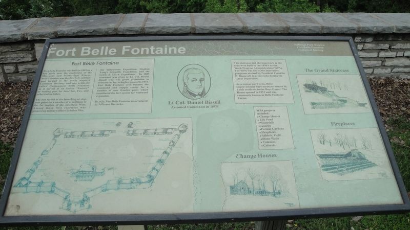
The fort served as the launching or stopover point for a number of expeditions to the far reaches of the American West. Among those first explorers was pioneering military officer Zebulon Pike, the Yellowstone Expedition, Stephen Long's Scientific Expedition, and the Lewis & Clark Expedition. In 1809 command was given to Lt. Col. Daniel Bissell who was given permission to relocate the fort to higher ground in 1810. Fort Belle Fontaine soon became the command and supply center for a number of new frontier posts which constituted the fort system for westward expansion.
In 1826, Fort Belle Fontaine was replaced by Jefferson Barracks.
This staircase and the stonework in the area were built in the 1930's by the Work Progress Administration (WPA). The WPA was one of the innovative programs started by President Franklin D. Roosevelt to create jobs during the Great Depression.
As a unique park area, these improvements were meant to attract St. Louis residents to the Boys Home. The Home opened in 1915 and was commonly known as Belle Fontaine Farms.
Erected by Fort Belle Fontaine Historical Society and the National Park Service.
Topics and series. This historical marker is listed in these topic lists: Exploration • Forts and Castles • Government & Politics • Native Americans. In addition, it is included in the Lewis & Clark Expedition series list.
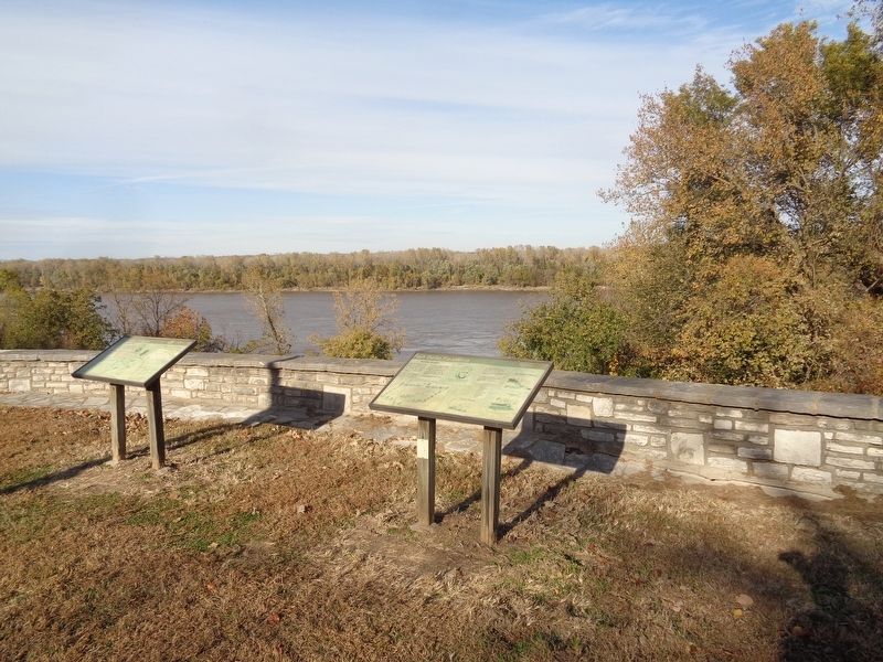
Location. 38° 49.655′ N, 90° 12.841′ W. Marker is in Spanish Lake, Missouri, in St. Louis County. Marker is on Bellefontaine Road, 0.6 miles east of Fountainhead Lane, on the left when traveling east. Marker is on the grounds of Fort Belle Fontaine Park, on top of the stonewall structure. Please note that the marker is accessed only from 8am to the park's closure (30 minutes after sunset). Visitors may be asked to check in with the guards at the park's entrance. Touch for map. Marker is at or near this postal address: 13002 Bellefontaine Road, Saint Louis MO 63138, United States of America. Touch for directions.
Other nearby markers. At least 8 other markers are within 2 miles of this marker, measured as the crow flies. The Lewis and Clark Expedition (here, next to this marker); a different marker also named Fort Belle Fontaine (within shouting distance of this marker); Belle Fontaine - Beautiful Fountain (about 500
feet away, measured in a direct line); Welcome to Fort Belle Fontaine (approx. 0.3 miles away); a different marker also named Fort Belle Fontaine (approx. 0.3 miles away); Coldwater Creek (approx. ¾ mile away); Spanish Lake (approx. 2 miles away); Columbia Bottom Conservation Area (approx. 2.1 miles away). Touch for a list and map of all markers in Spanish Lake.
Credits. This page was last revised on November 13, 2019. It was originally submitted on November 13, 2019, by Jason Voigt of Glen Carbon, Illinois. This page has been viewed 193 times since then and 21 times this year. Photos: 1, 2. submitted on November 13, 2019, by Jason Voigt of Glen Carbon, Illinois. • Devry Becker Jones was the editor who published this page.

