
Dover Air Force Base in Kent County, Delaware — The American Northeast (Mid-Atlantic)
C-5A
Galaxy
| — | S/N 69-0014 | — |
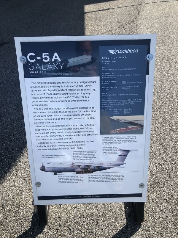
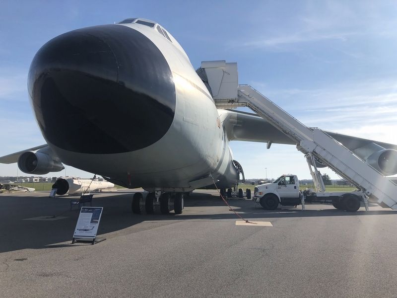
The most noticeable and revolutionary design feature of Lockheed's C-5 Galaxy is its immense size. Other large aircraft played important roles in aviation history, but none of those giants could haul anything, anywhere, anytime as well as the C-5. Today, the C-5 continues to combine greatness with unromantic achievement.
The C-5 was the biggest and heaviest airplane in its class when test pilots thundered aloft for the first time on 30 June 1968. Today, the upgraded C-5M Super Galaxy continues to be the largest aircraft in the U.S. Air Force inventory.
Whether it's supporting humanitarian relief efforts or supplying warfighters across the globe, the C-5 can carry almost every item in the U.S. military inventory, over greater distances, and more reliably and efficiently than any other strategic airlifter.
In October 1974, the museum's C-5 became the first and only aircraft in history to launch an intercontinental ballistic (ICBM) in flight.
Topics. This historical marker is listed in this topic list: Air & Space. A significant historical date for this entry is June 30, 1968.
Location. 39° 7.038′ N, 75° 27.387′ W. Marker is
this page online

Regionally, this marker is in the American Mid-Atlantic, on the Delmarva Peninsula, and on the Eastern Seaboard. Globally, it is in the North Atlantic Region, North America, the Western Hemisphere, the Western World, and the Anglosphere. Historically, it finds itself in what was once New Netherland, one of the original Thirteen Colonies, and the Antebellum South.
Other nearby markers. At least 8 other markers are within walking distance of this marker: KC-10A (here, next to this marker); A-10C (a few steps from this marker); LGM-30 (within shouting distance of this marker); KC-135E (within shouting distance of this marker); C-45G (within shouting distance of this marker); KC-97L (within shouting distance of this marker); C-60 (within shouting distance of this marker); C-5 (within shouting distance
Credits. This page was last revised on September 17, 2023. It was originally submitted on November 13, 2019, by Devry Becker Jones of Washington, District of Columbia. This page has been viewed 351 times since then and 13 times this year. Photos: 1, 2, 3, 4. submitted on November 13, 2019, by Devry Becker Jones of Washington, District of Columbia.
