Flint in Genesee County, Michigan — The American Midwest (Great Lakes)
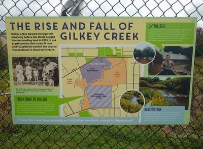
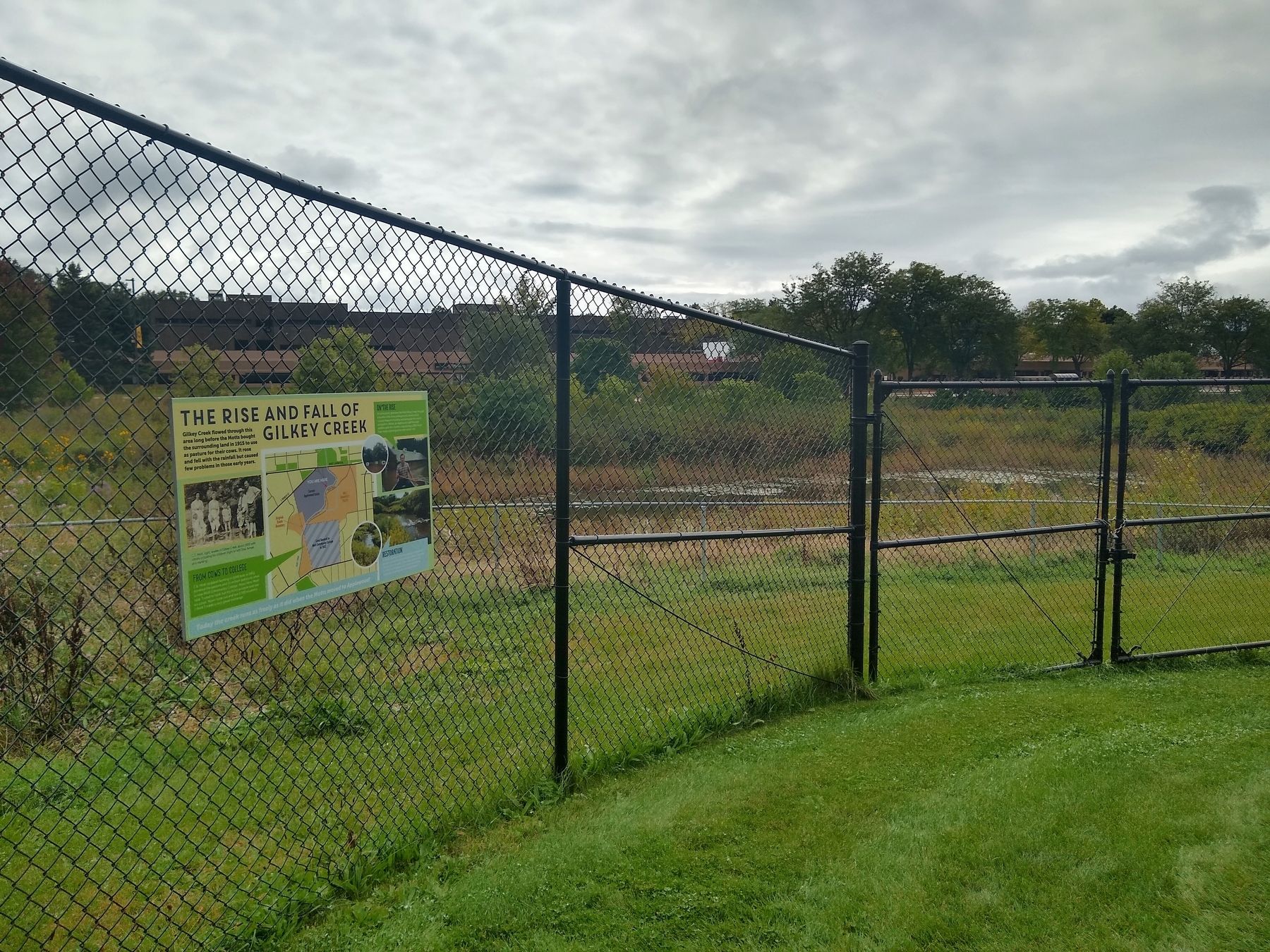
The Rise and Fall of Gilkey Creek
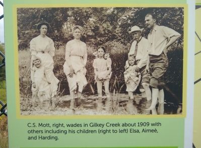
Gilkey Creek flowed through this area long before the Motts bought the surrounding land in 1915 to use as pasture for their cows. It rose and fell with the rainfall but caused few problems in those early years.
From Cows to College
C.S. Mott stopped farming in 1949 and, in 1952, donated the pasture and $1 million dollars to what is now Mott Community College. Years later, Mott said, "I used to look out my front window and see six cows. Now I look out and see 7,000 students. I think I made a very good exchange."
On the Rise
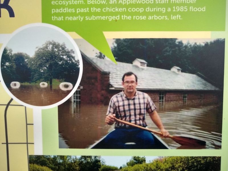
At some point, planners diverted Gilkey Creek through a quarter-mile-long underground culvert which caused frequent flooding and damaged the creek's ecosystem. Below, an Applewood staff member paddles past the chicken coop during a 1985 flood that nearly submerged the rose arbors, left.
Restoration
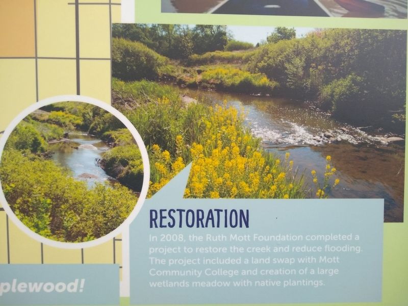
In 2008, the Ruth Mott Foundation completed a project to restore the creek and reduce flooding. The project included a land swap with Mott Community College and creation of a large wetlands meadow with native plantings.
Today the creek runs as freely as it did when the Motts moved to Applewood!
Topics. This historical marker is listed in these topic lists: Education • Environment. A significant historical year for this entry is 1915.
Location. 43° 1.395′ N, 83° 40.299′ W. Marker is in Flint, Michigan, in Genesee County. Marker can be reached from Albert R. Horrigan Drive. Marker is on the Applewood Estate about 300 feet south of the east entrance to the estate. Touch for map. Marker is at or near this postal address: 1400 East Kearsley Street, Flint MI 48503, United States of America. Touch for directions.
Other nearby markers. At least 8 other markers are within walking distance of this marker. Applewood Estate (about 300 feet away, measured in a direct line); Terrace Reconstruction Project (about 400 feet away); Ruth Mott's Point of View (about 400 feet away); Fun and Games (about 500 feet away); Renewing an Old Orchard (about 600 feet away); The Demonstration Garden (approx. 0.2 miles away); The Heart of the Farm (approx. 0.2 miles away); Gatehouse (approx. 0.2 miles away). Touch for a list and map of all markers in Flint.
Also see . . . Gilkey Creek project could become national model for environmental restoration. Article on MLive about the Ruth Mott Foundation's project to "daylight" 1,100 feet of the creek that had been running through an underground tunnel and caused flooding during severe rain. (Submitted on November 16, 2019, by Joel Seewald of Madison Heights, Michigan.)
Credits. This page was last revised on June 29, 2020. It was originally submitted on November 16, 2019, by Joel Seewald of Madison Heights, Michigan. This page has been viewed 369 times since then and 80 times this year. Photos: 1, 2, 3, 4, 5. submitted on November 16, 2019, by Joel Seewald of Madison Heights, Michigan.
