Near Williston in Williams County, North Dakota — The American Midwest (Upper Plains)
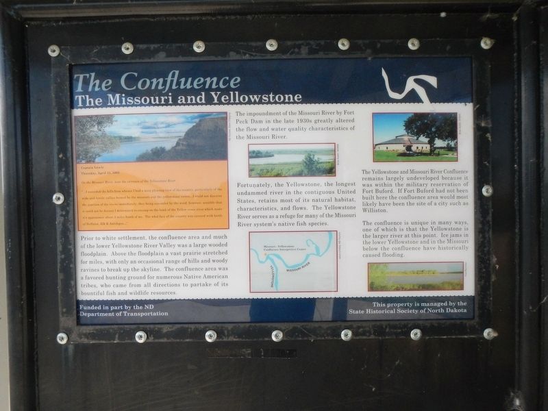
The Confluence
The Missouri and Yellowstone
Captain Lewis
Thursday, April 25, 1805
On the Missouri River, near the entrance of the Yellowstone River
"...I ascended the hills from whence I had a most pleasing view of the country, particularly of the wide and fertile vallies formed by missouri and yellowstone rivers...I could not discover the junction of the rivers immediately, they being concealed by the woods; however, sensible that it could not be distant I determined to encamp on the bank of the Yellow stone river which made it's appearance about 2 miles South of me. The whol face of the country was covered with herds of Buffaloe, Elk & Antelope..."
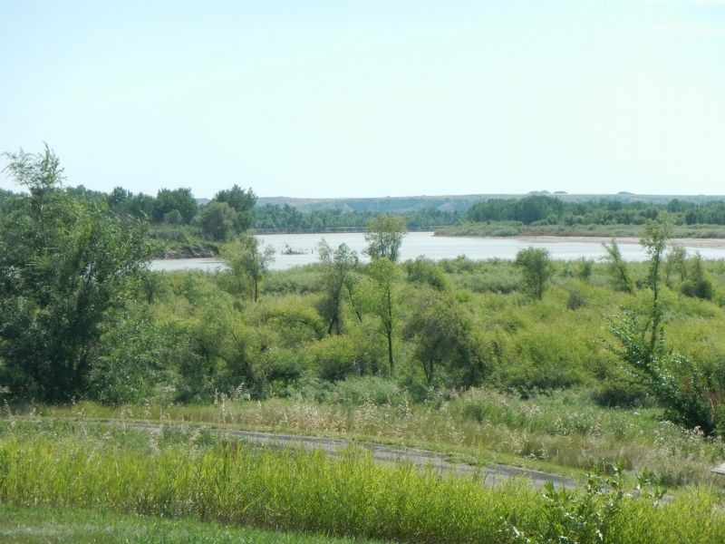
Prior to white settlement, the confluence area and much of the lower Yellostone River Valley was a large wooded floodplain. Above the floodplain a vast prairie stretched for miles, with only an occasional range of hills and woody ravines to break up the skyline. The confluence area was a favored hunting ground for numerous Native American tribes, who came from all directions to partake of its bountiful fish and wildlife resources.
Fortunately, the Yellowstone, the longest undammed river in the contiguous United States, retains most of its natural habitat, characteristics, and flows. The Yellowstone River serves as a refuge for many of the Missouri River systems's native fish species.
The Yellowstone and Missouri River Confluence remains largely undeveloped because it was within the military reservation of Fort Buford. If Fort Buford had not been built here the confluence area would most likely have been the site of a city such as Williston.
The confluence is unique in many ways, one of which is that the Yellowstone is the larger river at this point. Ice jams in the lower Yellowstone and in the Missouri below the confluence have historically caused flooding.
Erected by State Historical Society of North Dakota.
Topics and series. This historical marker is listed in these topic lists: Exploration • Waterways & Vessels. In addition, it is included in the Lewis & Clark Expedition series list. A significant historical date for this entry is April 25, 1805.
Location. 47° 59.146′ N, 103° 59.185′ W. Marker is near Williston, North Dakota, in Williams County. Marker can be reached from 39th Lane Northwest near 153rd Avenue Northwest. Touch for map. Marker is at or near this postal address: 15349 39th Lane Northwest, Williston ND 58801, United States of America. Touch for directions.
Other nearby markers. At least 8 other markers are within walking distance of this marker. Lewis & Clark's America (here, next to this marker); Fur Trade Forts (here, next to this marker); Buford-Trenton Project (here, next to this marker); Oxbow Wetland (within
shouting distance of this marker); Missouri-Yellowstone Confluence Area (about 300 feet away, measured in a direct line); A Beaver Boom (about 400 feet away); Missouri-Yellowstone Confluence (about 500 feet away); Mosquitoes (about 600 feet away). Touch for a list and map of all markers in Williston.
More about this marker. This marker is located at a small hexagonal kiosk on the east end of the Missouri-Yellowstone Confluence Interpretive Center property. I regret that I forgot to photograph it.
Credits. This page was last revised on November 29, 2019. It was originally submitted on November 29, 2019, by Barry Swackhamer of Brentwood, California. This page has been viewed 184 times since then and 11 times this year. Photos: 1, 2. submitted on November 29, 2019, by Barry Swackhamer of Brentwood, California.
Editor’s want-list for this marker. A mid-distance view of the kiosk and markers. • Can you help?

