Chilcoot in Plumas County, California — The American West (Pacific Coastal)
Beckwourth Pass
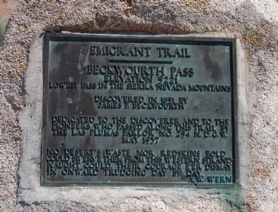
Emigrant Trail
— Elevation 5221 —
Discovered in 1851 by
James P. Beckwourth
Dedicated to the discoverer and to the pioneers who passed along this trail by the Las Plumas Parlor No. 254 N.D.G.W.
No desert’s waste nor redskins bold could swerve them from this western stand, naught could their courage e’er dismay in onward trudging day by day.
A.W. Wern
Erected 1973 by Native Daughters of the Golden West, Las Pluma Parlor No. 254. (Marker Number 336.)
Topics and series. This historical marker is listed in this topic list: Roads & Vehicles. In addition, it is included in the Beckwourth Trail, the California Historical Landmarks, and the Native Sons/Daughters of the Golden West series lists. A significant historical year for this entry is 1851.
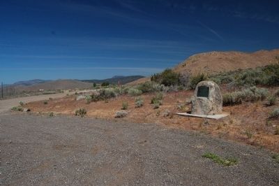
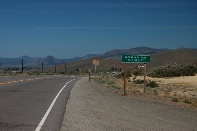
Location. 39° 47.499′ N, 120° 6.815′ W. Marker is in Chilcoot, California, in Plumas County. Marker can be reached from California Route 70. This marker is located on a dirt, side road just west of Beckwourth Summit on the south side of Highway 70. Beckwourth Summit is the boundary line for Plumas and Lassen counties. Touch for map. Marker is in this post office area: Chilcoot CA 96105, United States of America. Touch for directions.
Other nearby markers. At least 5 other markers are within 16 miles of this marker , measured as the crow flies. Beckwourth Trail - Beckwourth Pass (approx. half a mile away); Beckwourth Trail - Long Valley (approx. 3˝ miles away); Beckwourth Trail - Beckwourth Valley (approx. 5.2 miles away); Loyalton (approx. 10.6 miles away); Historic Transportation From Honey Lake To Virginia City (approx. 15.6 miles away in Nevada).
More about this marker. Beckwourth Pass, at an elevation of 5,221 feet, the lowest pass in the Sierra Nevada, was discovered in 1851 by James P. Beckwourth. The monument is dedicated to the discoverer and to the pioneers who passed along this trail.
Source: California Office of Historic Preservation website.
Also see . . . The Beckwourth Trail - beckwourth.org. James Beckwourth discovered what is now known as Beckwourth Pass in the spring of 1850, and immediately set about establishing a trail to Marysville. He worked on the trail in the summer and fall of 1850 and the spring of 1851, and in the late summer of that year led the first wagon train of settlers along the trail into Marysville. (Submitted on June 16, 2012, by Barry Swackhamer of Brentwood, California.)
Credits. This page was last revised on December 11, 2019. It was originally submitted on June 16, 2012, by Barry Swackhamer of Brentwood, California. This page has been viewed 916 times since then and 41 times this year. Last updated on December 11, 2019, by Craig Baker of Sylmar, California. Photos: 1, 2, 3. submitted on June 16, 2012, by Barry Swackhamer of Brentwood, California. • J. Makali Bruton was the editor who published this page.


