
Near Alturas in Modoc County, California — The American West (Pacific Coastal)
Chimney Rock
Photographed by Syd Whittle, May 11, 2008
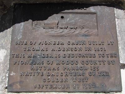
1. Chimney Rock Marker
Erected 1932 by Alturas Parlor 159 Native Daughters of the Golden West. (Marker Number 109.)
Topics and series. This historical marker is listed in this topic list: Settlements & Settlers. In addition, it is included in the California Historical Landmarks, and the Native Sons/Daughters of the Golden West series lists. A significant historical month for this entry is September 1865.
Location. 41° 35.773′ N, 120° 25.434′ W. Marker is near Alturas, California, in Modoc County. It can be reached from U.S. 395. Marker is beside RR track along State Highway 395. Touch for map. Marker is in this post office area: Alturas CA 96101, United States of America. Touch for directions.

Regionally, this marker is on California’s Modoc Plateau and in the Shasta Cascade. It is also in the American Mountain West. Globally, it is in North America, on the Ring of Fire, in the Pacific Rim, in the Western Hemisphere, in the Western World, and
this page online
Other nearby markers. At least 8 other markers are within 15 miles of this marker, measured as the crow flies: Lassen Trail - Conical Rocks (approx. 2.3 miles away); Sacred Heart Catholic Church (approx. 9½ miles away); Nevada-California-Oregon Railway Passenger Depot (approx. 9.7 miles away); Applegate Trail - Davis Creek (approx. 9.8 miles away); Applegate Trail - New Road to Yreka (approx. 9.8 miles away); Lassen Trail - Pit River Ford (approx. 10.1 miles away); Working Farm Roots (approx. 10.4 miles away); South Road - McGinty Creek (approx. 14.4 miles away). Touch for a list and map of all markers in Alturas.
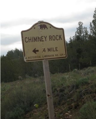
More about this marker. The landmark and marker are on a dirt road that turns west off of State Highway 395. There is a State Historical Landmark directional sign on Highway 395.
Regarding Chimney Rock. The Registered California Historical Landmark No. 109 description is:
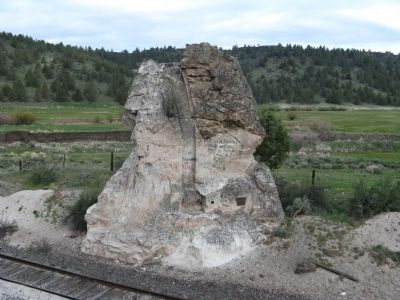
Chimney Rock - The chimney was cut out of the solid rock by Thomas L. Denson, who came west by the way of the Santa Fe Trail in
Photographed by Syd Whittle, May 11, 2008
2. Chimney Rock
Photographed by Syd Whittle, May 11, 2008
3. Chimney Rock Marker
State Historical Landmark Directional Sign Located on State Highway 395
Credits. This page was last revised on December 12, 2019. It was originally submitted on August 14, 2008, by Syd Whittle of Mesa, Arizona. This page has been viewed 2,852 times since then and 60 times this year. Last updated on December 12, 2019, by Craig Baker of Sylmar, California. Photos: 1, 2, 3. submitted on August 14, 2008, by Syd Whittle of Mesa, Arizona. • J. Makali Bruton was the editor who published this page.
