Near Joplin in Newton County, Missouri — The American Midwest (Upper Plains)
Three State Corner
Kansas • Oklahoma • Missouri

Photographed by Duane Hall, June 14, 2014
1. Three State Corner Marker
This point was established in 1857 by an 800 member expedition starting at the southwest corner of Missouri and working north. The party included soldiers, teamsters, cooks, astronomers and surveyors. The expedition took nearly six months, being hampered by rough terrain, heavy timber and high water.
The stone marker was built by the National Youth Administration in 1938. The original plaques read; Missouri 1821 on East, Oklahoma 1907 on South, Kansas 1861 on North and on the west side a description of why and how the point was established.
Topics. This historical marker is listed in this topic list: Notable Places. A significant historical year for this entry is 1857.
Location. This marker has been replaced by another marker nearby. It was located near 36° 59.916′ N, 94° 37.077′ W. Marker was near Joplin, Missouri, in Newton County. It could be reached from South East 118th Street 0.2 miles south of Downstream Boulevard. Marker is located at southern terminus of South East 118th Street. Touch for map. Marker was at or near this postal address: 1183 South East 118th Street, Joplin MO 64804, United States of America.
this page online

Regionally, this marker was in Southwest Missouri. It was also in the American Ozarks, in the Lewis & Clark Corridor, and in the Corn Belt. Globally, it was in North America, the Western Hemisphere, the Western World, and the Anglosphere. Historically, it found itself in what was once the territory of the Mississippian Culture, the Louisiana Purchase, and the Antebellum South.
Other nearby markers. At least 8 other markers are within 6 miles of this location, measured as the crow flies: The Kansas Ozarks (approx. 3.3 miles away in Kansas); War Memorial (approx. 5½ miles away in Kansas); Gearhead Curios, Galena, Kansas (approx. 5½ miles away in Kansas); Mining And Its Impacts (approx. 5½ miles away in Kansas); Welcome To Galena (approx. 5½ miles away in Kansas); Galena Growth And Change (approx. 5½ miles away in Kansas); Pappy Litch Park, Galena, Kansas (approx. 5½ miles away in Kansas); Route 66 Howard 'Pappy' Litch Park (approx. 5½ miles away in Kansas).
Another marker is no longer nearby. Galena Chamber of Commerce, Galena, Kansas (was approx. 5½ miles away in Kansas but has been replaced

Photographed by Duane Hall, June 14, 2014
2. KS-MO-OK Tripoint Monument
by the Missouri Association of County Surveyors
Also see . . . Stand on Three States: Kansas, Missouri, Oklahoma. Roadside America website entry (Submitted on February 20, 2023, by Larry Gertner of New York, New York.)

Photographed by Duane Hall, June 14, 2014
3. Kansas - Missouri - Oklahoma Boundary Lines

Photographed by Duane Hall, June 14, 2014
4. KS-MO-OK Tripoint Monument
and NYA Stone Marker
and NYA Stone Marker

Photographed by Duane Hall, June 14, 2014
5. Three State Corner Marker
and KS-MO-OK Tripoint Monument
and KS-MO-OK Tripoint Monument

Photographed by Duane Hall, June 14, 2014
6. NYA Stone Marker
and KS-MO-OK Tripoint Monument
and KS-MO-OK Tripoint Monument

Photographed by Duane Hall, June 14, 2014
7. National Youth Administration Stone Marker
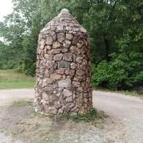
Photographed by Marc Hayot, July 29, 2018
8. Three State Corner Marker
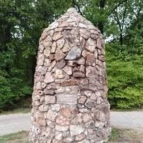
Photographed by Marc Hayot, July 29, 2018
9. Three State Corner Marker
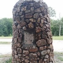
Photographed by Marc Hayot, July 29, 2018
10. Three State Corner Marker
Credits. This page was last revised on October 6, 2026. It was originally submitted on June 27, 2014, by Duane Hall of Abilene, Texas. This page has been viewed 3,124 times since then and 234 times this year. Last updated on December 12, 2019, by Jason Voigt of Glen Carbon, Illinois. Photos: 1, 2, 3, 4, 5, 6, 7. submitted on June 27, 2014, by Duane Hall of Abilene, Texas. 8, 9, 10. submitted on September 28, 2026, by Marc Hayot of Siloam Springs, Arkansas. • Devry Becker Jones was the editor who published this page.
