Mountain Rest in Oconee County, South Carolina — The American South (South Atlantic)
Cherokee Boundary (1777)
[Front Side]:
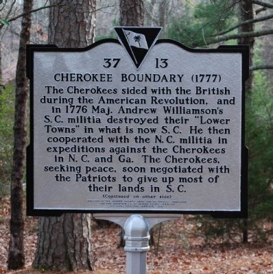
The Cherokee sided with the British during the American Revolution, and in 1776 Maj. Andrew Williamson's S.C. militia destroyed their "Lower Towns" in what is now S.C. He then cooperated with the N.C. militia in expeditions against the Cherokees in N.C. and Ga. The Cherokees, seeking peace, soon negotiated with the Patriots to give up most of their lands in S.C.
[Reverse Side]:
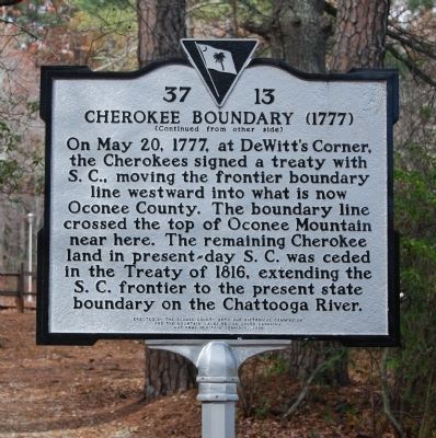
On May 20, 1777, at DeWitt's Corner, the Cherokees signed a treaty with S.C., moving the frontier boundary line westward into what is now Oconee County. The boundary line crossed the top of Oconee Mountain near here. The remaining Cherokee land in present-day S.C. was ceded in the Treaty of 1816, extending the S.C. frontier to the present state boundary on the Chattooga River.
Erected 2006 by Oconee County Arts and Historical Commission, the Mountain Lakes Region South Carolina, and the National Heritage Corridor. (Marker Number 37-13.)
Topics. This historical marker is listed in these topic lists: Native Americans • Settlements & Settlers • War, US Revolutionary. A significant historical month for this entry is May 1933.
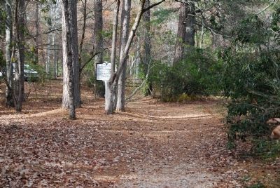
Location. 34° 51.917′ N, 83° 6.286′ W. Marker is in Mountain Rest, South Carolina, in Oconee County. Marker is on State Park Road. Marker is located east of the main parking lot, a short walk down a path. Touch for map. Marker is at or near this postal address: 624 State Park Road, Mountain Rest SC 29664, United States of America. Touch for directions.
Other nearby markers. At least 10 other markers are within 4 miles of this marker, measured as the crow flies. Oconee State Park (within shouting distance of this marker); Building a Tradition (within shouting distance of this marker); Civilian Conservation Corps Monument (within shouting distance of this marker); A Building with a Past (within shouting distance of this marker); The Civilian Conservation Corps (within shouting distance of this marker); The Oconee Waterwheel (about 400 feet away, measured in a direct line); Mountain Rest School / Hillbilly Day (approx. 2.3 miles away); Oconee Station / Oconee County (approx. 2.4 miles away); Oconee Town (approx. 2.8 miles away); Chauga Town (approx. 3.1 miles away). Touch for a list and map of all markers in Mountain Rest.
Related markers. Click here for a list of markers that are related to this marker. Other markers denoting the boundary in present-day Greenville County, 1767
Credits. This page was last revised on December 14, 2019. It was originally submitted on December 10, 2008, by Brian Scott of Anderson, South Carolina. This page has been viewed 2,141 times since then and 71 times this year. Photos: 1, 2, 3. submitted on December 10, 2008, by Brian Scott of Anderson, South Carolina.


