Marker Logo
THE HISTORICAL
MARKER DATABASE
“Bite-Size Bits of Local, National, and Global History”
Near Lewistown in Fergus County, Montana — The American West (Mountains)
 

Pre-War Hangar
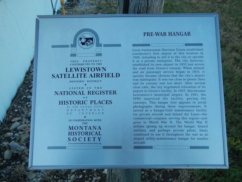
 
 
Pre-War Hangar Marker image. Click for full size.
Photographed by Barry Swackhamer, August 18, 2019
1. Pre-War Hangar Marker
Inscription. Local businessman Harrison Green established Lewistown’s first airport at this location in 1928, intending to sell it to the city or operate it as a private enterprise. The city, however, established its own airport in 1933 just across the road from Green’s runway. When airmail and air passenger service began in 1933, it quickly became obvious that the city’s airport was inadequate. It was too close to power lines and its runway was too short. After several close calls, the city negotiated relocation of its airport to Green’s facility. In 1937, this became Lewistown’s municipal airport. In 1941, the WPA improved the facility, paving the runways. This hangar first appears in aerial photographs during these improvements. It served as a hangar-field maintenance facility for private aircraft and Inland Air Lines—the commercial company serving this region—just prior to World War II. The World War II airbase sprang up around the hangar. Inland Airlines, and perhaps private pilots, likely continued to use it throughout the war as an airport utility-maintenance hangar for smaller aircraft.
 
Erected by The Montana
Paid Advertisement
Click or scan to see
this page online
National Register Sign Program.
 
Topics and series. This historical marker is listed in these topic lists: Air & SpaceCharity & Public WorkWar, World II. In addition, it is included in the Montana National Register Sign Program series list.
 
Location. 47° 2.874′ N, 109° 27.395′ W. Marker is near Lewistown, Montana, in Fergus County. It is at the intersection of East Aztec Drive and Stratosphere Drive, on the right when traveling east on East Aztec Drive. Touch for map. Marker is in this post office area: Lewistown MT 59457, United States of America. Touch for directions.

Regionally, this marker is in andspecifically entral Montana in Russell Country. It is also in the American Mountain West and in the Lewis & Clark Corridor. Globally, it is in North America, the Western Hemisphere, the Western World, and the Anglosphere. Historically, it finds itself in what was once Rupert’s Land and also the Louisiana Purchase.

Other nearby markers. At least 8 other markers are within walking distance of this marker: Training Building (within shouting distance of this
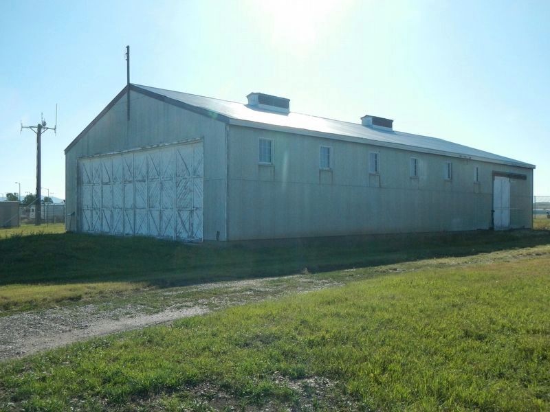
Pre-War Hangar and Marker image. Click for full size.
Photographed by Barry Swackhamer, August 18, 2019
2. Pre-War Hangar and Marker
The marker is to the left of the hangar door.
marker); All Purpose Shop (within shouting distance of this marker); Camouflage Building (about 300 feet away, measured in a direct line); Quartermaster Warehouses (about 300 feet away); Armament Building (about 400 feet away); Crew Chief Building (about 400 feet away); Recreation Building (about 500 feet away); Lewiston Satellite Airfield Historic District (about 800 feet away). Touch for a list and map of all markers in Lewistown.
 
More about this marker. This marker is located at the former Lewistown Satellite Airfield, now the Lewiston Municipal Airport.
 
 
Credits. This page was last revised on December 22, 2019. It was originally submitted on December 16, 2019, by Barry Swackhamer of Brentwood, California. This page has been viewed 213 times since then and 13 times this year. Photos:   1, 2. submitted on December 16, 2019, by Barry Swackhamer of Brentwood, California.

m=143593

CeraNet Cloud Computing sponsors the Historical Marker Database.
This website earns income from purchases you make after using our links to Amazon.com. We appreciate your support.
Paid Advertisement
Jul. 15, 2026