Port Morien in Cape Breton Region, Nova Scotia — The Atlantic Provinces (North America)
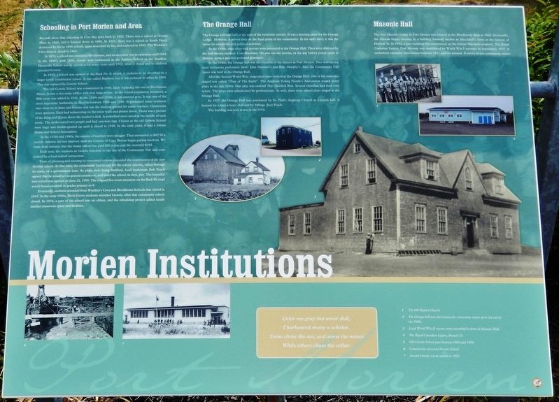
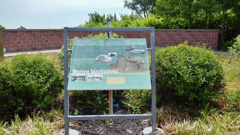
Morien Institutions
Schooling in Port Morien and Area
Records show that schooling in Cow Bay goes back to 1826. There was a school at Gowrie Mine in 1862, and it burned down in 1880. In 1867, there was a school at South Head, destroyed by fire in 1890, rebuilt, again destroyed by fire, and replaced in 1892. The Wadden's Cove School closed in 1965.
In 1870, a school was erected at Blockhouse, and its successor was in operation until 1965. In the 1890's until 1906, classes were conducted in the Auburn School at the Sandbar. Homeville School was in operation for many years until 1952, when it closed and its students attended Gowrie.
In 1893, a school was opened at the Back Pit. It closed, it students to be absorbed by a larger newly constructed school. It was called Bayview, but it was reduced to ashes in 1899. This was replaced by Gowrie School.
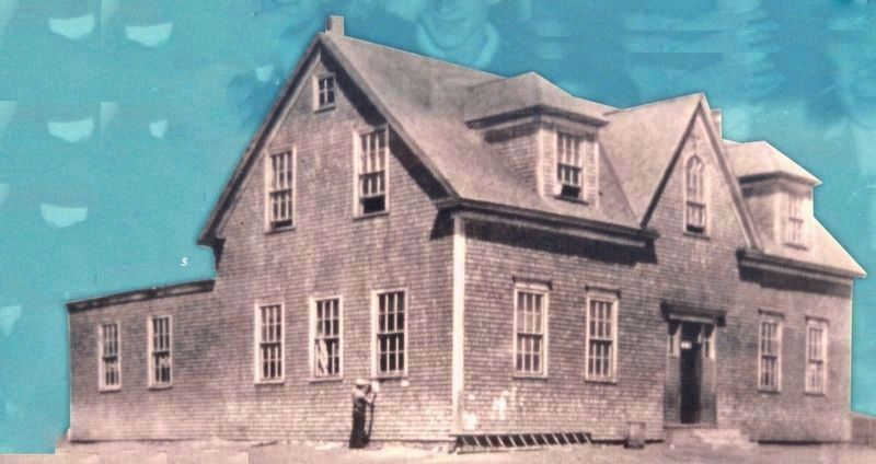
The old Gowrie School was constructed in 1900, likely replacing the one at Blockhouse Mines. It was a two-story edifice with four large rooms. As the school population increased, a fifth room was added in 1924. In the 1940s and 1950s, it was painted gray. It was one of the most important landmarks in Morien between 1900 and 1949. It graduated many residents who went on to fame and fortune and was the training ground for many teachers. Classrooms were spacious. Each had wainscoting on the lower walls and plaster above. There was a picture of the King and Queen above the teacher's desk. A potbellied stove stood in the middle of each room. The desks seated two people and had cast-iron legs. Classes at the old Gowrie School were large and double-graded up until it closed in 1949. In the early years, it had a robust Home and School Association.
In the 1930s and 1940s, the salaries of teachers were meager: They amounted to $42.50 a month. Salaries did not improve until the County of Cape Breton began paying teachers. We learn from minutes that the truant officer was paid $50 a year and the secretary $165.
Each year, the students at Gowrie marched to the site of the Community Fair and were trained by a local retired serviceman.
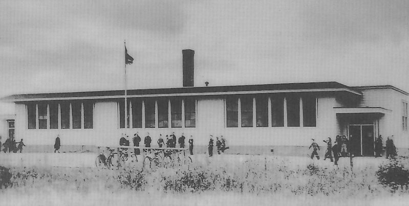
Years of planning and meeting by concerned citizens preceded the construction of the new Gowrie school. At that time, the community had to pay for the school directly, either through its taxes, or a government loan. As plans were being finalized, local tradesman Rob Peach agreed that he would act as general contractor, and build the school on days, pay. The beautiful new school was opened on June 21, 1950. The original five-room structure on the Back Pit road would house students in grades primary to 9.
Eventually, students attended from Wadden's Cove and Blockhouse Schools that closed in 1965. In the early 1980s, Birch Grove students attended Gowrie, after that community school closed. In 1974, a part of the school was set ablaze, and the rebuilding project added much needed classroom space and facilities.
The Orange Hall
The Orange hall was built at the turn of the twentieth century. It was a meeting place for the Orange Lodge. However, it served early as the focal point of the community. In the early days, it was the venue for vaudeville and political activities.
In the 1930s, stage plays and movies were presented at the Orange Hall. Plays were directed by the well-known resident Tom Maclnnis. He also ran the movies, in the day before power came to Morien, using a gasoline-powered generator.
In the 1940s, the Orange hall was the location of the dances in Port Morien. Two well-known local orchestras performed there: John Murrant's and Billy Murphy's. Also the Community Fair dance was held at the Orange Hall.
After the Second World War, stage plays were revived at the Orange Hall. One of the comedies staged was called "Dust of The Earth". The Anglican Young People's Association staged many plays in the late 1940s. One play was entitled The Glorified Brat. Several churches had their own actors. The plays were adjudicated by professionals. As well, there were school plays staged at the Orange Hall.
In 1957, the Orange
Hall was purchased by St. Paul's Anglican Church as a parish hall. It housed for a time a boys' club run by Millage (Joe) Peach.
The building was torn down in the 1979.
Masonic Hall
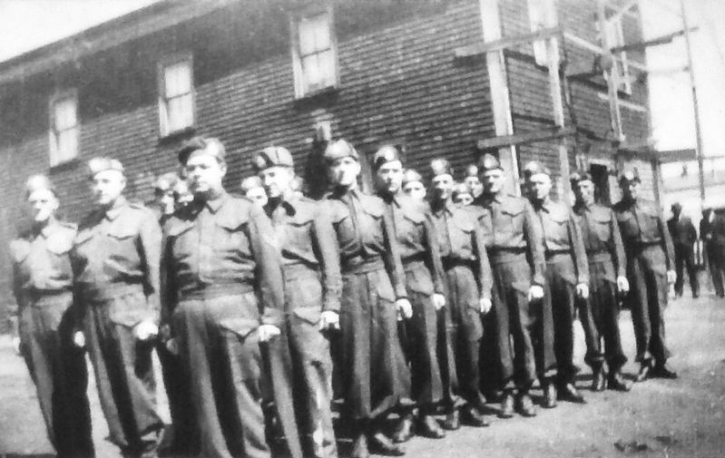
The first Masonic Lodge in Port Morien was located in the Blockhouse Area in 1865. Eventually, the Masons began meeting in a building formerly known as MacAskill's Store at the bottom of Hanway St. In 1962, a new building was constructed on the former Maclnnis property. The Royal Canadian Legion, Port Morien, was established by World War I veterans in September, 1937. It underwent extensive renovations between 1951 and the present. It serves as our community center.
(photo captions)
1. The Old Baptist Church.
2. The Orange hall was the location for community events up to the end of the 1960s.
3. Local World War II reserve army assembled in front of Masonic Hall.
4. The Royal Canadian Legion, Branch 55.
5. Old Gowrie School open between 1900 and 1950.
6. Construction of second Gowrie School.
7. Second Gowrie school opened in 1950.
Erected by Enterprise Cape Breton Corporation, Cape Breton County Economic Development Authority, and the Cape Breton Regional Municipality.
Topics. This historical marker is listed in these topic lists: Education • Entertainment • Fraternal or Sororal Organizations.
Location. 46° 8.01′ N, 59° 52.367′ W. Marker is in Port Morien, Nova Scotia, in Cape Breton Region. Marker is at the intersection of Marconi Trail (Nova Scotia Route 255) and Breakwater Street, on the right when traveling north on Marconi Trail. Marker is located in a roadside interpretive plaza at the southeast corner of the intersection. Touch for map. Marker is in this post office area: Port Morien NS B1B 1A8, Canada. Touch for directions.
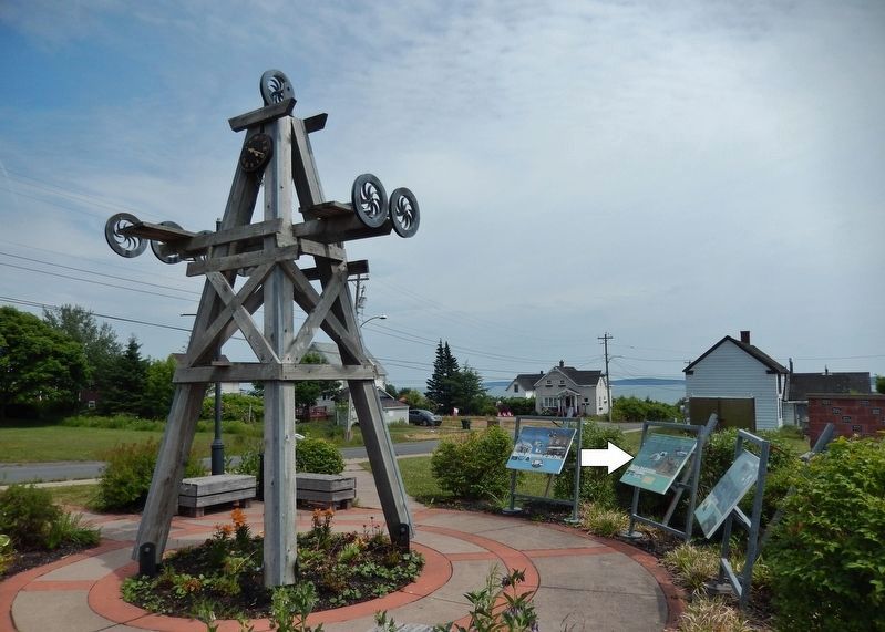
Other nearby markers. At least 8 other markers are within walking distance of this marker. Morien's Legacy (here, next to this marker); Morien Businesses of the Past (here, next to this marker); Flint Island Light Station (approx. half a kilometer away); Gowrie and North Atlantic Collieries (approx. half a kilometer away); The Fishery in Port Morien (approx. half a kilometer away); Morien Bay (approx. half a kilometer away); First Boy Scout Troop in North America (approx. 0.6 kilometers away); The First Coal Workings in North America (approx. 0.6 kilometers away). Touch for a list and map of all markers in Port Morien.
Related markers. Click here for a list of markers that are related to this marker. Port Morien Interpretive Walking Tour
Credits. This page was last revised on January 2, 2020. It was originally submitted on January 2, 2020, by Cosmos Mariner of Cape Canaveral, Florida. This page has been viewed 260 times since then and 29 times this year. Photos: 1, 2, 3, 4, 5, 6. submitted on January 2, 2020, by Cosmos Mariner of Cape Canaveral, Florida.
