Port Morien in Cape Breton Region, Nova Scotia — The Atlantic Provinces (North America)
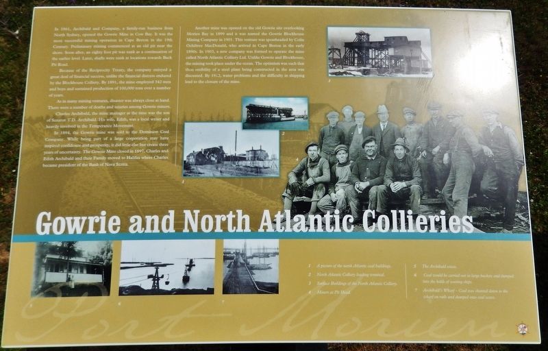
Gowrie and North Atlantic Collieries
Because of the Reciprocity Treaty, the company enjoyed a great deal of financial success, unlike the financial distress endured by the Blockhouse Colliery. By 1891, the mine employed 342 men and boys and sustained production of 100,000 tons over a number of years.
As in many mining ventures, disaster was always close at hand. There were a number of deaths and injuries among Gowrie miners.
Charles Archibald, the mine manager at the time was the son of Senator T.D. Archibald. His wife, Edith, was a local writer and heavily involved in the Temperance Movement.
In 1894, the Gowrie mine was sold to the Dominion Coal Company. While being part of a large corporation may have inspired confidence and prosperity, it did little else but create three years of uncertainty. The Gowrie Mine closed in 1897. Charles and Edith Archibald and their Family moved to Halifax where Charles became president of the Bank of Nova Scotia.
Another mine was opened on the old Gowrie site overlooking Morien Bay in 1899 and it was named the Gowrie Blockhouse Mining Company in 1901. This venture was spearheaded by Colin Ochiltree MacDonald, who arrived in Cape Breton in the early 1890s. In 1903, a new company was formed to operate the mine called North Atlantic Colliery Ltd. Unlike Gowrie and Blockhouse, the mining took place under the ocean. The optimism was such that the possibility of a steel plant being constructed in the area was discussed. By 1912, water problems and the difficulty in shipping lead to the closure of the mine.
(photo captions)
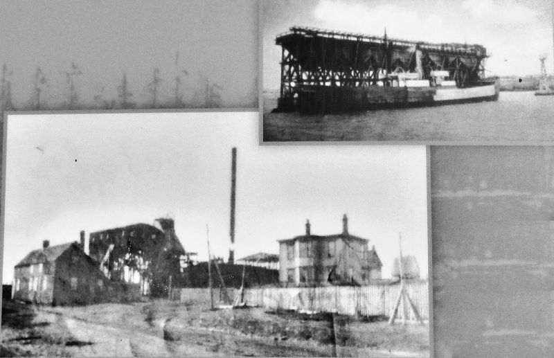
1. A picture of the north Atlantic coal buildings.
2. North Atlantic Colliery loading terminal.
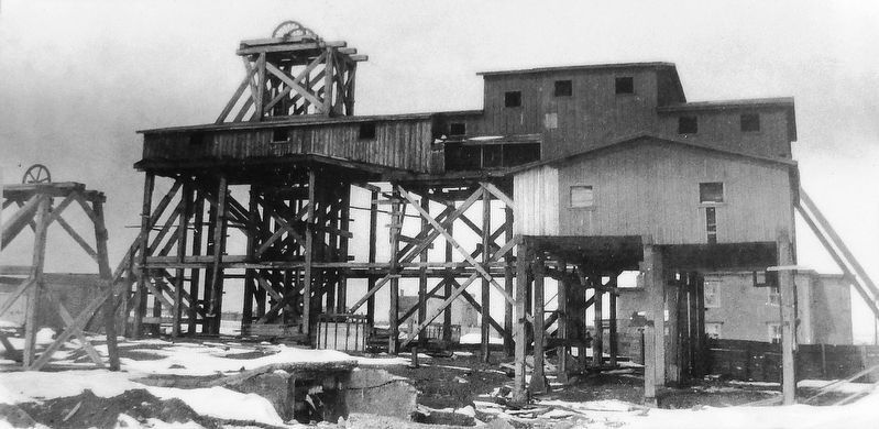
3. Surface Buildings of the North Atlantic Colliery.
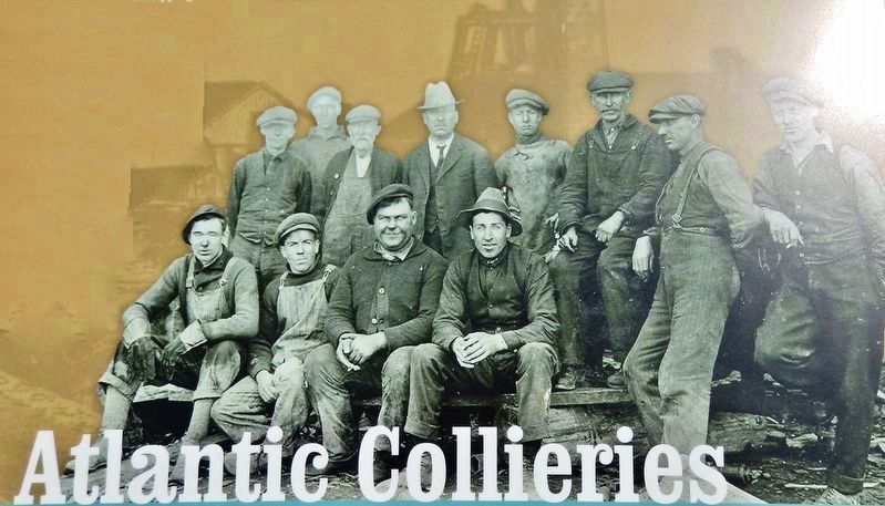
4. Miners at Pit Head.
5. The Archibald estate.
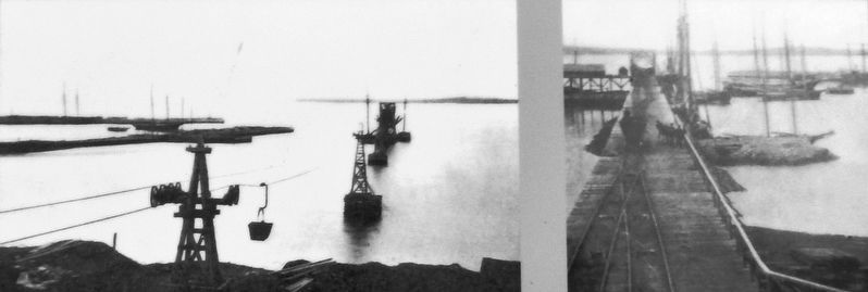
6. Coal would be carried out in large buckets and dumped into the holds of waiting ships.
7. Archibald’s Wharf — Coal was shunted down to the wharf on rails and dumped onto coal scows.
Erected by Enterprise Cape Breton Corporation, Cape Breton County Economic Development Authority, and the Cape Breton Regional Municipality.
Topics. This historical marker is listed in this topic list: Industry & Commerce. A significant historical year for this entry is 1861.
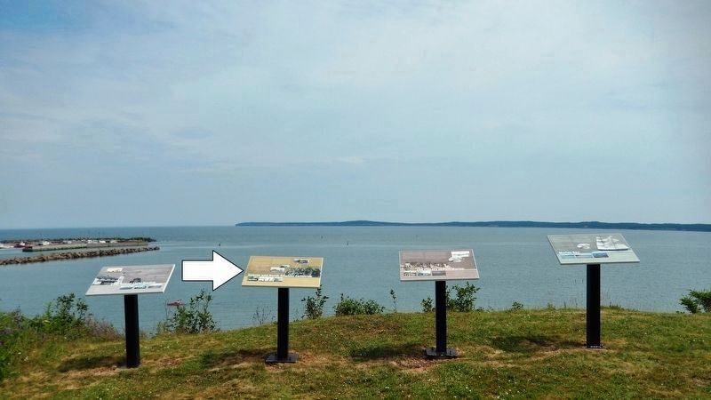
Location. 46° 7.799′ N, 59° 52.55′ W. Marker is in Port Morien, Nova Scotia, in Cape Breton Region. Marker is on Marconi Trail (Nova Scotia Route 255) 0.2 kilometers south of Birch Grove Road, on the right when traveling north. Marker is located beside the highway on the south side of Morien Cliffs Municipal Park, overlooking Morien Bay. Touch for map. Marker is in this post office area: Port Morien NS B1B 1V9, Canada. Touch for directions.
Other nearby markers. At least 8 other markers are within walking distance of this marker. The Fishery in Port Morien (here, next to this marker); Flint Island Light Station (here, next to this marker); Morien Bay (here, next to this marker); Morien's Legacy (approx. half a kilometer away); Morien Institutions (approx. half a kilometer away); Morien Businesses of the Past (approx. half a kilometer away); First Boy Scout Troop in North America (approx. 1.1 kilometers away); The First Coal Workings in North America (approx. 1.1 kilometers away). Touch for a list and map of all markers in Port Morien.
Related markers. Click here for a list of markers that are related to this marker. Port Morien Interpretive Walking Tour
Also see . . .
1. Canadian–American Reciprocity Treaty (Wikipedia). The Canadian–American Reciprocity Treaty of 1854 was a trade treaty between the United Kingdom and the United States, applying to British possessions in North America including the Province of Canada, New Brunswick, Nova Scotia, Prince Edward Island, and Newfoundland Colony. It covered raw materials and was in effect from 1854 to 1866. (Submitted on January 3, 2020, by Cosmos Mariner of Cape Canaveral, Florida.)
2. Cape Breton's undersea coal field. French explorer Nicholas Deny discovered abundant coal ("a mountain of very good coal four leagues up the river") on Cape Breton Island in 1672. Within a few years, miners were prying coal from rock outcroppings along the coast with crowbars. Cape Breton miners went under the sea for coal as early as 1877 (eventually digging tunnels more than three miles in length). (Submitted on January 3, 2020, by Cosmos Mariner of Cape Canaveral, Florida.)
Credits. This page was last revised on January 3, 2020. It was originally submitted on January 2, 2020, by Cosmos Mariner of Cape Canaveral, Florida. This page has been viewed 246 times since then and 12 times this year. Photos: 1. submitted on January 2, 2020, by Cosmos Mariner of Cape Canaveral, Florida. 2, 3, 4, 5, 6. submitted on January 3, 2020, by Cosmos Mariner of Cape Canaveral, Florida.
