Lorentz in Upshur County, West Virginia — The American South (Appalachia)
Population Center
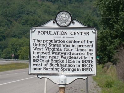
Photographed by J. J. Prats, July 15, 2008
1. Population Center Marker
Erected by West Virginia Archives and History.
Topics and series. This historical marker is listed in this topic list: Notable Places. In addition, it is included in the West Virginia Archives and History series list. A significant historical year for this entry is 1820.
Location. 39° 0.642′ N, 80° 18.117′ W. Marker is in Lorentz, West Virginia, in Upshur County. It is at the intersection of U.S. 33 and County Highway 5/1, on the right when traveling west on U.S. 33. Touch for map. Marker is in this post office area: Lorentz WV 26229, United States of America. Touch for directions.

Regionally, this marker is in North Central West Virginia. It is also in the American South, specifically in
this page online
Other nearby markers. At least 8 other markers are within 4 miles of this marker, measured as the crow flies: Lorentz (approx. ¼ mile away); The Bassel House (approx. 2.7 miles away); The History Center (approx. 3.9 miles away); Buckhannon City Seal Mural (approx. 3.9 miles away); In Tribute to and in Memory of Buckhannon Volunteer Fire Department, Inc. (approx. 4 miles away); Buckhannon / Frontier Days (approx. 4 miles away); Operation Desert Storm Memorial (approx. 4 miles away); Destruction at the Courthouse (approx. 4 miles away).
Related marker. Click here for another marker that is related to this marker.
Also see . . . Centers of Population. If
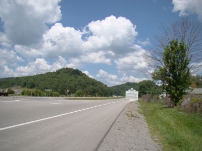
Photographed by J. J. Prats, July 15, 2008
2. Population Center Marker
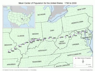
the Geography Division, U.S. Census Bureau, 2001
3. Mean Center of Population for the United States
Click on image to enlarge. This map shows county boundaries.
Credits. This page was last revised on June 9, 2020. It was originally submitted on December 14, 2008, by J. J. Prats of Powell, Ohio. This page has been viewed 1,475 times since then and 31 times this year. Photos: 1, 2, 3. submitted on December 14, 2008, by J. J. Prats of Powell, Ohio.
