Fredericksburg, Virginia — The American South (Mid-Atlantic)
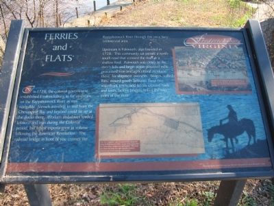
Ferries and Flats
Upstream is Falmouth, also founded in 1728. This community sat astride a north-south road that crossed the river at a shallow ford. Falmouth was closer to the river's falls and large, water-powered mills processed iron and agricultural products there, for shipment overseas. Barges called flats, moved goods between these two waterfront towns and ferries crossed back and forth, before bridges linked the two sides of the river.
Topics. This historical marker is listed in these topic lists: Industry & Commerce • Waterways & Vessels. A significant historical year for this entry is 1728.
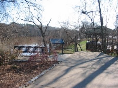
Location. Marker has been permanently removed. It was located near 38° 18.088′ N, 77° 27.362′ W. Marker was in Fredericksburg, Virginia. Marker could be reached from Sophia Street, on the right when traveling north . Located in a parking area in the downtown Fredericksburg area, at an overlook of the river. Touch for map. Marker was in this post office area: Fredericksburg VA 22401, United States of America.
We have been informed that this sign or monument is no longer there and will not be replaced. This page is an archival view of what was.
Other nearby markers. At least 8 other markers are within walking distance of this location. The sandstone blocks… (a few steps from this marker); This natural rise in the landscape… (within shouting distance of this marker); 1846-47 / Philip Y. Wyatt (about 400 feet away, measured in a direct line); Shiloh Baptist Church (Old Site) (about 400 feet away); Thornton's Tavern (about 400 feet away); The African Baptist Church (about 500 feet away); a different marker also named Shiloh Baptist Church (Old Site) (about 500 feet away); 1950 Walker-Grant Protest (about 500 feet away). Touch for a list and map of all markers in Fredericksburg.
More about this marker. In the upper right is a painting of Fredericksburg around 1856. This detail from an 1856 lithograph depicts a busy Fredericksburg waterfront, just downstream of a wooden railroad bridge. Note the flat-bottomed ferry to the left. The barges or flats, that plied these waters to and from Falmouth would have been very similar.
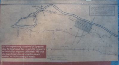
In the lower center is a map captioned: This 1817 engineer's map documented the topography along the Rappahannock River, as part of the preparation for constructing a navigational canal system. This detail also shows the nearly two-mile separation between Falmouth and Fredericksburg's port facilities.
Credits. This page was last revised on March 4, 2023. It was originally submitted on December 14, 2008, by Craig Swain of Leesburg, Virginia. This page has been viewed 1,057 times since then and 27 times this year. Photos: 1, 2, 3, 4. submitted on December 14, 2008, by Craig Swain of Leesburg, Virginia.


