Missoula in Missoula County, Montana — The American West (Mountains)
Charles C. Brothers Residence
University Area Historic District
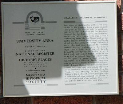
Photographed by Barry Swackhamer, August 20, 2019
1. Charles C. Brothers Residence Marker
this page online
Erected by Montana National Register Sign Program.
Topics and series. This historical marker is listed in these topic lists: Architecture • Notable Buildings. In addition, it is included in the Montana National Register Sign Program series list.
Location. 46° 51.615′ N, 113° 59.662′ W. Marker is in Missoula, Montana, in Missoula County. It is at the intersection of University Avenue and Ronald Avenue on University Avenue. Touch for map. Marker is at or near this postal address: 240 University Avenue, Missoula MT 59801, United States of America. Touch for directions.

Regionally, this marker is in Western Montana and in Glacier Country. It is also in the American Mountain West and in the Lewis & Clark Corridor. Globally, it is in North America, the Rocky Mountains, the Western Hemisphere, the Western World, and the Anglosphere. Historically, it finds itself in what was once Rupert’s Land and also the Louisiana Purchase.
Other nearby markers. At least 8 other markers are within walking distance of this marker: John M. Keith House (about 300 feet away, measured
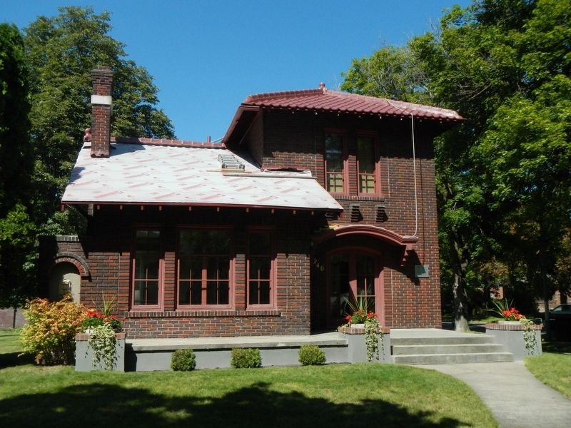
Photographed by Barry Swackhamer, August 20, 2019
2. Charles C. Brothers Residence and Marker
The marker is to the right of the entry.
Credits. This page was last revised on January 9, 2020. It was originally submitted on January 9, 2020, by Barry Swackhamer of Brentwood, California. This page has been viewed 231 times since then and 16 times this year. Photos: 1, 2. submitted on January 9, 2020, by Barry Swackhamer of Brentwood, California.
