Pawling in Dutchess County, New York — The American Northeast (Mid-Atlantic)
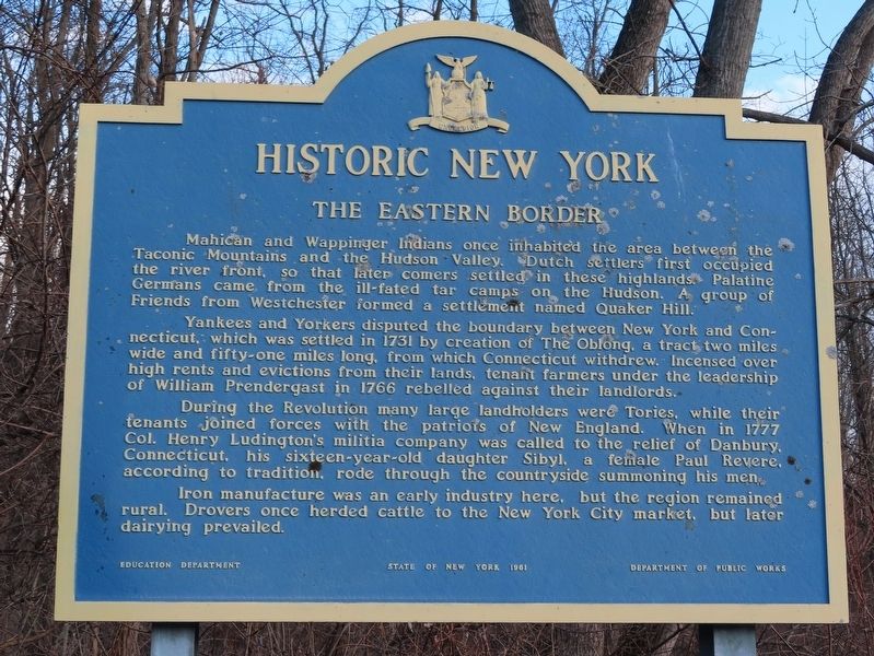
The Eastern Border
Historic New York
Mahican and Wappinger Indians once inhabited the area between the Taconic Mountains and the Hudson Valley. Dutch settlers first occupied the river front, so that later comers settled in these highlands. Palatine Germans came from the ill-fated tar camps on the Hudson. A group of Friends from Westchester formed a settlement named Quaker Hill.
Yankees and Yorkers disputed the boundary between New York and Connecticut, which was settled in 1731 by creation of The Oblong, a tract two miles wide and fifty-one miles long, from which Connecticut withdrew. Incensed over high rents and evictions from their lands, tenant farmers under the leadership of William Prendergast in 1766 rebelled against their landlords.
During the Revolution many large landholders were Tories, while their tenants joined forces with the patriots of New England. When in 1777 Col. Henry Ludington's militia company was called to the relief of Danbury, Connecticut, his sixteen-year-old daughter Sibyl. a female Paul Revere, according to tradition, rode through the countryside summoning his men.
Iron manufacture was an early industry here, but the region remained rural. Drovers once herded cattle to the New York City market, but later dairying prevailed.
Erected 1961 by Education Department & Department of Public Works.
Topics. This historical marker is listed in this topic list: Colonial Era. A significant historical year for this entry is 1731.
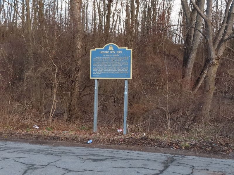
Location. 41° 35.697′ N, 73° 35.177′ W. Marker is in Pawling, New York, in Dutchess County. Marker is on New York State Route 22 & 55, 0.4 miles north of N Quaker Hill Road, on the right when traveling north. Touch for map. Marker is in this post office area: Pawling NY 12564, United States of America. Touch for directions.
Other nearby markers. At least 8 other markers are within 3 miles of this marker, measured as the crow flies. Applachian Trail (within shouting distance of this marker); Grange Hall (approx. 1.6 miles away); Lakeside Park (approx. 1.6 miles away); Pawling School 1907 (approx. 1.7 miles away); Murrow Park (approx. 2.4 miles away); Memorial Trees (approx. 2.4 miles away); Cole’s Mill (approx. 2.4 miles away); Pawling Veterans Memorial (approx. 2.4 miles away). Touch for a list and map of all markers in Pawling.
Credits. This page was last revised on January 10, 2020. It was originally submitted on January 10, 2020, by Michael Herrick of Southbury, Connecticut. This page has been viewed 217 times since then and 34 times this year. Photos: 1, 2. submitted on January 10, 2020, by Michael Herrick of Southbury, Connecticut.

