Austin in Lander County, Nevada — The American Mountains (Southwest)
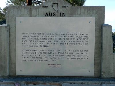
Austin
1864 — 1964
A town called Clifton flourished briefly in Pony Canyon, but fast-growing Austin soon took over and became the county seat in 1863. Before the mines began to fail in the 1880's Austin was a substantial city of 10,000 people. From Austin, prospectors fanned out to open many other important mining camps.
Nevada Centennial Marker No. 8
Nevada State Park System
Erected 1975 by Nevada State Park System. (Marker Number 8.)
Topics. This historical marker is listed in these topic lists: Industry & Commerce • Settlements & Settlers. A significant historical month for this entry is May 1841.
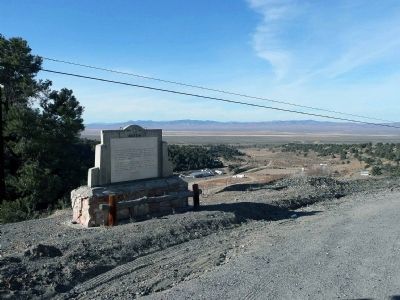
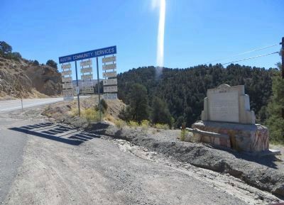
Location. 39° 29.9′ N, 117° 4.767′ W. Marker is in Austin, Nevada, in Lander County. Marker is on Highway 50, on the right when traveling east. Touch for map. Marker is in this post office area: Austin NV 89310, United States of America. Touch for directions.
Other nearby markers. At least 8 other markers are within walking distance of this marker. Austin Cemetery (1863) (approx. 0.3 miles away); Stokes Castle (approx. 0.3 miles away); International Hotel (approx. half a mile away); The Sazerac Lying Club (approx. 0.6 miles away); Reese River Navigation Company (approx. 0.6 miles away); Austin City Railway (approx. 0.6 miles away); Votes for Women (approx. 0.6 miles away); St. Augustine (approx. 0.6 miles away). Touch for a list and map of all markers in Austin.
Also see . . .
1. Ghost Towns - Austin. (Submitted on December 25, 2008, by Karen Key of Sacramento, California.)
2. New Amended Text for Marker. The Nevada State Historic Preservation Office (SHPO) recently updated the text of the roughly 260 state historical markers in Nevada. The Nevada SHPO placed the amended text of each individual marker on its website and will change the actual markers in the field as funding allows. The marker has been amended to remove the reference to "mother town of mining camps" and to change the population from 10,000 to several thousand. The link will take you to the Nevada SHPO page for the marker with the amended text. (Submitted on November 12, 2013, by Duane Hall of Abilene, Texas.)
Credits. This page was last revised on October 27, 2020. It was originally submitted on December 15, 2008, by Karen Key of Sacramento, California. This page has been viewed 1,168 times since then and 27 times this year. Photos: 1, 2. submitted on December 15, 2008, by Karen Key of Sacramento, California. 3, 4. submitted on October 22, 2013, by Bill Kirchner of Tucson, Arizona.


