Missoula in Missoula County, Montana — The American West (Mountains)
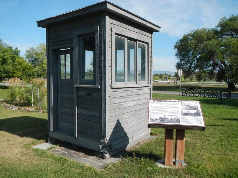
Fort Missoula Guard Tower
Inscription.
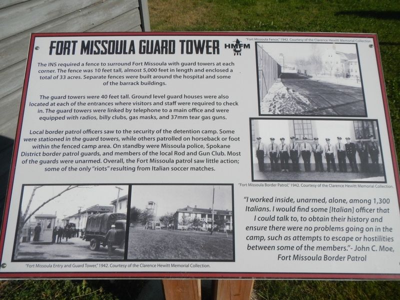
The INS required a fence to surround Fort Missoula with a guard tower at each corner. The fence was 10 feet tall, almost 5,000 feet in length and enclosed a total of 33 acres. Separate fences were built around the hospital and some of the barrack buildings.
The guard towers were 40 feet tall. Ground level guard houses were also located at each of the entrances where visitors and staff were required to check in. The guard towers are linked by telephone to the main office and were equipped with radios, billy clubs, gas masks, and 37mm tear gas guns.
Local border patrol officers saw to the security of the detention camp. Some were stationed in the guard towers, while others patrolled on horseback or foot within the fenced camp area. On standby where Missoula police, Spokane District border patrol guards, and members of the local Rod and Gun Club. Most of the guards were unarmed. Overall, the Fort Missoula patrol saw little action; some of the only "riots" resulting from Italian soccer matches.
"I worked inside, unarmed, alone, among 1,300 Italians. I would find some (Italian) officer that I could talk to, to obtain their history and ensure there were no problems going on in the camp, such as attempts to escape or hostilities between some of the members." - John C. Moe, Fort Missoula Border Patrol.
Erected by Historical Museum at Fort Missoula.
Topics. This historical marker is listed in these topic lists: Forts and Castles • War, World II.
Location. 46° 50.643′ N, 114° 3.761′ W. Marker is in Missoula, Montana, in Missoula County. Marker is on Captain Rawn Way near Fort Missoula Road, on the left when traveling north. Touch for map. Marker is at or near this postal address: 3400 Captain Rawn Way, Missoula MT 59804, United States of America. Touch for directions.
Other nearby markers. At least 8 other markers are within walking distance of this marker. Quartermaster's Root Cellar (within shouting distance of this marker); "Galloping Goose" (about 300 feet away, measured in a direct line); Sliderock Lookout Tower (about 400 feet away); Fort Missoula Alien Detention Camp (approx. 0.2 miles away); a different marker also named Fort Missoula Alien Detention Camp (approx. 0.2 miles away); Fort Missoula Barrack Building (approx. 0.2 miles away); Fort Missoula Post Headquarters (approx. ¼ mile away); T-1 Post Headquarters (approx. ¼ mile away). Touch for a list and map of all markers in Missoula.
More about this marker. The Guard Tower is next to the Historical Museum at Fort Missoula
Credits. This page was last revised on January 12, 2020. It was originally submitted on January 12, 2020, by Barry Swackhamer of Brentwood, California. This page has been viewed 160 times since then and 8 times this year. Photos: 1, 2. submitted on January 12, 2020, by Barry Swackhamer of Brentwood, California.

