Kahoka in Clark County, Missouri — The American Midwest (Upper Plains)
Clark County
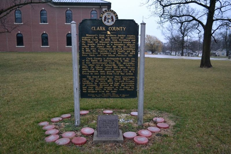
Missouri's first northern border county, organized in 1836, is named for explorer William Clark. In 1839, Iowa Territory and the State of Missouri mobilized troops on the nearby border in a boundary dispute called the Honey War for the bee trees in the area. Compromise averted hostilities. In 1851, the Supreme Court finally set the Missouri-Iowa boundary at the old 1824 Iowa, Sauk [Sac] and Fox Indian Purchase Line.
Clark County is distinguished as the site of the Battle of Athens, Aug. 5, 1861, one of two northernmost Civil War Skirmishes, (The other was at Salineville, Ohio, July 26, 1863). At Athens, about 500 Union troops under Col. David Moore routed some 800 pro-Southern guards under Col. M.E. Green to save Iowa from Civil War action.
The famed Anti-Horse Thief Association was first organized by David McKee at Luray, to the west, 1854, to curb frontier banditry by capture and legal prosecution of criminals. Revived in 1863, the society had over 40,000 members in 11 states by the early 1900's. In 1926, the word "Horse" was dropped from the name.
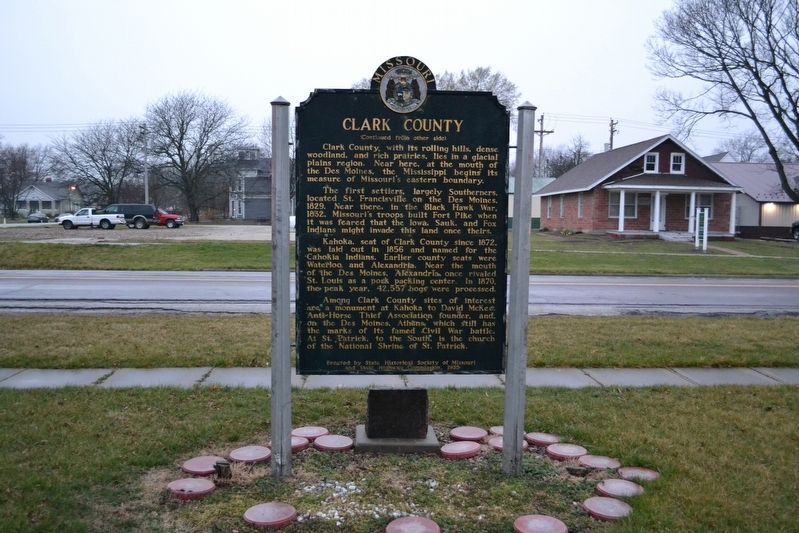
The first settlers, largely Southerners, located St. Francisville on the Des Moines, 1829. Near here, in the Black Hawk War, 1832, Missouri's troops built Fort Pike when it was feared that the Iowa, Sauk, and Fox Indians might invade this land once theirs.
Kahoka, seat of Clark County since 1872, was laid out in 1856 and named for the Cahokia Indians. Earlier county seats were Waterloo and Alexandria. Near the mouth of the Des Moines, Alexandria once rivaled St. Louis as a pork packing center. In 1870, the peak year, 42,557 hogs were processed.
Among Clark County sites of interest are a monument at Kahoka to David McKee, Anti-Horse Thief Association founder, and, on the Des Moines, Athens, which still has the marks of its famed Civil War battle. At St. Patrick, to the south, is the church of the National Shrine of St. Patrick.
Erected 1955 by State Historical Society of Missouri and State Highway Commission.
Topics and series. This historical marker is listed in these topic lists: Industry & Commerce • Settlements & Settlers • War, US Civil. In addition, it is included in the Missouri, The State Historical Society of series list. A significant historical year for this entry is 1836.
Location. 40° 25.481′ N, 91° 43.158′ W. Marker is in Kahoka, Missouri, in Clark County. Marker is on North Johnson Street (Missouri Route 81) north of East Court Street, on the right when traveling north. This marker is located on the west side of the Clark County Court House. Touch for map. Marker is at or near this postal address: 500 North Johnson Street, Kahoka MO 63445, United States of America. Touch for directions.
Other nearby markers. At least 8 other markers are within 12 miles of this marker, measured as the crow flies. Jane Gray House Foundation (approx. 11.1 miles away); Battle of Athens (approx. 11.1 miles away); The Cannons Roar (approx. 11.1 miles away); Businesses in Athens, circa 1853-1860 (approx. 11.1 miles away); The Athens General Store (approx. 11.2 miles away); Missouri State Guard Defends Southern Rights (approx. 11.2 miles away); Athens and Missouri - a Town and State Divided by Civil War (approx. 11.2 miles away); Aftermath of the Battle (approx. 11.2 miles away).
Credits. This page was last revised on January 20, 2020. It was originally submitted on January 17, 2020, by Michael E Sanchez, Jr. of Kansas City, Missouri. This page has been viewed 293 times since then and 68 times this year. Photos: 1, 2. submitted on January 19, 2020, by Michael E Sanchez, Jr. of Kansas City, Missouri. • Bernard Fisher was the editor who published this page.

