
Independence in Jackson County, Missouri — The American Midwest (Upper Plains)
Woodson House
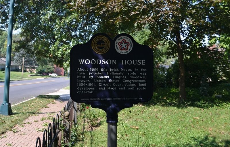
Photographed by Michael E Sanchez, Jr., September 15, 2019
1. Woodson House Marker
About 1866 this brick house, in the then popular Italianate style was built by Samuel Hughes Woodson, lawyer, United States Congressman, 1856-1861, Circuit Judge, land developer, and stage and mail route operator.
Erected 1976 by American Revolution Bicentennial Commission of Independence 1976.
Topics and series. This historical marker is listed in this topic list: Architecture. In addition, it is included in the The Spirit of ’76, America’s Bicentennial Celebration series list. A significant historical year for this entry is 1866.
Location. 39° 5.193′ N, 94° 26.154′ W. Marker is in Independence, Missouri, in Jackson County. It is on West Lexington Avenue just east of South Proctor Place, on the right when traveling west. Touch for map. Marker is at or near this postal address: 1604 West Lexington Avenue, Independence MO 64052, United States of America. Touch for directions.

Regionally, this marker is in Greater Kansas City. It is also in the American Midwest, in the Lewis & Clark Corridor, in the Corn Belt, and on the Santa Fe Trail Corridor. Globally, it is in North America, the Western Hemisphere, the Western
this page online
Other nearby markers. At least 8 other markers are within walking distance of this marker: Battle Line at Railroad Cut (approx. 0.2 miles away); Flournoy House (approx. half a mile away); Temple Lot (approx. half a mile away); Flournoy Home (approx. half a mile away); F.M. Smith Study (approx. half a mile away); The Stone Church (approx. half a mile away); Temple Site (approx. half a mile away); Confederate Line (approx. 0.6 miles away). Touch for a list and map of all markers in Independence.
Also see . . . Woodson/Sawyer House. National Register of Historic Places Inventory Nomination Form (Submitted on January 17, 2020, by Michael E Sanchez, Jr. of Kansas City, Missouri.)
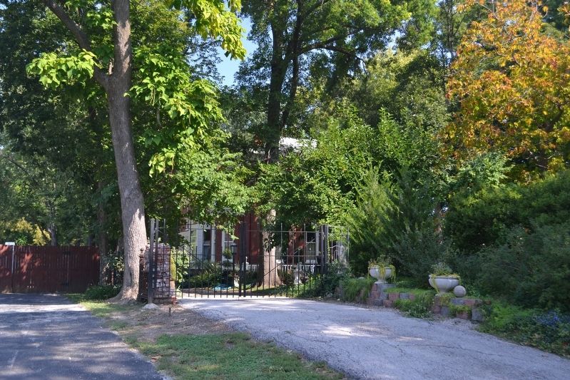
Photographed by Michael E Sanchez, Jr., September 15, 2019
2. Woodson House
Credits. This page was last revised on December 16, 2025. It was originally submitted on January 17, 2020, by Michael E Sanchez, Jr. of Kansas City, Missouri. This page has been viewed 1,216 times since then and 83 times this year. Photos: 1, 2. submitted on January 17, 2020, by Michael E Sanchez, Jr. of Kansas City, Missouri. • Devry Becker Jones was the editor who published this page.
