Oella in Baltimore County, Maryland — The American Northeast (Mid-Atlantic)
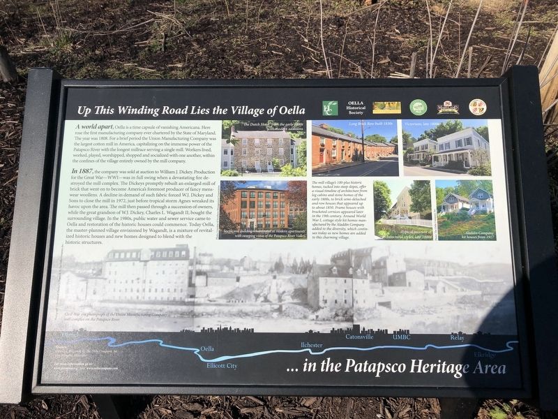
Up This Winding Road Lies the Village of Oella
... in the Patapsco Heritage Area
Photographed by Devry Becker Jones (CC0), January 19, 2020
1. Up This Winding Road Lies the Village of Oella Marker
In 1887, the company was sold at auction to William J. Dickey. Production for the Great War—WWI—was in full swing when a devastating fire destroyed the mill complex. The Dickeys promptly rebuilt an enlarged mill of brick that went on to become America's foremost producer of fancy menswear woollens. A decline in the demand of such fabric forced W.J. Dickey and Sons to close the mill in 1972, just before tropical storm Agnes wreaked its havoc upon the area. The mill then passed through a succession of owners, while the great grandson of W.J. Dickey, Charles L. Wagandt II, bought the surrounding village.
this page online
[Caption:]
The mill village's 100-plus historic homes, tucked into steep slopes offer a visual timeline of architecture from log cabins and stone homes of the early 1800s, to brick semi-detached and row houses that appeared up to about 1850. Frame houses with bracketed cornices appeared later in the 19th century. Around World War I, cottage style kit homes manufactured by the Aladdin Company added to the diversity, which continues today as new homes are added to this charming village.
Erected by Howard County Historical Commission; Oella Historical Society; Patapsco Valley Heritage Greenway; Maryland Heritage Area Authority; Baltimore County, Maryland.
Topics. This historical marker is listed in these topic lists: Architecture • Industry & Commerce • Settlements & Settlers • War, World I • Waterways & Vessels. A significant historical year for this entry is 1808.
Location. 39° 16.074′ N,
Photographed by Devry Becker Jones (CC0), January 19, 2020
2. Up This Winding Road Lies the Village of Oella Marker

Regionally, this marker is in the Baltimore Metro Region and in Central Maryland. It is also in the American Mid-Atlantic, in the Chesapeake Bay Region, and on the Eastern Seaboard. Globally, it is in the North Atlantic Region, North America, the Western Hemisphere, the Western World, and the Anglosphere. Historically, it finds itself in what was once one of the original Thirteen Colonies and also the Antebellum South.
Other nearby markers. At least 8 other markers are within walking distance of this marker: Oella (a few steps from this marker); Ellicott’s Mills (a few steps from this marker); "Just One Nickel and I Could Ride" (within shouting distance of this marker); The George Ellicott House (about 300 feet away, measured in a direct line); Baltimore and Frederick Turnpike Milestone (about 300 feet away); The Patapsco Hotel (about 400 feet away); Turntable & Track (about 400 feet away); a different marker also named B&O Railroad Station (about 400 feet away).
Other markers no longer nearby. Road Versus Rails (was about 400 feet away but has been replaced with another marker now near it); B&O Railroad Station (was about 400 feet away but has been replaced with another marker now near it).
Credits. This page was last revised on January 19, 2020. It was originally submitted on January 19, 2020, by Devry Becker Jones of Washington, District of Columbia. This page has been viewed 763 times since then and 49 times this year. Photos: 1, 2. submitted on January 19, 2020, by Devry Becker Jones of Washington, District of Columbia.
