Athens in Athens-Clarke County, Georgia — The American South (South Atlantic)
Gospel Pilgrim Cemetery
Photographed by David Seibert, November 20, 2008
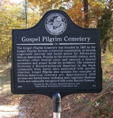
1. Gospel Pilgrim Cemetery Marker
The Gospel Pilgrim Cemetery was founded in 1882 by the Gospel Pilgrim Society, a fraternal organization, to furnish respectable funerals and burial places for Athens-area African Americans. Popular in the nineteenth century, such societies offset funeral costs and ensured a funeral procession and proper burial for members. The cemetery illustrates a Reconstruction-era departure in the black community from burial sites associated with specific churches. Gospel Pilgrim also contains fine examples of African-American funerary art. Approximately 3500 persons are buried here, including state legislator Madison Davis and nationally recognized folk artist Harriet Powers.
Erected 2008 by The Georgia Historical Society and East Athens Development Corporation, Inc. (Marker Number 29-6.)
Topics and series. This historical marker is listed in these topic lists: African Americans • Cemeteries & Burial Sites • Fraternal or Sororal Organizations. In addition, it is included in the Georgia Historical Society series list. A significant historical year for this entry is 1882.
Location. 33° 58.199′ N, 83° 21.739′ W. Marker is
this page online

Regionally, this marker is in the Classic City Area and in the Piedmont. It is also in the American South and specifically in the Deep South. Globally, it is in North America, the Western Hemisphere, the Western World, and the Anglosphere. Historically, it finds itself in what was once the territory of the Mississippian Culture, one of the original Thirteen Colonies, one of the Confederate States of America, and the Antebellum South.
Other nearby markers. At least 8 other markers are within walking distance of this marker: Cook & Brother Armory Earthworks (approx. 0.6 miles away); River Overlook (approx. 0.7 miles away); Hanna Manufacturing Co. (approx. 0.7 miles away); Charles E. Aguar (approx. ¾ mile away); River Overview (approx. 0.8 miles away); a different marker also named River Overview (approx. 0.8 miles away); A View to History (approx.
Photographed by David Seibert, November 20, 2008
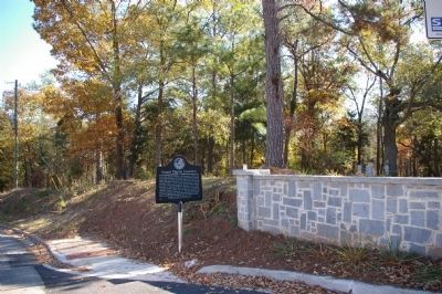
2. Gospel Pilgrim Cemetery Marker looking northeast toward Old Hull Road
Photographed by David Seibert, November 20, 2008
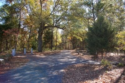
3. Gospel Pilgrim Cemetery
Credits. This page was last revised on July 16, 2018. It was originally submitted on December 17, 2008, by David Seibert of Sandy Springs, Georgia. This page has been viewed 1,450 times since then and 28 times this year. Photos: 1, 2, 3. submitted on December 17, 2008, by David Seibert of Sandy Springs, Georgia. • Christopher Busta-Peck was the editor who published this page.
