
Menntaskólinn í Reykjavík
⎯⎯⎯
High School in Reykjavík
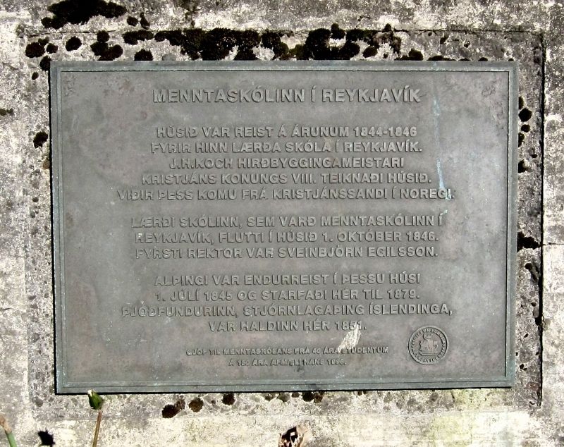

Húsið var reist á árunum 1844-1846 fyrir hinn lærða skóla í Reykjavík. J.H.Koch Hirðbyggingameistari Kristjáns Konungs VIII. Teiknaði Húsið. Viðir þess komu frá Kristjánssand í Noregi.
Laerði skólinn, sem varð menntaskólinn í Reykjavík, flutti í Húsið 1. Október 1846. Fyrsti rektor var Sveinbjörn Egilsson.
Alþingi var endurreist í þessu húsi 1. Juli 1845 og starfaði hér til 1879. Þjoðfundurinn, Stjórnlagaþing Íslendinga, var haldinn hér 1851.
Gjöf til Menntaskólans frá 40 ára studentum á 150 ára afmæli hans 1996.
-
The school, which became the secondary (or high(er)) school for
Reykjavik, moved into the building October 1, 1846.
The first rector was Sveinbjörn Egilsson.
Parliament was restored here in this building on July 1, 1845 and was seated here until 1879. The National Assembly - the Icelandic Constitutional
This plaque is given to the High School from 40 year old students
on its 150th birthday in 1996.
this page online
Erected 1996.
Topics. This historical marker is listed in these topic lists: Education • Government & Politics. A significant historical date for this entry is October 1, 1846.
Location. 64° 8.775′ N, 21° 56.249′ W. Marker is in Reykjavík, Capital Region (Höfuðborgarsvæðið), in Reykjavíkurborg. It is in Downtown. It is at the intersection of Lækjargata and Amtmannstígur, on the right when traveling north on Lækjargata. Touch for map. Marker is in this post office area: Reykjavík, Capital Region 101, Iceland. Touch for directions.
Regionally, it is on the Atlantic Ocean, in the North Atlantic Region, on the Atlantic Arc, in Europe, in Atlantic Europe, in the Nordic Countries, in the Schengen Area, in the Western Hemisphere, and in the Western World.
Other nearby markers. At least 8 other markers are within walking distance of this marker: Þjóðfundurinn 1851 / The National Assembly of 1851 (a few steps from this marker); Landlæknihúsið (within shouting distance of this marker); Gimli (about 90 meters
Also see . . . 1. október 1846 - Hús Hins lærða skóla í Reykjavík var vígt (thingeyri.is, in Icelandic). "On October 1, 1846, the building for the "educational" school in Reykjavík (now the Secondary School) was inaugurated, but the school had previously been located at Bessastaðir.
This was by far the largest building in town. The transfer of the school "played a major role in transforming Reykjavik from a semi-Danish seafront to an international marketplace," according to Bishop Jón Helgason." (Submitted on February 1, 2020.)
Credits. This page was last revised on February 1, 2020. It was originally submitted on February 1, 2020, by Andrew Ruppenstein of Lamorinda, California. This page has been viewed 437 times since then and 32 times this year. Photos: 1, 2. submitted on February 1, 2020, by Andrew Ruppenstein of Lamorinda, California.
