Saint John in Saint John County, New Brunswick — The Atlantic Provinces (North America)
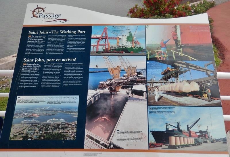
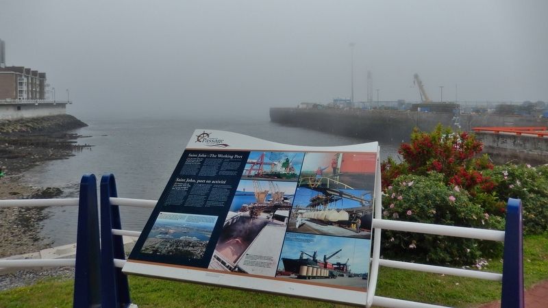
Saint John – The Working Port
Saint John, port en activité
— Harbour Passage Trail —
For more than two hundred years the City of Saint John and its sheltered, ice-free port, have been critical to the economic success of New Brunswick. Historically providing a port of entry for people and products, the port also provided the means for New Brunswick products to be exported worldwide. This was true in the mid-1800s, when Saint John had the third largest timber and shipbuilding trade in the world, and it is true today.
Major commodities passing through the Port today are petroleum, potash, forest products, containers, metals and project cargo. In addition, the Port is a major port of call for cruise ships in the Canada — New England cruise itinerary.
Administered by the Saint John Port Authority, the Port of Saint John is an international transportation centre. With north-south and east-west rail line connections, and direct truck routes to the United States and central Canada, the Port has access to four rail companies and a large number of trucking firms, operating an extensive fleet of tractors and trailers.
Saint John is a modern port of national significance, able to handle large vessels of all kinds, with separate terminals for oil, forest products, containers, potash, dry and liquid bulk products, project cargoes, cruise ships and the ferry to Nova Scotia.
As the largest petroleum port in Canada, Saint John will typically handle more than 25 million tonnes of cargo per year.
Pendant plus de deux siècles, Saint John et son port protégé et libre de glace en hiver sont déterminants de la réussite économique du Nouveau-Brunswick. Historiquement, le port de Saint John n'est pas seulement une porte d'entrée pour les gens et les marchandises; il sert aussi à exporter les produits du Nouveau-Brunswick vers le monde entier. Déjà, au milieu du XIXe siècle, le port de Saint John occupe le troisième rang mondial en matière de commerce de bois d'œuvre et de construction navale.
De nos jours, d'essentiel des marchandises qui transitent par le port sont le pétrole, la potasse, des produits forestiers, des conteneurs, des métaux et des cargaisons liées à un projet. En outre, le port est une des principales escales pour les navires de croisière qui relient le Canada et la Nouvelle-Angleterre.
Géré par l'Administration portuaire de Saint John, le port est un centre de transport international. Relié à des axes ferroviaires nord-sud et est-ouest et à des routes directes vers
Courtesy Saint John Port Authority
2. Marker detail: Diversification
English:
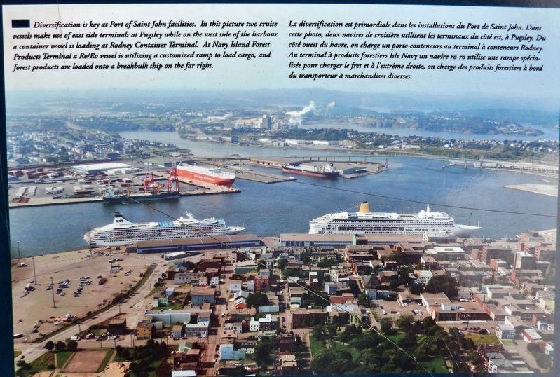
Diversification is key at Port of Saint John facilities. In this picture two cruise vessels make use of east side terminals at Pugsley while on the west side of the harbour a container vessel is loading at Rodney Container Terminal. At Navy Island Forest Products Terminal a Ro/Ro vessel is utilizing a customized ramp to load cargo, and forest products are loaded onto a breakbulk ship on the far right.
Français:
La diversification est primordiale dans les installations du Port de Saint John. Dans cette photo, deux navires de croisière utilisent les terminaux du côté est, à Pugsley. Du côté ouest du havre, on charge un porte-conteneurs au terminal à conteneurs Rodney. Au terminal à produits forestiers Isle Navy un navire ro-ro utilise une rampe spécialisée pour charger le fret et à l'extrême droite, on charge des produits forestiers à bord du transporteur à marchandises diverses.
Saint John est un port moderne d'importance nationale, accessible aux navires de gros tonnage de toutes sortes. Il dispose de terminaux distincts pour le pétrole, les produits forestiers, les conteneurs, la potasse, les marchandises en vrac sèches et liquides, les cargaisons reliées à des projet, les navires de croisière et les traversiers vers la Nouvelle-Écosse.
Plus grand port pétrolier au Canada, Saint John manutentionne plus de 25 millions de tonnes de marchandises par année.
Topics. This historical marker is listed in these topic lists: Industry & Commerce • Waterways & Vessels.
Location. 45° 16.488′ N, 66° 4.066′ W. Marker is in Saint John, New Brunswick, in Saint John County. Marker is on Long Wharf, 0.1 kilometers west of Smythe Street, on the left when traveling west. Marker is located along the Harbour Passage Trail, overlooking the harbor. Touch for map. Marker is in this post office area: Saint John NB E2L 5A7, Canada. Touch for directions.
Other nearby markers. At least 8 other markers are within walking distance of this marker. Electrifying the Uptown (about 120 meters away, measured in a direct line); Defending the Harbour (about 120 meters away); Saint John Harbour Defensive Network
Courtesy Saint John Port Authority
3. Marker detail: Container Ships
English:
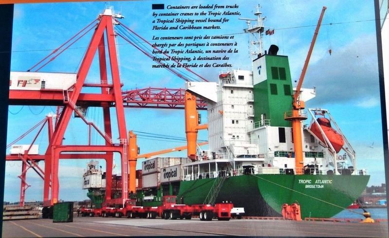
Containers are loaded from trucks by container cranes to the Tropic Atlantic, a Tropical Shipping vessel bound for Florida and Caribbean markets.
Français:
Les conteneurs sont pris des camions et chargés par des portiques à conteneurs à bord du Tropic Atlantic, un navire de la Tropical Shipping à destination des marchés de la Floride et des Caraïbes.
Also see . . . Port of Saint John (Wikipedia). The port did not begin to develop in earnest until the influx of United Empire Loyalists in 1783. It developed rapidly as a result of timber trade and shipbuilding. Saint John became the province's leading industrial centre during the 19th century with much of the shipbuilding industry being concentrated on Courtney Bay outside the main harbour area. (Submitted on February 16, 2020, by Cosmos Mariner of Cape Canaveral, Florida.)
Courtesy Saint John Port Authority
4. Marker detail: Potash
English:
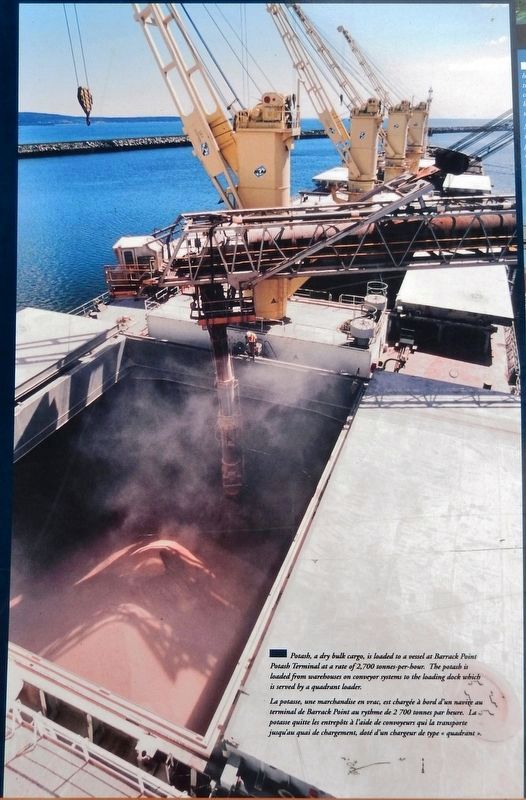
Potash, a dry bulk cargo, is loaded to a vessel at Barrack Point Potash Terminal at a rate of 2,700 tonnes-per-hour. The potash is loaded from warehouses on conveyor systems to the loading dock which is served by a quadrant loader.
Français:
La potasse, une marchandise en vrac, est chargée à bord d'un navire au terminal de Barrack Point au rythme de 2 700 tonnes par heure. La potasse quitte les entrepôts à l'aide de convoyeurs qui la transporte jusqu'au quai de chargement, doté d'un chargeur de type « quadrant ».

Courtesy Saint John Port Authority
5. Marker detail: Harbour Pilots
English:
Our harbour pilots board ships entering the harbour from the pilot boat by means of a ladder on the ship's side which they then climb to the deck of the vessel.
Français:
Nos pilotes du havre quittent le bateau pilote et montent à bord des navires arrivant au port à l'aide d'une échelle placée le long du navire.
Courtesy Saint John Port Authority
6. Marker detail: Longshoremen
English:
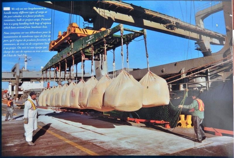
We rely on our longshoremen to handle many different types of cargo at the port whether it is forest products, containers, bulk or project cargo. Pictured here is a gang handling bulk bags of tapioca which have arrived from Southeast Asia.
Français:
Nous comptons sur nos débardeurs pour la manutention de nombreux types de fret au port, qu'il s’agisse de produits forestiers, de conteneurs, de vrac ou de cargaisons liées á un projet. On voit ici une équipe qui charge des sacs de tapioca en vrac arrivant de l’Asie du Sud-Est.
Courtesy Saint John Port Authority
7. Marker detail: Forest Products
English:
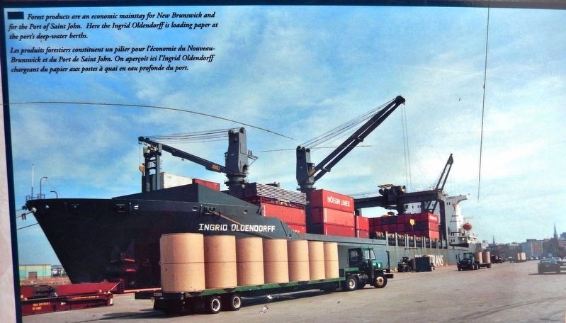
Forest products are an economic mainstay for New Brunswick and for the Port of Saint John. Here the Ingrid Oldendorff is loading paper at the port's deep-water berths.
Français:
Les produits forestiers constituent un pilier pour l'économie du Nouveau-Brunswick et du Port de Saint John. On aperçoit ici l’Ingrid Oldendorff chargeant du papier aux postes à quai en eau profonde du port.
Credits. This page was last revised on November 3, 2022. It was originally submitted on February 14, 2020, by Cosmos Mariner of Cape Canaveral, Florida. This page has been viewed 209 times since then and 12 times this year. Photos: 1, 2, 3, 4, 5, 6, 7, 8. submitted on February 16, 2020, by Cosmos Mariner of Cape Canaveral, Florida.
