Saint John in Saint John County, New Brunswick — The Atlantic Provinces (North America)
Clearing Customs in Style
Franchir les douanes avec grâce
— Harbour Passage Trail —
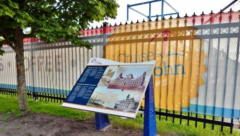
Inscription.
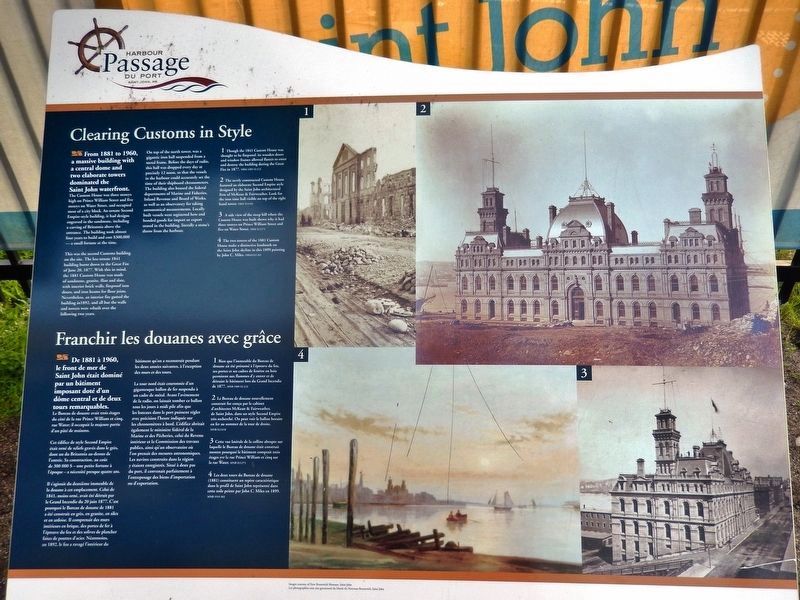
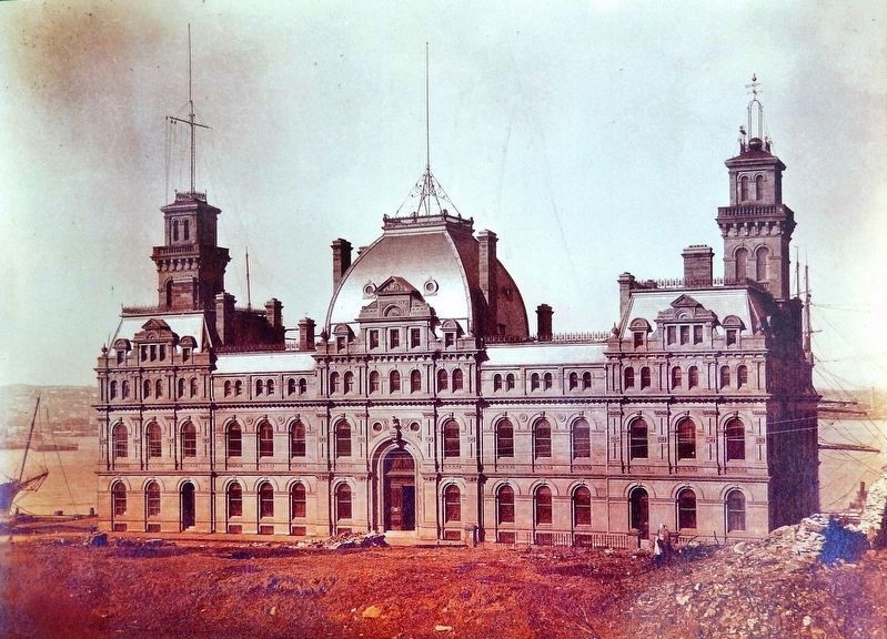
From 1881 to 1960, a massive building with a central dome and two elaborate towers dominated the Saint John waterfront.
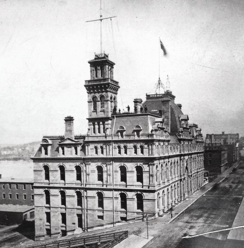
The Custom House was three storeys high on Prince William Street and five storeys on Water Street, and occupied most of a city block. An ornate Second Empire-style building, it had designs engraved in the sandstone, including a carving of Britannia above the entrance. The building took almost four years to build and cost $300,000 — a small fortune at the time.
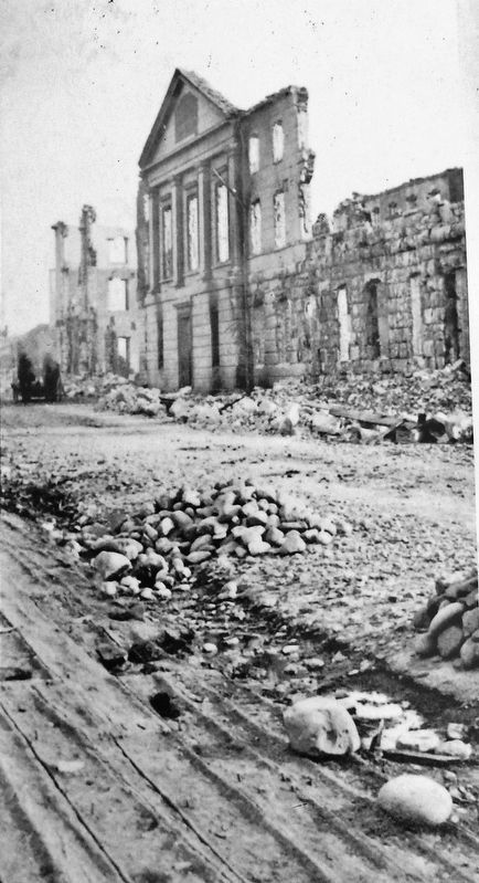
This was the second Customs building on the site. The less ornate 1841 building burnt down in the Great Fire of June 20, 1877. With this in mind, the 1881 Custom House was made of sandstone, granite, flint and slate, with interior brick walls, fireproof iron doors, and iron beams for floor joists. Nevertheless, an interior fire gutted the building in 1892, and all but the walls and towers were rebuilt over the following two years.
On top of the north tower, was a gigantic iron ball suspended from a metal frame. Before the days of radio, this ball was dropped every day at precisely 12 noon, so that the vessels in the harbour could accurately set the time of their shipboard chronometers. The building also housed the federal departments of Marine and Fisheries, Inland Revenue and Board of Works, as well as an observatory for taking astronomical measurements. Locally built vessels were registered here and bonded goods for import or export stored in the building, literally a stone's throw from the harbour.
De 1881 à 1960, le front de mer de Saint John était dominé par un bâtiment imposant doté d'un dôme central et de deux tours remarquables.
Le Bureau de douane avait trois étages du côté de la rue Prince William et cinq, rue Water; il occupait la majeure partie d'un pâté de maisons.
Cet édifice de style Second Empire était orné de reliefs gravés dans le grès, dont un du Britannia au-dessus de l'entrée. Sa construction, au coût de 300 000 $ — une petite fortune à l'époque — a nécessité presque quatre ans.
Il s'agissait du deuxième immeuble de la douane à cet emplacement. Celui de 1841, moins orné, avait été détruit par le Grand Incendie du 20 juin 1877. C'est pourquoi le Bureau de douane de 1881 a été construit en grès, en granite, en silex et en ardoise. Il comprenait des murs intérieurs en brique, des portes de fer à l'épreuve du feu et des solives de plancher faites de poutres d'acier. Néanmoins, en 1892,
Courtesy New Brunswick Museum, Saint John • 1989-52-2(3)
2. Marker detail: Great Fire 1877
English:
Though the 1841 Custom House was thought to be fireproof, its wooden doors and window frames allowed flames to enter and destroy the building during the Great Fire in 1877.
Français:
Bien que l'immeuble du Bureau de douane ait été présumé à l'épreuve du feu, ses portes et ses cadres de fenêtre en bois permirent aux flammes d'y entrer et de détruire le bâtiment lors du Grand Incendie de 1877.
La tour nord était couronnée d'un gigantesque ballon de fer suspendu à un cadre de métal. Avant l'avènement de la radio, on laissait tomber ce ballon tous les jours à midi pile afin que les bateaux dans le port puissent régler avec précision l'heure indiquée sur les chronomètres à bord. L'édifice abritait également le ministère fédéral de la Marine et des Pêcheries, celui du Revenu intérieur et la Commission des travaux publics, ainsi qu'un observatoire où l'on prenait des mesures astronomiques. Les navires construits dans la région y étaient enregistrés. Situé à deux pas du port, il convenait parfaitement à l'entreposage des biens d'importation ou d'exportation.
Topics. This historical marker is listed in these topic lists: Architecture • Disasters • Waterways & Vessels. A significant historical year for this entry is 1881.
Location. 45° 16.176′ N, 66° 3.727′ W. Marker is in Saint John, New Brunswick, in Saint John County. Marker is at the intersection of Water Street and Duke Street, on the right when traveling south on Water Street. Marker is located beside the sidewalk at the southwest corner of the intersection. Touch for map. Marker is in this post office area: Saint John NB E2L 2B9, Canada. Touch for directions.
Other nearby markers. At least 8 other markers are within walking distance of
Courtesy New Brunswick Museum, Saint John • X12418
3. Marker detail: 1881 Custom House
English:
The newly constructed Custom House featured an elaborate Second Empire style designed by the Saint John architectural firm of McKean & Fairweather. Look for the iron time ball visible on top of the right hand tower.
Français:
Le Bureau de douane nouvellement construit fut conçu par le cabinet d'architectes McKean & Fairweather, de Saint John, dans un style Second Empire très recherché. On peut voir le ballon horaire en fer au sommet de la tour de droite.
Courtesy New Brunswick Museum, Saint John • X11271
4. Marker detail: Custom House (side view)
English:
A side view of the steep hill where the Custom House was built shows why it had three storeys on Prince William Street and five on Water Street.
Français:
Cette vue latérale de la colline abrupte sur laquelle le Bureau de douane était construit montre pourquoi le bâtiment comptait trois étages sur la rue Prince William et cinq sur la rue Water.
Courtesy New Brunswick Museum, Saint John • 1945-361
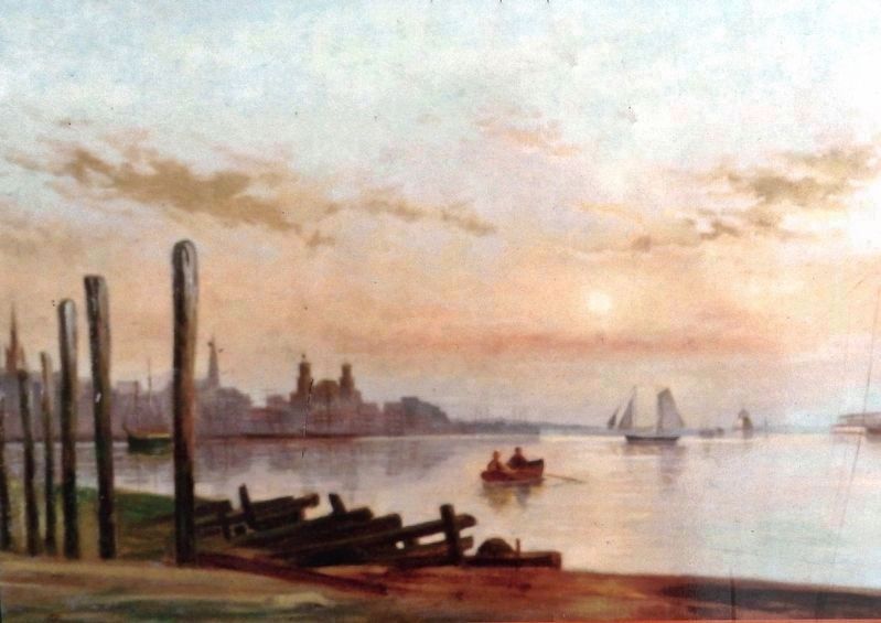
5. Marker detail: Saint John Skyline (1899)
English:
The two towers of the 1881 Custom House make a distinctive landmark on the Saint John skyline in this 1899 painting by John C. Miles.
Français:
Les deux tours du Bureau de douane (1881) constituent un repère caractéristique dans le profil de Saint John représenté dans cette toile peinte par John C. Miles en 1899.
Credits. This page was last revised on November 3, 2022. It was originally submitted on February 14, 2020, by Cosmos Mariner of Cape Canaveral, Florida. This page has been viewed 124 times since then and 7 times this year. Photos: 1, 2, 3, 4, 5, 6. submitted on February 18, 2020, by Cosmos Mariner of Cape Canaveral, Florida.
