Holly Springs School
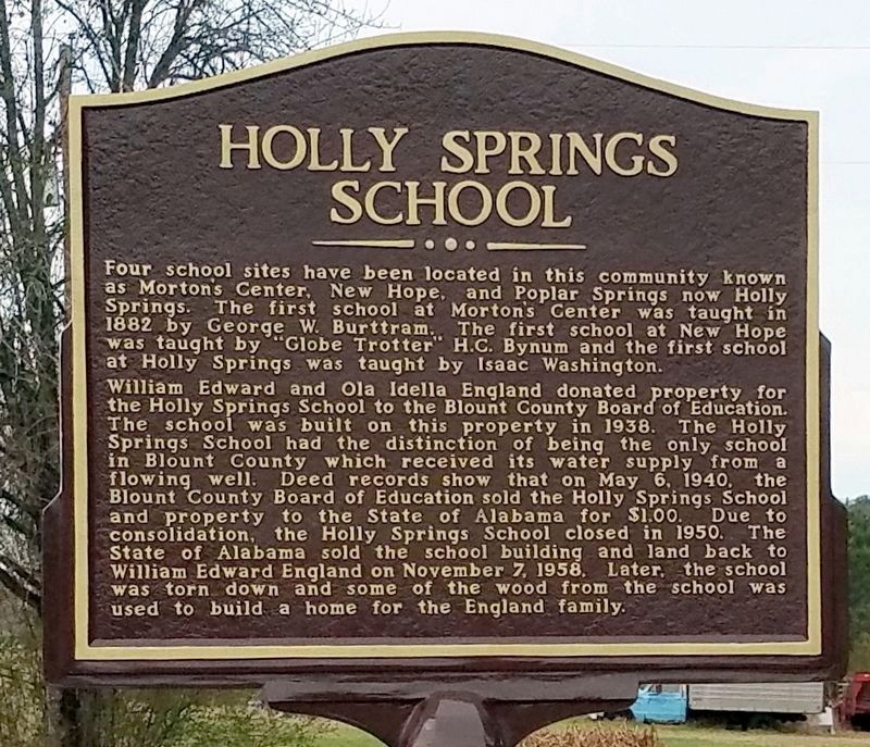
William Edward and Ola Idella England donated property for the Holly Springs School to the Blount County Board of Education. The school was built on this property in 1938. The Holly Springs School had the distinction of being the only school in Blount County which received its water supply from a flowing well. Deed records show that on May 6, 1940, the Blount County Board of Education sold the Holly Springs School and property to the State of Alabama for $1.00. Due to consolidation, the Holly Springs School closed in 1950. The State of Alabama sold the school building and land back to William Edward England on November 7, 1958. Later, the school was torn down and some od the wood from the school was used to build a home for the England family.
Topics. This historical
this page online
Location. 33° 49.58′ N, 86° 27.707′ W. Marker is in Holly Springs, Alabama, in Blount County. It is at the intersection of County Route 27 and Fred Young Road, on the right when traveling south on County Route 27. Touch for map. Marker is in this post office area: Springville AL 35146, United States of America. Touch for directions.

Regionally, this marker is in North Alabama and in the Birmingham Metropolitan Area. It is also in the American South and specifically in the Deep South. Globally, it is in North America, a Gulf of Mexico state, the Western Hemisphere, the Western World, and the Anglosphere. Historically, it finds itself in what was once the original Cherokee Nation, the territory of the Mississippian Culture, one of the Confederate States of America, and the Antebellum South.
Other nearby markers. At least 8 other markers are within 9 miles of this marker, measured as the crow flies: First Baptist Church Of Springville (approx. 3.1 miles away); Original Site of Pleasant Hill Methodist Church (approx. 4.7 miles
Credits. This page was last revised on February 15, 2020. It was originally submitted on February 14, 2020, by David J Gaines of Pinson, Alabama. This page has been viewed 996 times since then and 53 times this year. Photos: 1, 2. submitted on February 14, 2020, by David J Gaines of Pinson, Alabama. • Mark Hilton was the editor who published this page.
