Produce and Waterfront in Oakland in Alameda County, California — The American West (Pacific Coastal)
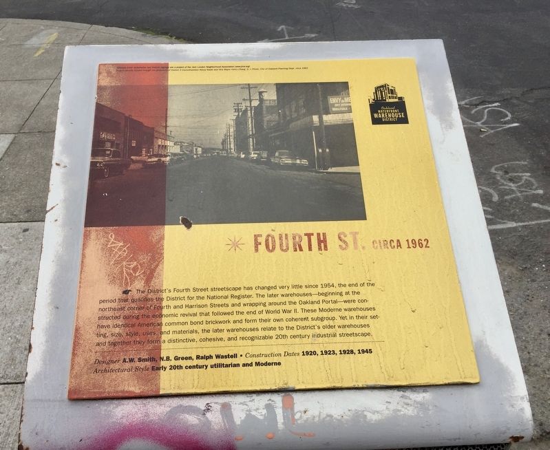
Fourth St. circa 1962
Oakland Waterfront Warehouse District
Photographed by Andrew Ruppenstein, February 13, 2020
1. Fourth St. circa 1962 Marker
Designer A.W. Smith, N.B. Green, Ralph Wastell • Architectural Style Early 20th century utilitarian and Moderne
Construction Dates 1920, 1923, 1928, 1945
Erected by Jack London Neighborhood Association.
Topics. This historical marker is listed in this topic list: Industry & Commerce. A significant historical year for this entry is 1954.
Location. Marker has been permanently removed. It was located near 37° 47.76′ N, 122° 16.296′ W.
this page online
We have been informed that this marker is no longer there and will not be replaced. This page is an archival view of what was.
Regionally, this marker was in California’s San Francisco Bay Area and on the Coast Ranges. It was also on the American Pacific Coast. Globally, it was in North America, on the Ring of Fire, on the Pacific Rim, in the Western Hemisphere, in the Western World, and in the Anglosphere. Historically, it found itself in what was once New Spain and also Mexico’s Alta California.

Other nearby markers. At least 8 other markers are within walking distance of this location: Saroni Wholesale Sugar & Rice (here, next to this marker); Oakland Plumbing Supply, P.E. O’Hair & Co. (within shouting distance of this marker); George A. Posey Tube Oakland Portal (within shouting distance of this marker); Fourth Street Circa 1962
Photographed by Andrew Ruppenstein, February 13, 2020
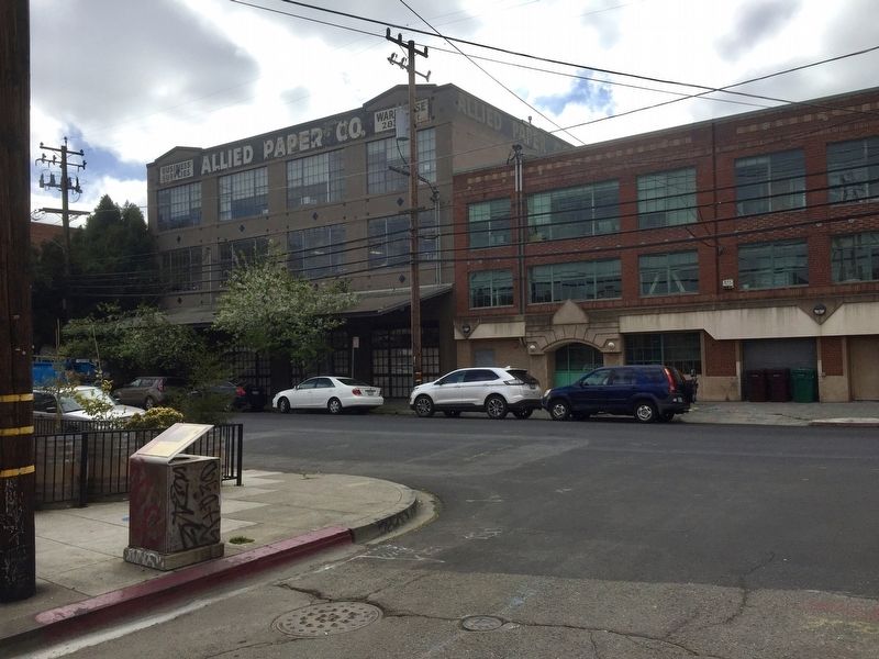
2. Fourth St. circa 1962 Marker - wide view
The marker is visible here on the left, forming the top part of the trash receptacle on the corner.
Other markers no longer nearby. Oakland Plumbing (was within shouting distance of this marker but has been permanently removed); Oakland Portal (was within shouting distance of this marker but has been permanently removed); Autocar Sales (was within shouting distance of this marker but has been permanently removed); C.L. Greeno Co. (was within shouting distance of this marker but has been permanently removed); Western Pacific RR (was about 300 feet away but has been permanently removed); United Grocers (was about 300 feet away but has been permanently removed).
Related marker. Click here for another marker that is related to this marker. Replacement Fourth Street Circa 1962 Marker
Additional commentary.
1. Marker

Photographed by Andrew Ruppenstein, February 13, 2020
3. Fourth Street, taken from the marker site, looking south(ish)
The historical markers in the Waterfront Warehouse District have been updated. A different marker on the same subject has been placed one block west from where this one was located.
— Submitted July 12, 2023, by Joseph Alvarado of Livermore, California.
Credits. This page was last revised on July 12, 2023. It was originally submitted on February 17, 2020, by Andrew Ruppenstein of Lamorinda, California. This page has been viewed 279 times since then and 23 times this year. Photos: 1, 2, 3. submitted on February 17, 2020, by Andrew Ruppenstein of Lamorinda, California.
