Doswell in Hanover County, Virginia — The American South (Mid-Atlantic)
Death Under The Trees
May 25, 1864
— Blue Trail —
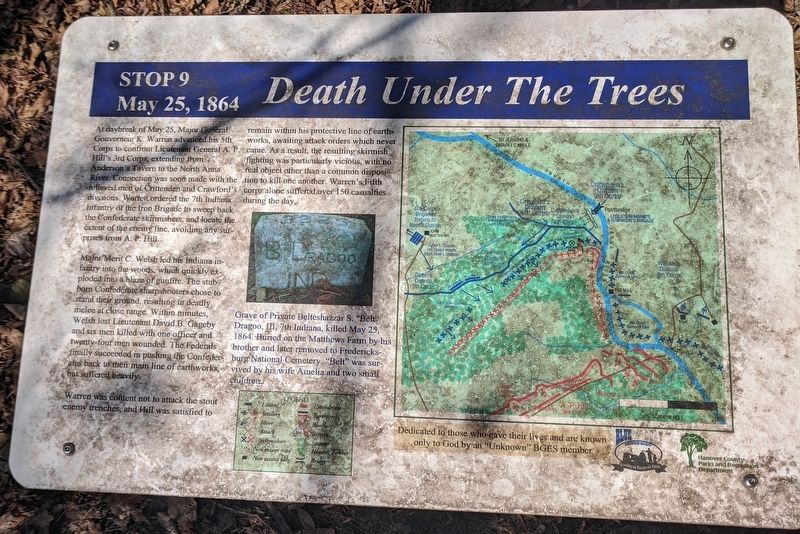
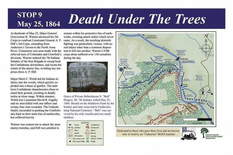
Major Merit C. Welsh led his Indiana infantry into the woods, which quickly exploded into a blaze of gunfire. The stubborn Confederate sharpshooters chose to stand their ground, resulting in deadly melee at close range. Within minutes, Welsh lost Lieutenant David B. Gageby and six men killed with one officer and twenty-four men wounded. The Federals finally succeeded in pushing the Confederates back to their main line of earthworks, but suffered heavily.
Warren was content not to attack the stout enemy trenches, and Hill was satisfied to remain within his protective line of earthworks, awaiting attack orders which never came. As a result, the resulting skirmish fighting was particularly vicious, with no real object other than a common disposition to kill one another. Warren's Fifth corps alone suffered over 150 casualties during the day.
(caption)
Grave of Private Belteshazzar S. "Belt" Dragoo, III, 7th Indianna, killed May 25, 1864. Buried on the Matthews farm by his brother and later removed to Fredericksburg National Cemetery. "Belt" was survived by his wife Amelia and two small children.
Dedicated to those who gave their lives and are known only to God by an "Unknown" BGES member
Erected 2014 by Blue & Gray Education Society, Hanover County Parks and Recreation Department. (Marker Number Stop 9.)
Topics. This historical marker is listed in this topic list: War, US Civil. A significant historical date for this entry is May 25, 1864.
Location. 37° 53.684′ N, 77° 29.795′ W. Marker is in Doswell, Virginia, in Hanover County. Marker can be reached from Verdon Road (Virginia Route 684) 0.2 miles west of New Market Mill Road (Virginia Route 685), on the right when traveling west. Located along the "Blue Trail” in North Anna Battlefield Park. Touch for map. Marker is at or near this postal address: 11576 Verdon Rd, Doswell VA 23047, United States of America. Touch for directions.
Other nearby markers. At least 8 other markers are within walking distance of this marker. Deadly Skirmishing (within shouting distance of this marker); Dig and Dig Some More (about 400 feet away, measured in a direct line); Stalemate (about 400 feet away); Reinforcements Arrive (about 500 feet away); Griffin's Artillery (about 500 feet away); Ledlie's Legacy (approx. 0.2 miles away); A Night of Agony (approx. 0.2 miles away); River War (approx. 0.2 miles away). Touch for a list and map of all markers in Doswell.
Related markers. Click here for a list of markers that are related to this marker. North Anna Battlefield Park "Blue Trail" Markers
Also see . . .
1. North Anna Battlefield Park. Hanover County Parks & Recreation (Submitted on February 25, 2020.)
2. The Battle of North Anna. Fredericksburg & Spotsylvania National Military Park (Submitted on February 25, 2020.)
3. North Anna. American Battlefield Trust (Submitted on February 25, 2020.)
4. North Anna Battlefield Park Sign Project. Blue & Gray Education Society (Submitted on February 26, 2020.)
Credits. This page was last revised on February 26, 2020. It was originally submitted on February 24, 2020, by Bernard Fisher of Richmond, Virginia. This page has been viewed 259 times since then and 21 times this year. Photos: 1. submitted on February 24, 2020, by Bernard Fisher of Richmond, Virginia. 2. submitted on February 26, 2020. 3. submitted on February 24, 2020, by Bernard Fisher of Richmond, Virginia.


