Near Mora in Mora County, New Mexico — The American Mountains (Southwest)
St. Vrain Mill
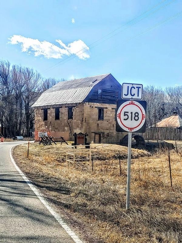
circa February 22, 2020
1. St. Vrain Marker
St. Vrain Mill
The St. Vrain Mill is a stone, water-powered, vertical gristmill. The mill (molino de piedra in Spanish) was one of several in the Mora Valley that supplied flour and meal to nearby Fort Union in the mid-1800s. The mill was built in 1864 by Ceran St. Vrain after his wood mill in Taos burned. St. Vrain operated the mill until his death in 1870. The mill continued to supply flour and grain to Mora Valley residents until 1933. After years of neglect, rehabilitation of the mill began in 2015.
Topics. This historical marker is listed in these topic lists: Industry & Commerce • Settlements & Settlers • Waterways & Vessels. A significant historical year for this entry is 1864.
Location. 35° 58.548′ N, 105° 19.743′ W. Marker is near Mora, New Mexico, in Mora County. It is at the intersection of New Mexico Route 434 and 518, on the left when traveling north on New Mexico Route 434. Touch for map. Marker is in this post office area: Mora NM 87732, United States of America. Touch for directions.

Regionally, this marker is in Northern New Mexico. It is also in the American Southwest, in the Mountain West,
this page online
Other nearby markers. At least 4 other markers are within 12 miles of this marker, measured as the crow flies: Curanderas — Women Who Heal (approx. 0.4 miles away); La Cueva National Historic District (approx. 5 miles away); La Cueva Mill (approx. 5 miles away); Strike Valleys (approx. 12 miles away).
Credits. This page was last revised on February 27, 2020. It was originally submitted on February 27, 2020. This page has been viewed 518 times since then and 58 times this year. Photo 1. submitted on February 27, 2020, by Sharon Murdock of Lubbock, Texas. • J. Makali Bruton was the editor who published this page.
Editor’s want-list for this marker. A close up photo of the marker • Can you help?
