
North Meadow Brook in Norfolk, Virginia — The American South (Mid-Atlantic)
Airship Roma Disaster
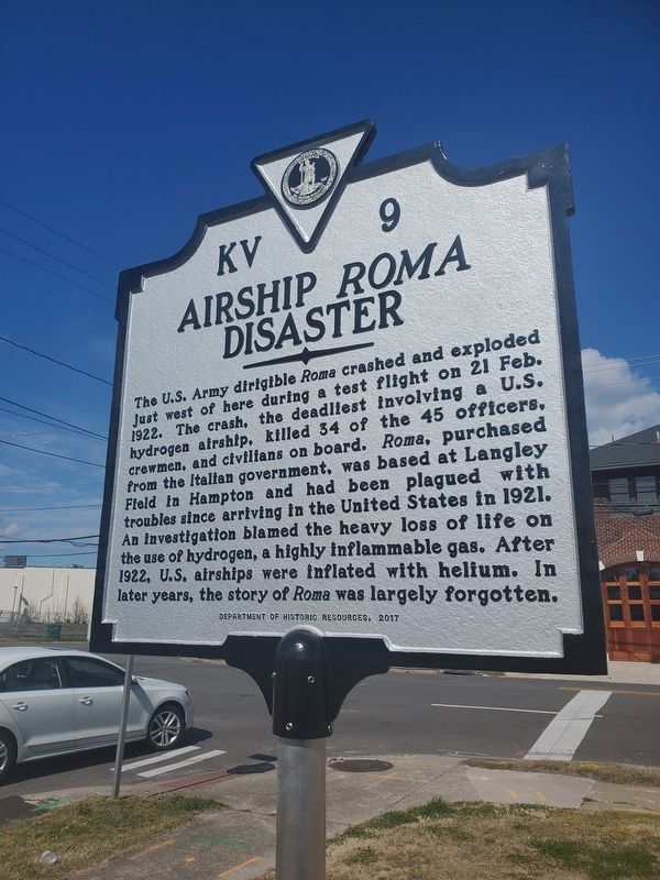
Photographed by Nancy E. Sheppard, 2020
1. Airship Roma Disaster
The marker upon its erection in 2020
Erected 2017 by Department of Historic Resources. (Marker Number KV-9.)
Topics and series. This historical marker is listed in these topic lists: Air & Space • Disasters • Military. In addition, it is included in the Virginia Department of Historic Resources (DHR) series list. A significant historical date for this entry is February 21, 1922.
Location. 36° 54.955′ N, 76° 18.427′ W. Marker is in Norfolk, Virginia. It is in North Meadow Brook. It is at the intersection of Baylor Place and West Little Creek Road (Virginia Route 165),
this page online

Regionally, this marker is in Virginia’s Hampton Roads, specifically in Coastal Virginia, and in the Hampton Roads Metropolitan Area. It is also in the American South, specifically in the Upper South, in the Tidewater, and on the Eastern Seaboard. Globally, it is in the North Atlantic Region, North America, the Western Hemisphere, the Western World, and the Anglosphere. Historically, it finds itself in what was once the territory of the Mississippian Culture, one of the original Thirteen Colonies, one of the Confederate States of America, and the Antebellum South.
Other nearby markers. At least 8 other markers are within 2 miles of this marker, measured as the crow flies: The Norfolk Facility (approx. ¼ mile away); Trophy Cannon from CSS Albemarle, 1860s (approx. half a mile away); Trophy Cannon from CSS Tennessee, 1860s (approx. half a mile away); Polaris A-3 Missile (approx. half a mile away); Tomahawk Cruise Missile (approx. half a mile away); Mk 48 Mod 1 Warshot Torpedo (approx. half a mile away); U.S. Submarine Veterans W.W. II Memorial (approx. 1.6 miles away); Old Academic Building Site (approx. 1.7 miles away). Touch for a list and map of all markers in Norfolk.
More about this marker. Sponsored by Nancy E. Sheppard, author & historian, on behalf of the families of the Roma 45.
Additional keywords. Airship Roma Disaster
Credits. This page was last revised on June 2, 2026. It was originally submitted on February 29, 2020, by Nancy E. Sheppard of Yorktown, Virginia. This page has been viewed 1,346 times since then and 93 times this year. Photo 1. submitted on February 29, 2020, by Nancy E. Sheppard of Yorktown, Virginia. • Bernard Fisher was the editor who published this page.
Editor’s want-list for this marker. Wide shot of marker and its surroundings. • Can you help?
