Sheet Harbour in Halifax Region, Nova Scotia — The Atlantic Provinces (North America)
The Community
— Sheet Harbour —
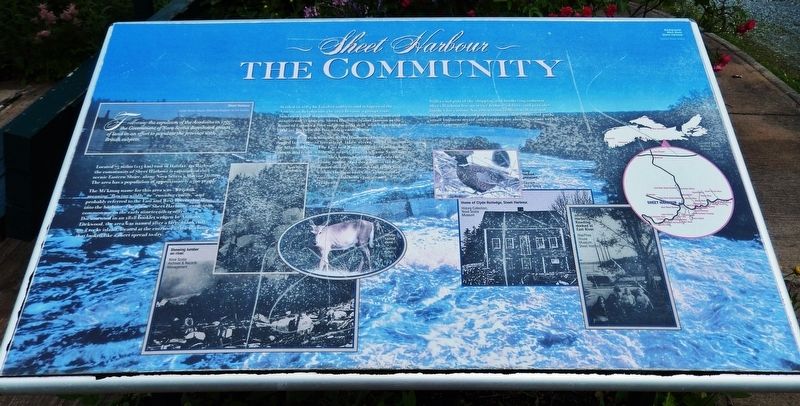
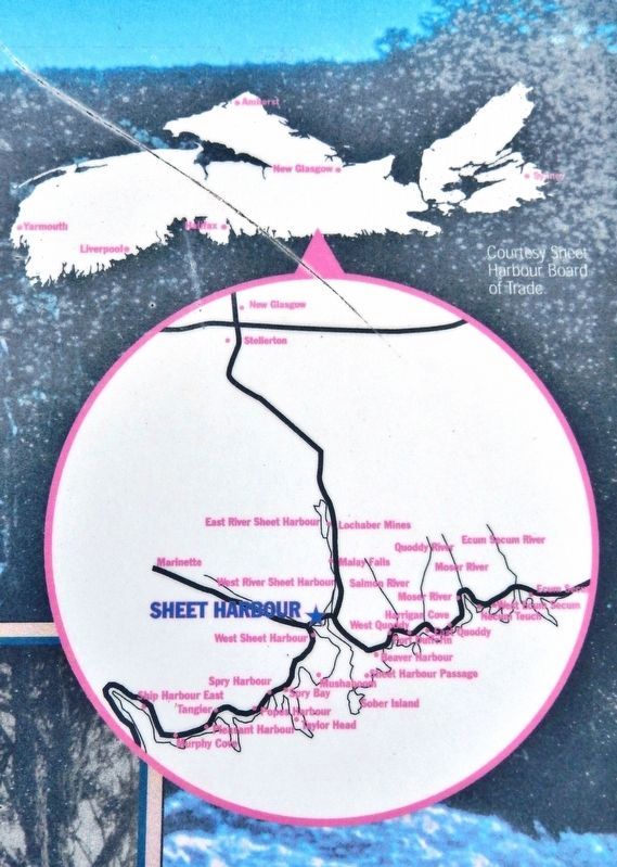
Located 75 miles (115 km) east of Halifax, on Highway 7, the community of Sheet Harbour is situated on the scenic Eastern Shore, along Nova Scotia’s Marine Drive. The area has a population of approximately 2500 people.
The Mi'kmaq name for this area was “Weijook” meaning “flowering wildly” or “running crazily,” and probably referred to East and West Rivers that flowed into the harbour. The name "Sheet Harbour" came into common use in the early nineteenth century. Documented in an 1818 booklet written by Anthony Lockwood, the area was named after a large blank cliff on a rocky island, located at the entrance of the harbour, that looked like a sheet spread to dry.
Settled in 1784 by Loyalist soldiers and refugees of the American Revolution, the area became a prosperous lumbering and shipbuilding centre in the eighteenth and nineteenth centuries. Sheet Harbour is also famous as the home of Canada’s first sulphite pulp mill, which operated on the East River in the late nineteenth century.
Apart from its rich history, Sheet Harbour is home to a rugged landscape of forestland, lakes, rivers, not to mention the Atlantic Ocean. The East and West Rivers are famous for salmon and trout, while the nearby Liscomb Game Sanctuary provides haven to a variety of waterfowl, birds, moose, and deer within its 200 square miles. Canoeing and sport fishing within the Sanctuary are also popular pastimes with both visitors and residents.
Still a vital part of the shipping and lumbering industry, Sheet Harbour has an active Industrial Port, and provides lumber for various Nova Scotia sawmills as well as wood chips for the pulp and paper industry. The industrial park, small business sector, and tourism are also important to this active community.
(photo captions)
• Ruth Falls, headworks. [MacPhee House Museum, Sheet Harbor]
• Showing Lumber on River. [Nova Scotia Archives & Records Management]
• White-tailed Deer. [Tourism Nova Scotia]
• Ring-necked Pheasant. [Tourism Nova Scotia]
• Four-masted schooner Herbert L. Rawding docked at East River. [MacPhee House Museum, Sheet Harbor]
Topics. This historical marker is listed in these topic lists: Animals • Industry & Commerce • Native Americans • Settlements & Settlers. A significant historical year for this entry is 1755.
Location. 44° 55.639′ N, 62° 32.633′ W. Marker is in Sheet Harbour, Nova Scotia, in Halifax Region. Marker can be reached from Marine Drive (Nova Scotia Trunk Highway 7), 0.3 kilometers east of Highway 224, on the right when traveling east. Marker is located on the grounds of the MacPhee House Museum & Visitor Centre, near the main front entrance. Touch for map. Marker is at or near this postal address: 22404 Nova Scotia Trunk Highway 7, Sheet Harbour NS B0J 3B0, Canada. Touch for directions.
Other nearby markers. At least 8 other markers are within 19 kilometers of this marker, measured as the crow flies. Lumbering & Sawmills (a few steps from this marker); The Pulp & Paper Industry (a few steps from this marker); Sheet Harbour (a few steps from this marker); Salmon (within shouting distance of this marker); Shipbuilding & Shipping (approx. 1.6 kilometers away); Hydroelectric Power (approx. 1.6 kilometers away); Early Settlement (approx. 1.6 kilometers away); Prince Alfred Arch / L'Arche Prince Alfred (approx. 18.3 kilometers away). Touch for a list and map of all markers in Sheet Harbour.
Related markers. Click here for a list of markers that are related to this marker. Sheet Harbour, Nova Scotia
Credits. This page was last revised on March 6, 2020. It was originally submitted on March 3, 2020, by Cosmos Mariner of Cape Canaveral, Florida. This page has been viewed 198 times since then and 37 times this year. Photos: 1. submitted on March 3, 2020, by Cosmos Mariner of Cape Canaveral, Florida. 2, 3, 4. submitted on March 5, 2020, by Cosmos Mariner of Cape Canaveral, Florida.


