
Spirited Rebuff
Star-Spangled Banner National Historic Trail
| — | War of 1812 | — |
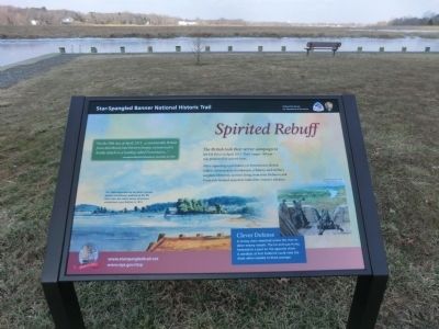
After capturing a gun battery at Frenchtown, British raiders destroyed its storehouses, a fishery, and military supplies. However, spirited firing from forts Defiance and Frederick located near here halted the enemy’s advance.
Clever Defense
A strong chain stretched across the river to deter enemy vessels. The far end was firmly fastened to a post on the opposite shore. A windlass at Fort Frederick could raise the chain when needed to block passage.
“On the 29th day of April, 1813…a considerable British force distributed into thirteen barges, commenced a hostile attack on a landing called Frenchtown…”
—Annapolis Maryland Republican, November 20, 1813.
(Inscription above the image in the center)
This 1806 watercolor by Benjamin Latrobe depicts Frenchtown, looking up the Elk River from the wharf where Americans established a gun battery in 1813.
(Inscription above the image on the right)
A conjectural view of the forts and defensive chain that protected Elkton
this page online
Erected by National Park Service-United States Department of the Interior.
Topics and series. This historical marker is listed in this topic list: War of 1812. In addition, it is included in the Star-Spangled Banner National Historic Trail series list. A significant historical date for this entry is April 29, 1813.
Location. 39° 34.896′ N, 75° 51.114′ W. Marker has been reported unreadable. Marker is in Elkton, Maryland, in Cecil County. It is on River Bend Parkway. The marker is located in Elk River Park. Touch for map. Marker is in this post office area: Elkton MD 21921, United States of America. Touch for directions.
Regionally, this marker is in Greater Wilmington, on the Eastern Shore, and in Greater Philadelphia. It is also in the American Mid-Atlantic, on the Delmarva Peninsula, in the Tidewater, in the Chesapeake Bay Region, and on the Eastern Seaboard. Globally, it is in the North Atlantic Region, North America, the Western Hemisphere, the Western World, and the Anglosphere. Historically, it finds itself in what was once one of the original Thirteen Colonies and also the Antebellum South.
Other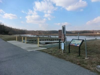
Another marker is no longer nearby. Site of Fort Defiance (was approx. ¾ mile away but has been confirmed missing).
More about this marker. I have reported today, March 5, 2020, that this marker is damaged. The damage is confined to the "Clever Defense" paragraph.
Credits. This page was last revised on March 6, 2020. It was originally submitted on January 18, 2015, by Don Morfe of Baltimore, Maryland. This page has been viewed 656 times since then and 11 times this year. Last updated on March 5, 2020, by Carl Gordon Moore Jr. of North East, Maryland. Photos: 1, 2. submitted on January 18, 2015, by Don Morfe of Baltimore, Maryland. • Bill Pfingsten was the editor who published this page.
