
Clarksville in Montgomery County, Tennessee — The American South (East South Central)
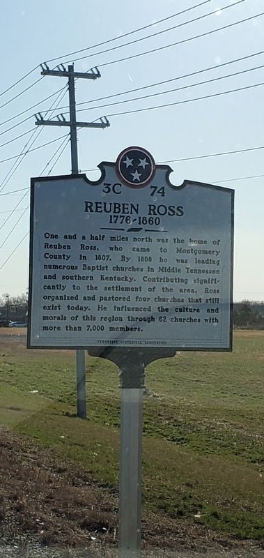
Reuben Ross
1776-1860
Photographed by Larry Newton, March 5, 2020
1. Reuben Ross Marker
One and a half miles north was the home of Reuben Ross, who came to Montgomery County in 1807. By 1808 he was leading numerous Baptist churches in middle Tennessee and southern Kentucky. Contributing significantly to the settlement of the area, Ross organized and pastored four churches that still exist today. He influenced the culture and morals of the region through 62 churches with more than 7,000 members.
Erected by Tennessee Historical Commission. (Marker Number 3C 74.)
Topics and series. This historical marker is listed in these topic lists: Religion & Religious Structures • Settlements & Settlers. In addition, it is included in the Tennessee Historical Commission series list. A significant historical year for this entry is 1807.
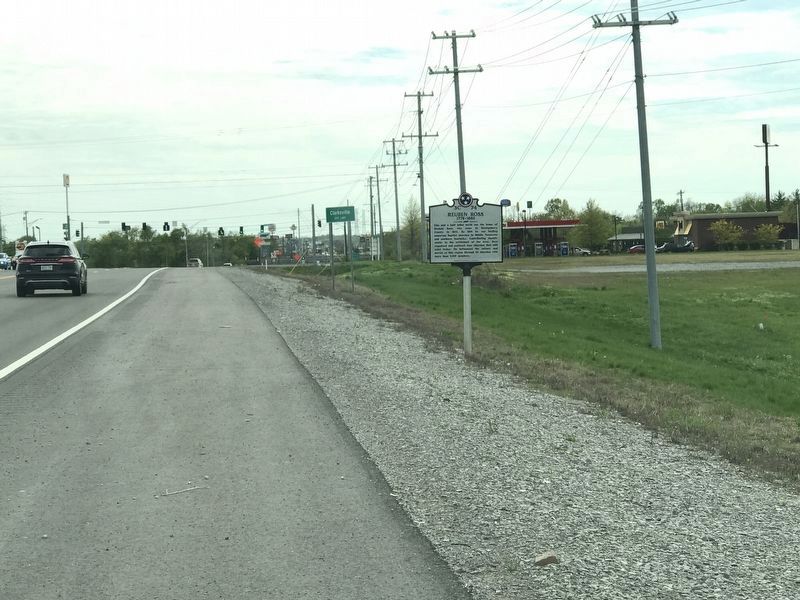
Location. 36° 36.288′ N, 87° 16.619′ W. Marker is in Clarksville, Tennessee, in Montgomery County. It is on Guthrie Highway (U.S. 79) 0.1 miles south of Oakland Road, on the right when traveling south. Touch for map. Marker is at or near this postal address: 3355 Guthrie Highway, Clarksville TN 37040, United States of America. Touch for directions.

Regionally, this marker is in Middle Tennessee and in the Highland Rim. It is also in the American South and specifically in the Upper South. Globally, it is in North America, the Western Hemisphere, the Western World, and the Anglosphere. Historically, it finds itself in what was once the territory of the Mississippian Culture, one of the Confederate States of America, and the Antebellum South.
Other nearby markers. At least 8 other markers are within 4 miles of this marker, measured as the crow flies: Camp Boone (approx. 1.4 miles away); Country Woman's Club (approx. 3 miles away); Wilma Glodean Rudolph (approx. 3½ miles away); Civil War in Tennessee (approx. 3.9 miles away); The Dance Floor (approx. 3.9 miles
this page online
Another marker is no longer nearby. Woodstock (was approx. 3.4 miles away in Kentucky but has been confirmed missing).
Photographed by Duane and Tracy Marsteller, April 11, 2020
2. Reuben Ross Marker
Credits. This page was last revised on April 12, 2020. It was originally submitted on March 5, 2020, by Larry Newton of Clarksville, Tennessee. This page has been viewed 1,176 times since then and 66 times this year. Photos: 1. submitted on March 5, 2020, by Larry Newton of Clarksville, Tennessee. 2. submitted on April 11, 2020, by Duane and Tracy Marsteller of Murfreesboro, Tennessee. • Devry Becker Jones was the editor who published this page.
