Lower Merion Township near Bala Cynwyd in Montgomery County, Pennsylvania — The American Northeast (Mid-Atlantic)
Vine Creek
Cynwyd Heritage Trail
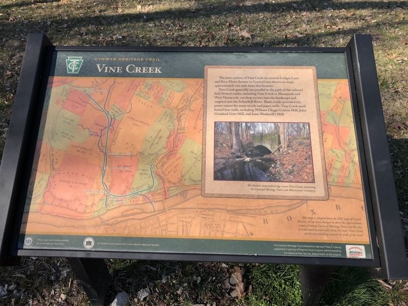
The main sources of Vine Creek are around Lodges Lane and Bryn Mawr Avenue in Cynwyd (not shown on map), approximately one mile from this location.
Vine Creek generally ran parallel to the path of the railroad bed. Several creeks, including Vine Creek in Manayunk and West Manayunk, cut deep ravines into the landscape and emptied into the Schuylkill River. These creeks provided the power source for many textiles and paper mills. Vine Creek itself hosted four mills, including William Clegg's Cotton Mill, John Grindred Grist Mill, and Isaac Wetherill's Mill.
Erected by Lower Merion Township; Preserve America grant administered by the National Park Service, U.S. Department of the Interior.
Topics. This historical marker is listed in these topic lists: Industry & Commerce • Railroads & Streetcars • Waterways & Vessels.
Location. 40° 1.061′ N, 75° 13.513′ W. Marker is near Bala Cynwyd, Pennsylvania, in Montgomery County. It is in Lower Merion Township. Marker is on Cynwyd Heritage Trail, 0.3 miles east of East Levering Mill Road. Touch for map. Marker is in this post office area: Bala Cynwyd PA 19004, United States of America. Touch for directions.
Other nearby markers. At least 8 other markers are within walking distance of this marker. West Laurel Hill Train Station (about 700 feet away, measured in a direct line); Barmouth Train Station (approx. 0.2 miles away); William Clegg's Cotton Mill (approx. 0.2 miles away); Duffy's Cut 57 (approx. 0.2 miles away); West Laurel Hill Cemetery (approx. 0.2 miles away); The Manayunk Skyline (approx. 0.3 miles away); Transportation Corridor in Transition (approx. 0.3 miles away); The Spaventa Switchback (approx. 0.4 miles away). Touch for a list and map of all markers in Bala Cynwyd.
Credits. This page was last revised on February 7, 2023. It was originally submitted on March 8, 2020, by Devry Becker Jones of Washington, District of Columbia. This page has been viewed 283 times since then and 31 times this year. Photos: 1, 2. submitted on March 8, 2020, by Devry Becker Jones of Washington, District of Columbia.

