
Brandywine Hundred in Claymont in New Castle County, Delaware — The American Northeast (Mid-Atlantic)
Claymont Stone School
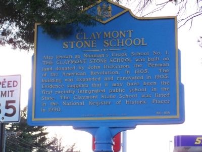
Photographed by Beverly Pfingsten, November 22, 2008
1. Claymont Stone School Marker
Erected 1999 by Delaware State Archives. (Marker Number NC-105.)
Topics and series. This historical marker is listed in this topic list: Education. In addition, it is included in the Delaware Public Archives, and the National Register of Historic Places (NRHP) series lists. A significant historical year for this entry is 1805.
Location. 39° 48.275′ N, 75° 27.265′ W. Marker is in Claymont, Delaware, in New Castle County. It is in Brandywine Hundred. It is at the intersection of Philadelphia Pike (U.S. 13) and Darley Road, on the right when traveling south on Philadelphia Pike. Touch for map. Marker is in this post office area: Claymont DE 19703, United States of America. Touch for directions.

Regionally, this marker is in
this page online
Other nearby markers. At least 8 other markers are within walking distance of this marker: The Darley House (a few steps from this marker); Church of the Ascension (within shouting distance of this marker); Archmere (about 300 feet away, measured in a direct line); The Patio (approx. 0.2 miles away); World War II Memorial (approx. 0.4 miles away); In Honor of All Veterans (approx. 0.4 miles away); Old Claymont High School (approx. 0.6 miles away); Mother Catherine Rosarii (approx. 0.7 miles away). Touch for a list and map of all markers in Claymont.
Also see . . . Naaman's Creek School - National Register of Historic Places Nomination Form.
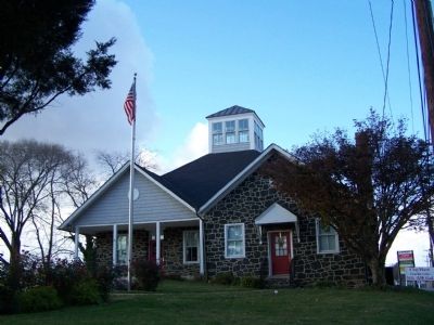
Naaman's Creek School is significant under Criterion A as a property that reveals much about the(Submitted on April 22, 2025, by Pete Skillman of Wilmington, Delaware.)development and the ultimate demise of the free rural school system in New Castle County. Its period of operation lasted 120 years, from 1805 through 1925 when the school was closed and a centralized school district was created. Through the course of its existence, it can be shown how Naaman's Creek School operated in response to the wants of the community, to legislative dictates, and to the dynamics of a community undergoing rapid transition from a rural to an industrial economy. The building's significance under education continues after the school closed. It remained a focal point in the community due to the efforts of the Women's Club of Claymont in establishing and maintaining a library beginning in 1929. Naaman's Creek School is also significant under Criterion C for representing the type of one room school that was common in nineteenth century New Castle County, and in exhibiting the physical changes made in the early twentieth century as the local school commission attempted to accommodate a rapidly growing population.Photographed by Beverly Pfingsten, November 22, 20082. Claymont Stone School
Credits. This page was last revised on May 28, 2026. It was originally submitted on December 26, 2008, by Bill Pfingsten of Bel Air, Maryland. This page has been viewed 1,962 times since then and 40 times this year. Last updated on March 8, 2020, by Carl Gordon Moore Jr. of North East, Maryland. Photos: 1, 2. submitted on December 26, 2008, by Bill Pfingsten of Bel Air, Maryland.
