Alvarado Park
A Popular Gathering Place for 200 Years
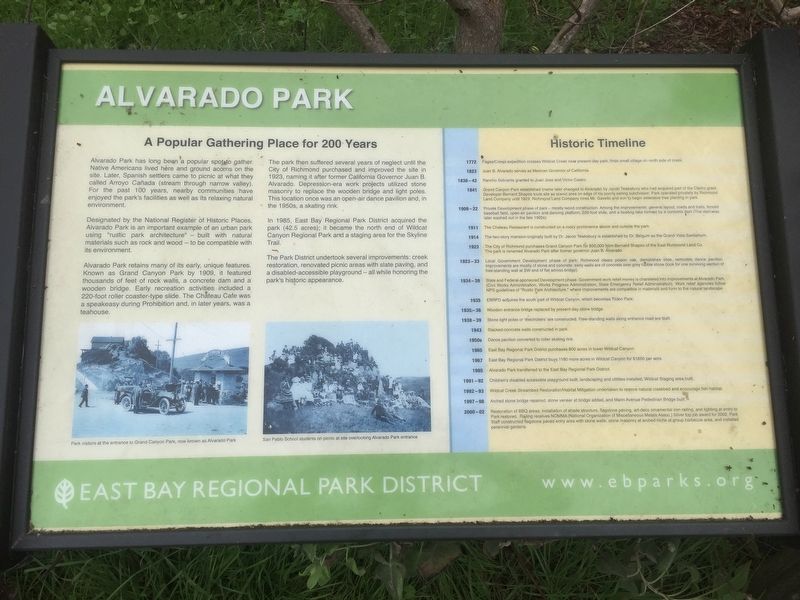
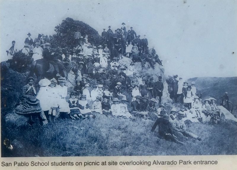
Alvarado Park has long been a popular spot to gather. Native Americans lived here and ground acorns on the site. Later, Spanish settlers came to picnic at what they called Arroyo Cañada (stream through narrow valley). For the past 100 years, nearby communities have enjoyed the park's facilities as well as its relaxing natural environment.
Designated by the National Register of Historic Places, Alvarado Park is an important example of an urban park using "rustic park architecture" materials such as rock and wood - to be compatible with built with natural its environment.
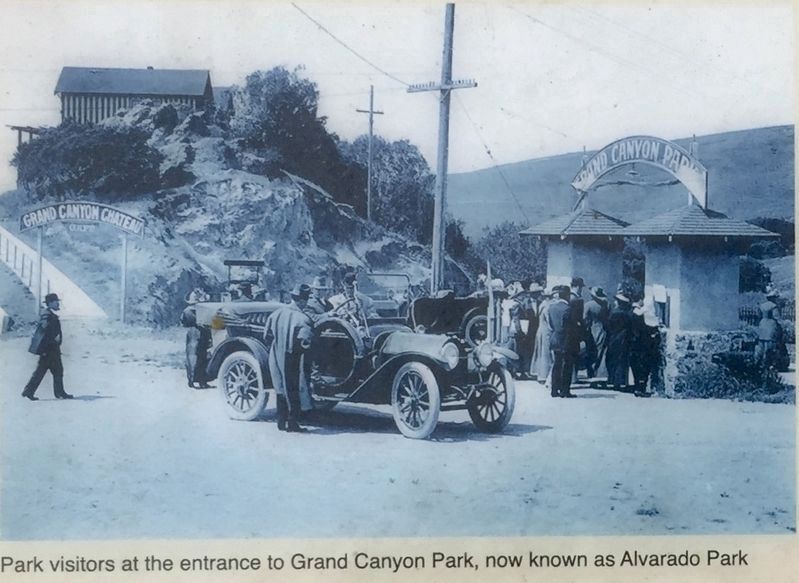
Alvarado Park retains many of its early, unique features. Known as Grand Canyon Park by 1909, it featured thousands of feet of rock walls, a concrete dam and a wooden bridge. Early recreation activities included a 220-foot roller coaster-type slide. The Chateau Cafe was a speakeasy during Prohibition and, in later years, was a teahouse.
The park then suffered several years of neglect until the City of Richmond purchased and improved the site in 1923, naming it after former California Governor Juan B. Alvarado. Depression-era work projects utilized stone masonry to replace the wooden bridge and light poles. This location once was an open-air dance pavilion and, in the 1950s, a skating
rink.In 1985, East Bay Regional Park District acquired the park (42.5 acres); it became the north end of Wildcat Canyon Regional Park and a staging area for the Skyline Trail. The Park District undertook several improvements: creek restoration, renovated picnic areas with slate paving, and a disabled-accessible playground — all while honoring the park's historic appearance.
Historic Timeline
1772 Fages/Crespi expedition crosses Wildcat Creek near present-day park, finds small village on north side of creek.
1823 Juan B. Alvarado serves as Mexican Governor of California.
1836-42 Rancho Sobrante granted to Juan Jose and Victor Castro.
1841 Grand Canyon Park established (name later changed to Alvarado) by Jacob Tewksbury who had acquired part of the Castro grant.
Developer Bernard Shapiro touts site as scenic area on edge of his poorly selling subdivision. Park operated privately by Richmond
Land Company until 1923. Richmond Land Company hires Mr. Gavello and son to begin extensive tree planting in park.
1909-22 Private Development phase of park - mostly wood construction. Among the improvements: general layout, roads and trails, fenced baseball field, open-air pavilion and dancing platform, 220-foot slide, and a boating lake formed by a concrete dam (The dam was later washed
out in the late 1920s).1911 The Chateau Restaurant is constructed on a rocky prominence above and outside the park.
1914 The two-story mansion originally built by Dr. Jacob Tewksbury is established by Dr. Belgum as the Grand Vista Sanitarium.
1923 The City of Richmond purchases Grand Canyon Park for $50,000 from Bernard Shapiro of the East Richmond Land Co. The park is renamed Alvarado Park after former governor Juan B. Álvarado.
1923-33 Local Government Development phase of park: Richmond clears poison oak, demolishes slide, remodels dance pavilion. Improvements are mostly of stone and concrete: early walls are of concrete over grey rubble stone (look for one surviving section of free-standing wall at SW end of flat across bridge).
1934-39 State and Federal-sponsored Development phase. Government work relief money is channeled into improvements at Alvarado Park. (Civil Works Administration, Works Progress Administration, State Emergency Relief Administration). Work relief agencies follow NPS guidelines of "Rustic Park Architecture,” where improvements are compatible in materials and form to the natural landscape.
1935 EBRPD acquires the south part of Wildcat Canyon, which becomes Tilden Park.
1935-36 Wooden entrance bridge replaced by present-day stone bridge.
1938-39 Stone light poles or 'electroliers' are constructed. Free-standing walls along entrance road are built.
1943 Stacked-concrete walls constructed in park.
1950s
Dance pavilion converted to roller skating rink.
1965
East Bay Regional Park District purchases 800 acres in lower Wildcat Canyon.
1967
East Bay Regional Park District buys 1180 more acres in Wildcat Canyon for $1650 per acre.
1985 - Alvarado Park transferred to the East Bay Regional Park District.
1991-92
Children's disabled accessible playground built, landscaping and utilities installed, Wildcat Staging area built.
1992-93 Wildcat Creek Streambed Restoration/Habitat Mitigation undertaken to restore natural creekbed and encourage fish habitat.
1997-98
Arched stone bridge repaired, stone veneer at bridge added, and Marin Avenue Pedestrian Bridge built.
Restoration of BBQ areas, installation of shade structure, flagstone paving, art-deco ornamental iron railing, and lighting at entry to
Park restored. Railing receives NOMMA (National Organization of Miscellaneous Metals Assoc.) Silver top job award for 2002. Park Staff constructed flagstone paved entry area with stone walls, stone masonry at arched niche at group barbecue area, and installed
perennial gardens.
Erected by
Topics and series. This historical marker is listed in this topic list: Parks & Recreational Areas. In addition, it is included in the Works Progress Administration (WPA) projects series list. A significant historical year for this entry is 1909.
Location. 37° 57.14′ N, 122° 19.34′ W. Marker is in Richmond, California, in Contra Costa County. Marker is on Park Avenue north of McBryde Avenue. Touch for map. Marker is in this post office area: Richmond CA 94805, United States of America. Touch for directions.
Other nearby markers. At least 8 other markers are within walking distance of this marker. A different marker also named Alvarado Park (here, next to this marker); Native Peoples of the East Bay (a few steps from this marker); Where the Deer and the Antelope Play (approx. 0.2 miles away); California & Nevada Railroad (approx. 0.9 miles away); First Supermarket/Foster's Freeze (approx. 0.9 miles away); Ranchos to Ranches (approx. 0.9 miles away); Park Theatre (approx. 0.9 miles away); Arrival of the Strip Mall (approx. one mile away). Touch for a list and map of all markers in Richmond.
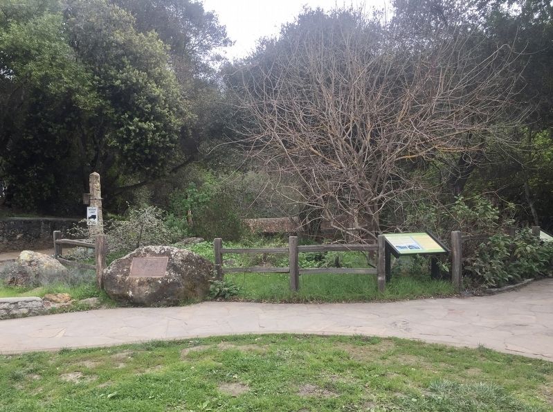
More about this marker. The marker is in Alvarado/Wildcat Canyon Park, about 300 feet in from the entrance, near the small pavilion in the picnic area.
Regarding Alvarado Park. Note that the "1841" date given in the timeline is incorrect; adding a good 60+ years would bring it closer to accurate.
Credits. This page was last revised on March 9, 2020. It was originally submitted on March 9, 2020, by Andrew Ruppenstein of Lamorinda, California. This page has been viewed 704 times since then and 111 times this year. Photos: 1, 2, 3, 4. submitted on March 9, 2020, by Andrew Ruppenstein of Lamorinda, California.


