The Anthracite Coal Fields
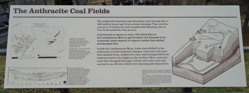
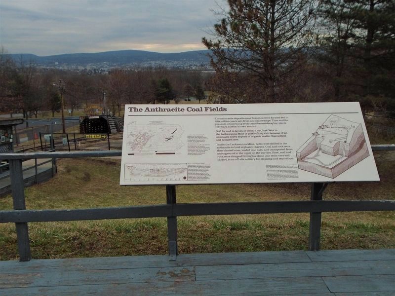
The anthracite deposits near Scranton were formed 345 to 280 million years ago from ancient swamps. Time and pressure of overlying rock transformed decaying plants into hard carbon known as coal.
Coal formed in layers or veins. The Clark Vein in the Lackawanna Mine is particularly rich because of an unusually heavy deposit of organic matter that settled and decayed here.
Inside the Lackawanna Mine, holes were drilled in the anthracite to hold explosive charges. Coal and rocks were then blasted loose, loaded into cars, and transported from underground to the tipple on the surface. Here, coal and rock were dropped through a chute into train cars and carried to an off-site colliery for cleaning and separation.
[Photo captions, counterclockwise from top left, read]
• Anthracite, or hard coal (shown in dot [dark] pattern), lies under 484 square miles of Northeastern Pennsylvania. Comprised of almost pure carbon, it is used mainly as domestic fuel.
Bituminous, or soft coal (shown in solid color), is used in industries. Pennsylvania ranks first in the nation for producing anthracite coal. In the 1940s this state's underground deposits were estimated to ber 15 billion tons.
• This cross-section of the Lackawanna Valley coal basin (as found under the town of Olyphant, 7 miles north of Scranton) shows the
positions of the individual veins. The coal veins directly beneath here follow this same pattern. The Lackawanna Coal Mine Tour is located on the western edge of the valley basin. The tour extends through the Clark, Dunmore #1 and Dunmore #2 coal veins.• Although you are standing on top of miles of abandoned coal mine workings, your tour takes you through only those sections of the mines which have been safely restored.
The illustration to the right depicts the relationship of The Lackawanna Coal Mine underground tour to the objects and buildings on the surface. The adventure begins when you board the mine car on the stairs to your left. [Y]our travel beneath the earth extends beyond the main park road and office which you passed as you arrived in McDade Park, and curves back underneath the ventilation fan to your right.
Erected by Lackawanna County.
Topics. This historical marker is listed in these topic lists: Education • Industry & Commerce • Parks & Recreational Areas.
Location. 41° 25.03′ N, 75° 42.928′ W. Marker is in Scranton, Pennsylvania, in Lackawanna County. Marker is on the deck adjacent to the Lackawanna Coal Mine Tour Hoist House, near the mine tour loading area in McDade Park. Touch for map. Marker
Other nearby markers. At least 8 other markers are within walking distance of this marker. The Heritage of the Anthracite American (here, next to this marker); The Slope 190 Story (a few steps from this marker); Charting the Course of Coal (a few steps from this marker); Information About This Piece of Coal (a few steps from this marker); A 13,000 lb. Black Diamond (a few steps from this marker); Franklin Colliery Coal Mine Car (within shouting distance of this marker); Dynamite Magazine & Cap House (within shouting distance of this marker); Mobile Fire Fighting Equipment (within shouting distance of this marker). Touch for a list and map of all markers in Scranton.
Also see . . .
1. History of the Pennsylvania Anthracite Region. (Submitted on March 17, 2020, by William Fischer, Jr. of Scranton, Pennsylvania.)
2. About the Anthracite Coal Mining Region of Northeastern Pennsylvania. (Submitted on March 17, 2020, by William Fischer, Jr. of Scranton, Pennsylvania.)
3. Lackawanna Coal Mine. (Submitted on March 17, 2020, by William Fischer, Jr. of Scranton, Pennsylvania.)
Credits. This page was last revised on March 17, 2020. It was originally submitted on March 17, 2020, by William Fischer, Jr. of Scranton, Pennsylvania. This page has been viewed 438 times since then and 76 times this year. Photos: 1, 2, 3. submitted on March 17, 2020, by William Fischer, Jr. of Scranton, Pennsylvania.


